Are you a property professional?Get qualified leads from motivated homeowners.
Get startedExtendedSold in 2022Edwardian
33 Fife Avenue, Chadderton, Oldham, OL9 8AG
This 68 square metre property in Chadderton, Oldham, Oldham carries an energy performance rating of D, in line with typical UK homes. It is heated by a gas central heating system and is currently listed as owner-occupied. The property last sold for £135,000 in April 2022.
Property Type
End-Terrace House
Bedrooms
3
Floor Area
68 m²
Council Tax
Band A
Property Features
Built 1900–1929
Get started
Ready to take the next step? Find the right professionals for your property journey.
Energy Performance
EPC rating and efficiency details
EPC Rating
A
B
C
D
D64
E
F
G
Main Heating
Gas
Main Fuel
Gas
Hot Water
Good
Windows
Good
CO2 Emissions
3.4 t/year
Tenure
Owner Occupied
Price & History
Transactions and market trends
Estimated value
£182,000
How our AI predicts property prices · Accurate to within 10%
Automated estimate only. For an accurate valuation, consult a surveyor or estate agent.
Transaction history
£135,000Latest
Apr 2022Source: HM Land Registry
Nearby in OL9 8AG
25 Fife Avenue Chadderton Oldham OL9 8AG
Oct 2025
£235,000
7 Fife Avenue Chadderton Oldham OL9 8AG
Aug 2025
£150,000
16 Fife Avenue Chadderton Oldham OL9 8AG
Mar 2025
£225,000
19 Fife Avenue Chadderton Oldham OL9 8AG
Feb 2025
£180,000
3 Fife Avenue Chadderton Oldham OL9 8AG
Oct 2024
£145,000
24 Fife Avenue Chadderton Oldham OL9 8AG
Mar 2024
£150,000
1 / 6
House Price Index
Oldham+3.6%
116.6
Jan 26
UK HPI from HM Land Registry. Baseline: Jan 2015 = 100.
How This Property Compares on Fife Avenue
See how this property stacks up against others nearby
Comparing to 27 other houses on this street
Price per m²
Property value per square metre of floor space
£1,985/£1,736 avg
LowerHigher
Higher than 64% of similar properties
Years Held
Time since last sale — indicates ownership stability
4 years/10 years avg
ShorterLonger
Held longer than only 24% of similar properties
EPC Rating
Government energy efficiency score (1–100)
64 (D)/61 (D) avg
Less efficientMore efficient
Around average
Floor Area
Total internal floor space
68 m²/68 m² avg
SmallerLarger
Around average
CO₂ Emissions
Annual carbon output from heating, hot water & lighting
3.4 t/year/3.3 t/year avg
Higher emissionsLower emissions
Around average
Habitable Rooms
Living spaces like bedrooms & living rooms
4 rooms/4 rooms avg
FewerMore
Around average
Comparisons are based on the most recent EPC data for each property in this postcode. Only similar property types (houses) are compared.
Get alerts for OL9 8AG
New sales, price changes, and market updates in this area
About Chadderton, Oldham
This property is located in Chadderton, a town in the Metropolitan Borough of Oldham, Greater Manchester, England, on the River Irk and Rochdale Canal.
Chadderton is a town in Greater Manchester, England. It is located in the foothills of the Pennines, about 1 mile west of Oldham, 5 miles south of Rochdale and 6 miles north‑east of Manchester. The town lies on the River Irk and the Rochdale Canal, and is near the A627(M) motorway. It is part of the Metropolitan Borough of Oldham and falls within the OL 9 postcode district. The locality is described as a town in Greater Manchester, England, and its summary notes its proximity to major roads and nearby urban centres. The description highlights its setting in the foothills of the Pennines and its position relative to the River Irk and canal, providing a sense of the surrounding landscape and transport links.
Places to visit
Road Noise
Average road noise levels for this postcode
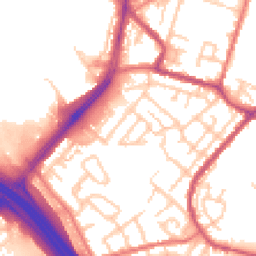
Daytime
07:00 – 23:00
54.7dB
Low
Night-time
23:00 – 07:00
45.5dB
Low55 dB
60 dB
65 dB
70 dB
75 dB
80 dB
Defra Road Noise Strategic Mapping, Round 4Crime Analysis
1 months of data for Oldham
Total Crimes
1
Monthly Avg
1
Recent Trend
Stable
Most Common
Violence & Sexual
Crime by Category
Violence & Sexual1(100%)
Recent Incidents
Violence & Sexual
Aug 2025On or near Parking Area
Data from Police UK • Updated monthly
Local Amenities
Schools and transport links nearby
Nearby Schools
54 within 3kmP
Yew Tree Community School
101m
1 min
P
Stanley Road Primary School
774m
9 mins
P
Whitegate End Primary and Nursery School
829m
10 mins
S
Saint John Henry Newman Roman Catholic College, A Voluntary Academy
940m
11 mins
S
Oasis Academy Oldham
1.7km
20 mins
S
The Radclyffe School
1.8km
21 mins
Transport Links
30 within 3kmWhitegate Lane
Bus Stop222m
3 mins
Lancaster Street
Bus Stop367m
4 mins
Boat & Horses
Bus Stop402m
5 mins
South Chadderton (Manchester Metrolink)
Tram406m
5 mins
Broadway
Bus Stop426m
5 mins
South Chadderton (Manchester Metrolink)
Underground568m
7 mins
School data from Dept. for Education • Transport data from NaPTAN
Nearby Property Businesses
Local professionals serving this area
Surveyor
GHCS - Garry Hallas - Chartered Surveyors
Oldham
RICSResidential
Surveyor
Breakey and Nuttall
Oldham
RICS
Surveyor
K Hill and Co
Oldham
RICS
Surveyor
Olympic Construction Ltd
Oldham
RICS
Surveyor
WGM Building Consultancy
Delph
RICS
Surveyor
Unique Building Services and Consultancy (UK) Ltd.
Oldham
RICS
Surveyor
Kirkham Property
Oldham
RICS
Map
84 points of interest nearby
Map data from OpenStreetMap • Transport data from NaPTAN • School data from Dept. for Education • Scenic data from Beautifulplaces.ai
Frequently Asked Questions
Common questions about this property