Are you a property professional?Get qualified leads from motivated homeowners.
Get startedBiggest on Street
1 Brierley Avenue, Failsworth, Manchester, M35 0RU
This 94 square metre property in Failsworth, Manchester, Manchester carries an energy performance rating of C, which is above the national average. It is heated by a gas central heating system and is currently listed as social housing.
Property Type
End-Terrace House
Bedrooms
3
Floor Area
94 m²
Council Tax
Band A
Property Features
Built 1950–1966
Get started
Ready to take the next step? Find the right professionals for your property journey.
Energy Performance
EPC rating and efficiency details
EPC Rating
A
B
C
C69
D
E
F
G
Main Heating
Gas
Main Fuel
Gas
Hot Water
Good
Windows
Average
CO2 Emissions
3.5 t/year
Tenure
Rented
Price & History
Transactions and market trends
Estimated value
£201,000
How our AI predicts property prices · Accurate to within 10%
Automated estimate only. For an accurate valuation, consult a surveyor or estate agent.
Transaction history
No sales history found
Nearby in M35 0RU
7 Brierley Avenue Failsworth Manchester M35 0RU
Oct 2025
£205,000
12 Brierley Avenue Failsworth Manchester M35 0RU
Sept 2023
£231,000
15 Brierley Avenue Failsworth Manchester M35 0RU
Jan 2021
£145,000
13 Brierley Avenue Failsworth Manchester M35 0RU
Jun 2019
£144,950
8 Brierley Avenue Failsworth Manchester M35 0RU
Oct 2001
£50,000
House Price Index
Manchester+6.0%
111.4
Dec 25
UK HPI from HM Land Registry. Baseline: Jan 2015 = 100.
How This Property Compares on Brierley Avenue
See how this property stacks up against others nearby
Comparing to 11 other houses on this street
EPC Rating
Government energy efficiency score (1–100)
69 (C)/70 (C) avg
Less efficientMore efficient
Around average
Floor Area
Total internal floor space
94 m²/83 m² avg
SmallerLarger
Larger than all similar properties
CO₂ Emissions
Annual carbon output from heating, hot water & lighting
3.5 t/year/3.0 t/year avg
Higher emissionsLower emissions
Lower emissions than only 27% of similar properties
Habitable Rooms
Living spaces like bedrooms & living rooms
5 rooms/5 rooms avg
FewerMore
More rooms than 64% of similar properties
Comparisons are based on the most recent EPC data for each property in this postcode. Only similar property types (houses) are compared.
Get alerts for M35 0RU
New sales, price changes, and market updates in this area
About Failsworth, Manchester
This property is located in Failsworth, a town in the Metropolitan Borough of Oldham, Greater Manchester, England, situated 4 miles north‑east of Manchester and 3 miles south‑west of Oldham, with the M60 ring‑road to the east.
Failsworth is a town in the Metropolitan Borough of Oldham, Greater Manchester, England, 4 miles (6.4 km) north‑east of Manchester and 3 miles (4.8 km) south‑west of Oldham. The M60 ring‑road motorway skirts it to the east. The population at the 2011 census was 20,680. Historically in Lancashire, Failsworth until the 19th century was a farming township linked ecclesiastically with Manchester. Inhabitants supplemented their farming income with domestic hand‑loom weaving. The humid climate and abundant labour and coal led to weaving of textiles as a Lancashire Mill Town with redbrick cotton mills. A current landmark is the Failsworth Pole. Daisy Nook is a country park on the southern edge.
Places to visit
Road Noise
Average road noise levels for this postcode
Daytime
07:00 – 23:00
51.3dB
Low
Night-time
23:00 – 07:00
39.8dB
Low55 dB
60 dB
65 dB
70 dB
75 dB
80 dB
Defra Road Noise Strategic Mapping, Round 4Crime Analysis
No crime data available for this area
Local Amenities
Schools and transport links nearby
Nearby Schools
39 within 3kmP
St John's Church of England Primary School
362m
4 mins
P
St Mary's RC Primary School, a Voluntary Academy
404m
5 mins
P
Propps Hall Junior Infant and Nursery School
457m
6 mins
S
Co-op Academy Failsworth
475m
6 mins
S
St Matthew's RC High School
2.0km
24 mins
S
Laurus Ryecroft
2.0km
24 mins
Transport Links
30 within 3kmLaycock Crescent
Bus Stop40m
< 1 min
School Road
Bus Stop87m
1 min
Orchard Road
Bus Stop197m
2 mins
Day Drive
Bus Stop288m
3 mins
Henry Street
Bus Stop308m
4 mins
Failsworth (Manchester Metrolink)
Underground752m
9 mins
School data from Dept. for Education • Transport data from NaPTAN
Nearby Property Businesses
Local professionals serving this area
Surveyor
Tuffin Ferraby Taylor (TFT) Ltd
Manchester
RICS
Surveyor
Jordan Fishwick West Ltd
Manchester
RICS
Surveyor
CDT Consulting Limited
Manchester
RICS
Surveyor
AECOM
Manchester
RICS
Surveyor
The Professional Snagging Company
Manchester
RICSResidential
Surveyor
AJP Surveyors Ltd
Manchester
RICSResidential
Surveyor
Walker Sime
Manchester
RICSResidential
Surveyor
Monaghans
Manchester
RICS
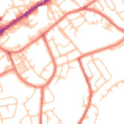
Map
69 points of interest nearby
Map data from OpenStreetMap • Transport data from NaPTAN • School data from Dept. for Education • Scenic data from Beautifulplaces.ai
Frequently Asked Questions
Common questions about this property