Are you a property professional?Get qualified leads from motivated homeowners.
Get started1 Gascoigne Avenue, Queniborough, Leicester, LE7 3FG
This property in Queniborough, Leicester, Leicester. Explore detailed information about this Queniborough, Leicester property including energy performance, price history, local schools, transport links and crime statistics.
Property Type
Property
Bedrooms
—
Floor Area
— m²
Council Tax
Band B
Get started
Ready to take the next step? Find the right professionals for your property journey.
Energy Performance
EPC rating and efficiency details
A
B
C
D
E
F
G
No EPC on record
This property doesn't have an Energy Performance Certificate yet. An EPC helps us give a more accurate valuation and is required to sell or let.
Price & History
Transactions and market trends
Transaction history
No sales history found
House Price Index
Leicester-0.2%
97.7
Dec 25
UK HPI from HM Land Registry. Baseline: Jan 2015 = 100.
How This Property Compares on Gascoigne Avenue
See how this property stacks up against others nearby
Not enough similar properties in this postcode to make meaningful comparisons.
Get alerts for LE7 3FG
New sales, price changes, and market updates in this area
About Queniborough, Leicester
This property is located in Queniborough, a village 7.5 miles north‑east of Leicester, providing a peaceful setting yet close to urban amenities.
Queniborough is an English village in the county of Leicestershire. It lies 2.5 miles north‑east of the town of Syston and 7.5 miles north‑east of the city of Leicester, and forms part of the Leicester Urban Area due to its proximity. In 2003 the 972 properties in Queniborough housed 1,878 registered electors; the population increased to 2,326 at the 2011 census. The parish church of St Mary’s is noted by the architectural historian Nikolaus Pevsner as having one of the finest spires in the whole of Leicestershire. The locality falls within the LE 7 postcode district.
Places to visit
Road Noise
Average road noise levels for this postcode
Daytime
07:00 – 23:00
48.5dB
Low
Night-time
23:00 – 07:00
39.4dB
Low55 dB
60 dB
65 dB
70 dB
75 dB
80 dB
Defra Road Noise Strategic Mapping, Round 4Crime Analysis
7 months of data for Leicester
Total Crimes
13
Monthly Avg
2
Recent Trend
Stable
Most Common
Violence & Sexual
Crime by Category
Violence & Sexual5(38%)
Public Order2(15%)
Vehicle Crime2(15%)
Weapons1(8%)
Drugs1(8%)
Other Theft1(8%)
Criminal Damage & Arson1(8%)
Recent Incidents
Violence & Sexual
Oct 2025On or near Main Street
Weapons
Oct 2025On or near Kings Lane
Drugs
Oct 2025On or near Main Street
Violence & Sexual
Aug 2025On or near Lady Jane Walk
Violence & Sexual
Jul 2025On or near Main Street
Public Order
Jun 2025On or near Petrol Station
Data from Police UK • Updated monthly
Local Amenities
Schools and transport links nearby
Nearby Schools
7 within 3kmP
Queniborough Church of England Primary School
187m
2 mins
P
Broomfield Community Primary School
981m
12 mins
P
St Peter and St Paul Church of England Academy
1.8km
21 mins
S
Wreake Valley Academy
1.3km
16 mins
Transport Links
30 within 3kmBarkby Road
Bus Stop120m
1 min
Primrose Way
Bus Stop208m
3 mins
Primrose Way
Bus Stop212m
3 mins
Avenue Road
Bus Stop388m
5 mins
Syston Road
Bus Stop580m
7 mins
New Zealand Lane
Bus Stop734m
9 mins
School data from Dept. for Education • Transport data from NaPTAN
Nearby Property Businesses
Local professionals serving this area
Surveyor
Mark Ferguson Ltd
Leicester
RICS
Surveyor
SBK Sales Ltd
Oadby
RICS

Ravi Seth Ltd
Leicester
RICSResidential
Surveyor
Ayonkosi Limited
Leicester
RICS
Surveyor
Clarke & Watt Building Consultancy Ltd
Leicester
RICSResidential
Surveyor
Gateley RJA Limited
Leicester
RICSResidential

Crest Surveyors Ltd
Leicester
RICSResidential
Surveyor
Ace Properties Commercial
Leicester
RICSResidential
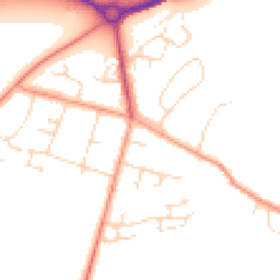
Map
37 points of interest nearby
Map data from OpenStreetMap • Transport data from NaPTAN • School data from Dept. for Education • Scenic data from Beautifulplaces.ai
Frequently Asked Questions
Common questions about this property