Are you a property professional?Get qualified leads from motivated homeowners.
Get started38 Freeman Way, Quorn, Loughborough, LE12 8SQ
This 53 square metre property in Quorn, Loughborough, Loughborough carries an energy performance rating of C, which is above the national average. It is heated by a gas central heating system and is currently listed as owner-occupied. It was sold for £233,000 in August 2023, up from £179,000 previously.
Property Type
End-Terrace House
Bedrooms
2
Bathrooms
1
Floor Area
53 m²
Council Tax
Band B
Flood Risk
Low
Property Features
Built 1983–1990
Private Garden
South-facing
Allocated Parking
Gas Heating
Dining Room
Separate dining space
Recently Refurbished
Renovated and updated
Get started
Ready to take the next step? Find the right professionals for your property journey.
Energy Performance
EPC rating and efficiency details
Current Certificate(1 of 2)
May 2023
EPC Rating
A
B
C
C69
D
E
F
G
Main Heating
Gas
Main Fuel
Gas
Hot Water
Good
Windows
Average
CO2 Emissions
2.4 t/year
Tenure
Owner Occupied
Property Improvements
Changes detected from historical EPC data
May 2023from Jul 2009
Heating Controls
Prog + StatFull
Heating controls upgraded for better temperature management
Hot Water
Very GoodGood
Hot water efficiency decreased
Roof
AverageGood
Roof insulation improved
Low Energy Lighting
38%100%
More low energy lighting installed
Are we missing something? Tell us about home improvements to help adjust your valuation.
Price & History
Transactions and market trends
Estimated value
£238,000
How our AI predicts property prices · Accurate to within 10%
Automated estimate only. For an accurate valuation, consult a surveyor or estate agent.
Transaction history
+30.2%(6y)
£233,000Latest
Aug 2023£179,000
Jun 2017£135,000
Oct 2009Source: HM Land Registry
Nearby in LE12 8SQ
32 Freeman Way Quorn Loughborough LE12 8SQ
May 2025
£247,500
46 Freeman Way Quorn Loughborough LE12 8SQ
Mar 2025
£233,000
12 Freeman Way Quorn Loughborough LE12 8SQ
Mar 2025
£300,000
30 Freeman Way Quorn Loughborough LE12 8SQ
Jun 2024
£192,500
44 Freeman Way Quorn Loughborough LE12 8SQ
Oct 2022
£183,000
26 Freeman Way Quorn Loughborough LE12 8SQ
Apr 2022
£205,000
1 / 4
House Price Index
England+3.3%
101.6
Jan 26
UK HPI from HM Land Registry. Baseline: Jan 2015 = 100.
How This Property Compares on Freeman Way
See how this property stacks up against others nearby
Comparing to 18 other houses on this street
Price per m²
Property value per square metre of floor space
£4,396/£3,236 avg
LowerHigher
Higher than 78% of similar properties
Years Held
Time since last sale — indicates ownership stability
3 years/9 years avg
ShorterLonger
Held longer than only 25% of similar properties
EPC Rating
Government energy efficiency score (1–100)
69 (C)/70 (C) avg
Less efficientMore efficient
More efficient than only 31% of similar properties
Floor Area
Total internal floor space
53 m²/74 m² avg
SmallerLarger
Larger than only 28% of similar properties
CO₂ Emissions
Annual carbon output from heating, hot water & lighting
2.4 t/year/2.7 t/year avg
Higher emissionsLower emissions
Around average
Habitable Rooms
Living spaces like bedrooms & living rooms
3 rooms/4 rooms avg
FewerMore
More rooms than only 28% of similar properties
Comparisons are based on the most recent EPC data for each property in this postcode. Only similar property types (houses) are compared.
Get alerts for LE12 8SQ
New sales, price changes, and market updates in this area
About Quorn, Loughborough
This property is located in Quorn, a village and civil parish in Leicestershire, England, within the LE 12 postal district and close to Loughborough.
Quorn, Leicestershire, is a village and civil parish situated in England, near the university town of Loughborough. Its name was shortened from Quorndon in 1889 to avoid postal difficulties owing to its similarity to the name of another village, Quarndon, in neighbouring Derbyshire. The locality offers a quiet rural environment and a close‑knit community feel within the LE 12 postal district.
Places to visit
Road Noise
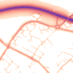
Average road noise levels for this postcode
Daytime
07:00 – 23:00
52.8dB
Low
Night-time
23:00 – 07:00
42.5dB
Low55 dB
60 dB
65 dB
70 dB
75 dB
80 dB
Defra Road Noise Strategic Mapping, Round 4Crime Analysis
9 months of data for Loughborough
Total Crimes
18
Monthly Avg
2
Recent Trend
Stable
Most Common
Violence & Sexual
Crime by Category
Violence & Sexual5(28%)
Criminal Damage & Arson5(28%)
Vehicle Crime2(11%)
Public Order2(11%)
Other Theft2(11%)
Burglary1(6%)
Other Crime1(6%)
Recent Incidents
Violence & Sexual
Nov 2025On or near Cemetery Road
Criminal Damage & Arson
Nov 2025On or near Rowena Court
Vehicle Crime
Nov 2025On or near Charnwood Avenue
Violence & Sexual
Nov 2025On or near Cemetery Road
Criminal Damage & Arson
Oct 2025On or near Rowena Court
Criminal Damage & Arson
Oct 2025On or near Hyacinth Close
Data from Police UK • Updated monthly
Local Amenities
Schools and transport links nearby
Nearby Schools
7 within 3kmP
St Bartholomew's Church of England Primary School
756m
9 mins
P
Barrow Hall Orchard Church of England Primary School
1.9km
23 mins
P
Lift Beacon
2.2km
27 mins
S
Rawlins
412m
5 mins
S
Humphrey Perkins School
1.7km
20 mins
S
Woodbrook Vale School
2.9km
35 mins
Transport Links
30 within 3kmAlexander Road
Bus Stop239m
3 mins
Barrow Road
Bus Stop314m
4 mins
Gamble Way
Bus Stop334m
4 mins
Farley Way
Bus Stop366m
4 mins
Quorn & Woodhouse (Great Central Railway)
Underground1.3km
15 mins
Quorn & Woodhouse (Great Central Railway)
Tram1.3km
16 mins
School data from Dept. for Education • Transport data from NaPTAN
Nearby Property Businesses
Local professionals serving this area
Surveyor
Wilkinson and Fox
Loughborough
RICS
Surveyor
Harborough London Limited
Leicester
RICS
Surveyor
Broadford
Leicester
RICS
Surveyor
Sinclair Estate Agents Ltd
Loughborough
RICS
Surveyor
4CA Solutions Limited
Loughborough
RICS
Surveyor
Addison Hunt Limited
Loughborough
RICS
Surveyor
Elite Home Surveys and Valuations Ltd
Loughborough
RICS
Surveyor
Sinclair Estate Agents Ltd
Loughborough
RICS
Map
37 points of interest nearby
Map data from OpenStreetMap • Transport data from NaPTAN • School data from Dept. for Education • Scenic data from Beautifulplaces.ai
Frequently Asked Questions
Common questions about this property