Are you a property professional?Get qualified leads from motivated homeowners.
Get startedVictorianMultiple Fireplaces
1 Mount Road, Stourbridge, DY8 1HZ
This 66 square metre property in Stourbridge carries an energy performance rating of D, in line with typical UK homes. It is heated by a gas central heating system and is currently listed as owner-occupied. The property last sold for £140,000 in 2016.
Property Type
Mid-Terrace House
Bedrooms
3
Floor Area
66 m²
Council Tax
Band B
Property Features
Built Before 1900
Get started
Ready to take the next step? Find the right professionals for your property journey.
Energy Performance
EPC rating and efficiency details
EPC Expired
This certificate is over 10 years old and is no longer valid.Expired 06 Mar 2023
Current Certificate(1 of 2)
Mar 2013
EPC Rating
A
B
C
D
D55
E
F
G
Main Heating
Gas
Main Fuel
Gas
Hot Water
Good
Windows
Good
CO2 Emissions
3.9 t/year
Tenure
Owner Occupied
Property Improvements
Changes detected from historical EPC data
Mar 2013from Mar 2011
EPC improved fromE48toD55
Are we missing something? Tell us about home improvements to help adjust your valuation.
Price & History
Transactions and market trends
Estimated value
£199,000
How our AI predicts property prices · Accurate to within 10%
Automated estimate only. For an accurate valuation, consult a surveyor or estate agent.
Transaction history
+7.7%(3y)
£140,000Latest
Jan 2016£130,000
May 2013£68,250
Feb 2002£27,500
Jun 1996Source: HM Land Registry
Nearby in DY8 1HZ
2 Mount Road Stourbridge DY8 1HZ
Apr 2023
£280,000
4 Mount Road Stourbridge DY8 1HZ
May 2021
£331,500
6 Mount Road Stourbridge DY8 1HZ
May 2021
£228,000
5 Mount Road Stourbridge DY8 1HZ
Feb 2020
£169,950
9a Mount Road Stourbridge DY8 1HZ
Apr 2019
£135,000
3 Mount Road Stourbridge DY8 1HZ
Mar 2019
£144,000
1 / 2
House Price Index
England+1.5%
101.6
Jan 26
UK HPI from HM Land Registry. Baseline: Jan 2015 = 100.
How This Property Compares on Mount Road
See how this property stacks up against others nearby
Comparing to 9 other houses on this street
Price per m²
Property value per square metre of floor space
£2,121/£2,186 avg
LowerHigher
Around average
Years Held
Time since last sale — indicates ownership stability
10 years/10 years avg
ShorterLonger
Held longer than 67% of similar properties
EPC Rating
Government energy efficiency score (1–100)
55 (D)/56 (D) avg
Less efficientMore efficient
More efficient than only 39% of similar properties
Floor Area
Total internal floor space
66 m²/77 m² avg
SmallerLarger
Larger than only 33% of similar properties
CO₂ Emissions
Annual carbon output from heating, hot water & lighting
3.9 t/year/4.6 t/year avg
Higher emissionsLower emissions
Around average
Habitable Rooms
Living spaces like bedrooms & living rooms
4 rooms/4 rooms avg
FewerMore
More rooms than only 33% of similar properties
Comparisons are based on the most recent EPC data for each property in this postcode. Only similar property types (houses) are compared.
Get alerts for DY8 1HZ
New sales, price changes, and market updates in this area
Places to visit
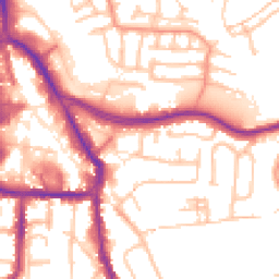
Road Noise
Average road noise levels for this postcode
Daytime
07:00 – 23:00
54.0dB
Low
Night-time
23:00 – 07:00
44.8dB
Low55 dB
60 dB
65 dB
70 dB
75 dB
80 dB
Defra Road Noise Strategic Mapping, Round 4Crime Analysis
12 months of data for Stourbridge
Total Crimes
33
Monthly Avg
3
Recent Trend
Rising
Most Common
Violence & Sexual
Crime by Category
Violence & Sexual25(76%)
Criminal Damage & Arson3(9%)
Vehicle Crime2(6%)
Robbery1(3%)
Drugs1(3%)
Weapons1(3%)
Recent Incidents
Criminal Damage & Arson
Jan 2026On or near Romilly Close
Violence & Sexual
Jan 2026On or near Romilly Close
Violence & Sexual
Nov 2025On or near Lowndes Road
Violence & Sexual
Nov 2025On or near Lowndes Road
Violence & Sexual
Nov 2025On or near Lowndes Road
Violence & Sexual
Nov 2025On or near Lowndes Road
Data from Police UK • Updated monthly
Local Amenities
Schools and transport links nearby
Nearby Schools
28 within 3kmP
Greenfield Primary School
671m
8 mins
P
Peters Hill Primary School
956m
12 mins
P
Rufford Primary School
959m
12 mins
S
Redhill School
275m
3 mins
S
King Edward VI College Stourbridge
524m
6 mins
S
Old Swinford Hospital
680m
8 mins
Transport Links
6 within 3kmStourbridge Town Rail Station
Rail120m
1 min
Stourbridge Junction Rail Station
Rail1.1km
13 mins
Lye (West Midlands) Rail Station
Rail1.7km
21 mins
Frairs Gorse
Bus Stop2.4km
29 mins
no. 56
Bus Stop2.5km
30 mins
Prestwood Drive
Bus Stop2.7km
32 mins
School data from Dept. for Education • Transport data from NaPTAN
Nearby Property Businesses
Local professionals serving this area
Map
34 points of interest nearby
Map data from OpenStreetMap • Transport data from NaPTAN • School data from Dept. for Education • Scenic data from Beautifulplaces.ai
Frequently Asked Questions
Common questions about this property