Are you a property professional?Get qualified leads from motivated homeowners.
Get startedLong-term Owner
33a, Chatsworth Drive, Tutbury, Burton On Trent, DE13 9NS
This property in Tutbury, Burton-on-trent, Burton On Trent. Records show the property last changed hands for £124,950 back in 2007.
Property Type
Property
Bedrooms
—
Floor Area
— m²
Council Tax
Band B
Get started
Ready to take the next step? Find the right professionals for your property journey.
Energy Performance
EPC rating and efficiency details
A
B
C
D
E
F
G
No EPC on record
This property doesn't have an Energy Performance Certificate yet. An EPC helps us give a more accurate valuation and is required to sell or let.
Price & History
Transactions and market trends
Transaction history
+242.3%(12y)
£124,950Latest
Dec 2007£36,500
Mar 1996£36,500
Feb 1996Source: HM Land Registry
Nearby in DE13 9NS
54 Chatsworth Drive Tutbury Burton On Trent DE13 9NS
Mar 2025
£257,000
43 Chatsworth Drive Tutbury Burton On Trent DE13 9NS
Dec 2024
£287,500
49 Chatsworth Drive Tutbury Burton On Trent DE13 9NS
Nov 2024
£239,000
31 Chatsworth Drive Tutbury Burton On Trent DE13 9NS
May 2024
£418,000
3 Chatsworth Drive Tutbury Burton On Trent DE13 9NS
Oct 2023
£330,000
35a Chatsworth Drive Tutbury Burton On Trent DE13 9NS
May 2023
£267,000
1 / 7
House Price Index
England+1.5%
101.6
Jan 26
UK HPI from HM Land Registry. Baseline: Jan 2015 = 100.
How This Property Compares on Chatsworth Drive
See how this property stacks up against others nearby
Not enough similar properties in this postcode to make meaningful comparisons.
Get alerts for DE13 9NS
New sales, price changes, and market updates in this area
About Tutbury, Burton-on-trent
This property is located in Tutbury, a village and civil parish in Staffordshire, England, situated about 4 miles north of Burton upon Trent and 20 miles south of the Peak District.
Tutbury is a village and civil parish in Staffordshire, England. It is 4 miles (6.4 km) north of Burton upon Trent and 20 miles (32 km) south of the Peak District. The village has a population of about 3,076 residents. It adjoins Hatton to the north on the Staffordshire–Derbyshire border.
Places to visit
Road Noise
Average road noise levels for this postcode
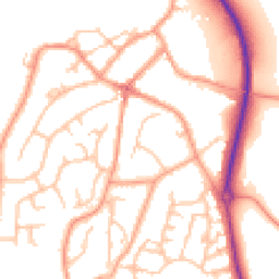
Daytime
07:00 – 23:00
52.3dB
Low
Night-time
23:00 – 07:00
41.1dB
Low55 dB
60 dB
65 dB
70 dB
75 dB
80 dB
Defra Road Noise Strategic Mapping, Round 4Crime Analysis
8 months of data for Burton On Trent
Total Crimes
36
Monthly Avg
5
Recent Trend
Stable
Most Common
Violence & Sexual
Crime by Category
Violence & Sexual28(78%)
Criminal Damage & Arson4(11%)
Other Theft3(8%)
Vehicle Crime1(3%)
Recent Incidents
Criminal Damage & Arson
Nov 2025On or near Anglesey Street
Violence & Sexual
Nov 2025On or near Anglesey Street
Violence & Sexual
Nov 2025On or near Anglesey Street
Violence & Sexual
Nov 2025On or near St Francis Close
Violence & Sexual
Nov 2025On or near Anglesey Street
Violence & Sexual
Nov 2025On or near Maple Drive
Data from Police UK • Updated monthly
Local Amenities
Schools and transport links nearby
Nearby Schools
3 within 3kmP
Richard Wakefield CofE Primary Academy
142m
2 mins
P
Heath Fields Primary School
1.4km
17 mins
P
John of Rolleston Primary School
2.7km
33 mins
Transport Links
30 within 3kmLudgate Street
Bus Stop157m
2 mins
Ironwalls Lane
Bus Stop202m
2 mins
Silk Mill Lane
Bus Stop236m
3 mins
Ye Olde Dog & Partridge
Bus Stop265m
3 mins
St Christopher Church
Bus Stop335m
4 mins
Tutbury & Hatton Rail Station
Rail1.0km
12 mins
School data from Dept. for Education • Transport data from NaPTAN
Nearby Property Businesses
Local professionals serving this area


Map
33 points of interest nearby
Map data from OpenStreetMap • Transport data from NaPTAN • School data from Dept. for Education • Scenic data from Beautifulplaces.ai
Frequently Asked Questions
Common questions about this property