Are you a property professional?Get qualified leads from motivated homeowners.
Get startedBiggest on StreetBest EPC on StreetExtended TwiceEPC B Rated
2 Cookes Close, Neston, CH64 3TL
This 219 square metre property in Neston carries an energy performance rating of B, indicating very good energy efficiency standards. It is heated by a gas central heating system and is currently listed as owner-occupied. Records show the property last changed hands for £274,950 back in 2003.
Property Type
Detached House
Bedrooms
5
Floor Area
219 m²
Council Tax
Band E
Property Features
Built 1996–2002
Get started
Ready to take the next step? Find the right professionals for your property journey.
Energy Performance
EPC rating and efficiency details
EPC Rating
A
B
B81
C
D
E
F
G
Main Heating
Gas
Main Fuel
Gas
Hot Water
Good
Windows
Average
CO2 Emissions
4.6 t/year
Tenure
Owner Occupied
Price & History
Transactions and market trends
Estimated value
£558,000
How our AI predicts property prices · Accurate to within 10%
Automated estimate only. For an accurate valuation, consult a surveyor or estate agent.
Transaction history
£274,950Latest
Dec 2003Source: HM Land Registry
Nearby in CH64 3TL
6 Cookes Close Neston CH64 3TL
Sept 2022
£460,000
17 Cookes Close Neston CH64 3TL
Jan 2022
£230,000
12 Cookes Close Neston CH64 3TL
Apr 2018
£197,000
1 Cookes Close Neston CH64 3TL
Oct 2017
£276,000
8 Cookes Close Neston CH64 3TL
Jul 2017
£215,000
5 Cookes Close Neston CH64 3TL
Jul 2015
£249,950
1 / 3
House Price Index
England+1.5%
101.6
Jan 26
UK HPI from HM Land Registry. Baseline: Jan 2015 = 100.
How This Property Compares on Cookes Close
See how this property stacks up against others nearby
Comparing to 12 other houses on this street
Price per m²
Property value per square metre of floor space
£1,255/£1,783 avg
LowerHigher
Higher than only 17% of similar properties
Years Held
Time since last sale — indicates ownership stability
22 years/12 years avg
ShorterLonger
Held longer than all similar properties
EPC Rating
Government energy efficiency score (1–100)
81 (B)/73 (C) avg
Less efficientMore efficient
More efficient than all similar properties
Floor Area
Total internal floor space
219 m²/129 m² avg
SmallerLarger
Larger than all similar properties
CO₂ Emissions
Annual carbon output from heating, hot water & lighting
4.6 t/year/3.5 t/year avg
Higher emissionsLower emissions
Lowest among similar properties
Habitable Rooms
Living spaces like bedrooms & living rooms
9 rooms/6 rooms avg
FewerMore
More rooms than all similar properties
Comparisons are based on the most recent EPC data for each property in this postcode. Only similar property types (houses) are compared.
Get alerts for CH64 3TL
New sales, price changes, and market updates in this area
Places to visit
Road Noise
Average road noise levels for this postcode
Daytime
07:00 – 23:00
50.9dB
Low
Night-time
23:00 – 07:00
40.4dB
Low55 dB
60 dB
65 dB
70 dB
75 dB
80 dB
Defra Road Noise Strategic Mapping, Round 4Crime Analysis
11 months of data for Neston
Total Crimes
24
Monthly Avg
2
Recent Trend
Stable
Most Common
Violence & Sexual
Crime by Category
Violence & Sexual11(46%)
Public Order9(38%)
Other Theft2(8%)
Bicycle Theft1(4%)
Criminal Damage & Arson1(4%)
Recent Incidents
Other Theft
Dec 2025On or near Churchill Way
Public Order
Oct 2025On or near Bevyl Road
Violence & Sexual
Oct 2025On or near Phoenix Court
Other Theft
Oct 2025On or near Dunstan Lane
Public Order
Oct 2025On or near Bevyl Road
Violence & Sexual
Sept 2025On or near Mill Lane
Data from Police UK • Updated monthly
Local Amenities
Schools and transport links nearby
Nearby Schools
5 within 3kmP
Neston Primary School
951m
11 mins
P
Parkgate Primary School
968m
12 mins
P
St Winefride's Catholic Primary School
1.2km
15 mins
S
Neston High School
683m
8 mins
Transport Links
30 within 3kmThe Priory
Bus Stop76m
1 min
New Hayes
Bus Stop100m
1 min
Malt Shovel Inn
Bus Stop184m
2 mins
Drake Road
Bus Stop325m
4 mins
Neston Rail Station
Rail353m
4 mins
Railway Station
Bus Stop391m
5 mins
School data from Dept. for Education • Transport data from NaPTAN
Nearby Property Businesses
Local professionals serving this area

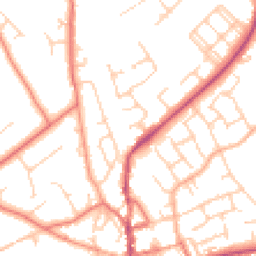
Map
35 points of interest nearby
Map data from OpenStreetMap • Transport data from NaPTAN • School data from Dept. for Education • Scenic data from Beautifulplaces.ai
Frequently Asked Questions
Common questions about this property