Are you a property professional?Get qualified leads from motivated homeowners.
Get started5 Rice Lane, Wallasey, CH44 0DE
This 108 square metre property in Wallasey carries an energy performance rating of D, in line with typical UK homes. The property is currently listed as owner-occupied. Records show the property last changed hands for £69,250 back in 2014.
Property Type
Mid-Terrace House
Bedrooms
2
Floor Area
108 m²
Council Tax
Band A
Property Features
Built 1967–1975
Get started
Ready to take the next step? Find the right professionals for your property journey.
Energy Performance
EPC rating and efficiency details
EPC Expired
This certificate is over 10 years old and is no longer valid.Expired 16 Apr 2024
Current Certificate(1 of 2)
Apr 2014
EPC Rating
A
B
C
D
D56
E
F
G
Main Heating
Gas
Main Fuel
Gas
Hot Water
Very Poor
Windows
Average
CO2 Emissions
4.8 t/year
Tenure
Owner Occupied
Property Improvements
Changes detected from historical EPC data
Apr 2014from Apr 2013
Heating Controls
ThermostatProg + Stat
Heating controls upgraded for better temperature management
Hot Water
Main (No Stat)Immersion
Hot water system changed
Roof
PoorAverage
Roof insulation improved
Are we missing something? Tell us about home improvements to help adjust your valuation.
Price & History
Transactions and market trends
Estimated value
£119,000
How our AI predicts property prices · Accurate to within 10%
Automated estimate only. For an accurate valuation, consult a surveyor or estate agent.
Transaction history
+48.9%(1y)
£69,250Latest
Oct 2014£46,500
Jul 2013£49,950
Jan 2004Source: HM Land Registry
House Price Index
England+1.5%
101.6
Jan 26
UK HPI from HM Land Registry. Baseline: Jan 2015 = 100.
How This Property Compares on Rice Lane
See how this property stacks up against others nearby
Comparing to 15 other houses on this street
Price per m²
Property value per square metre of floor space
£641/£769 avg
LowerHigher
Around average
Years Held
Time since last sale — indicates ownership stability
11 years/13 years avg
ShorterLonger
Around average
EPC Rating
Government energy efficiency score (1–100)
56 (D)/81 (C) avg
Less efficientMore efficient
Lowest among similar properties
Floor Area
Total internal floor space
108 m²/92 m² avg
SmallerLarger
Larger than 93% of similar properties
CO₂ Emissions
Annual carbon output from heating, hot water & lighting
4.8 t/year/1.8 t/year avg
Higher emissionsLower emissions
Lowest among similar properties
Habitable Rooms
Living spaces like bedrooms & living rooms
4 rooms/6 rooms avg
FewerMore
More rooms than only 8% of similar properties
Comparisons are based on the most recent EPC data for each property in this postcode. Only similar property types (houses) are compared.
Get alerts for CH44 0DE
New sales, price changes, and market updates in this area
Places to visit
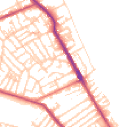
Road Noise
Average road noise levels for this postcode
Daytime
07:00 – 23:00
50.6dB
Low
Night-time
23:00 – 07:00
40.8dB
Low55 dB
60 dB
65 dB
70 dB
75 dB
80 dB
Defra Road Noise Strategic Mapping, Round 4Crime Analysis
6 months of data for Wallasey
Total Crimes
35
Monthly Avg
6
Recent Trend
Stable
Most Common
Violence & Sexual
Crime by Category
Violence & Sexual14(40%)
Criminal Damage & Arson5(14%)
Public Order5(14%)
Drugs4(11%)
Other Crime2(6%)
Weapons1(3%)
Vehicle Crime1(3%)
Shoplifting1(3%)
Other Theft1(3%)
Burglary1(3%)
Recent Incidents
Violence & Sexual
Nov 2025On or near Littledale Road
Weapons
Nov 2025On or near The Birches
Violence & Sexual
Nov 2025On or near The Birches
Criminal Damage & Arson
Nov 2025On or near Hawarden Avenue
Vehicle Crime
Nov 2025On or near Hawarden Avenue
Violence & Sexual
Nov 2025On or near Hawarden Avenue
Data from Police UK • Updated monthly
Local Amenities
Schools and transport links nearby
Nearby Schools
22 within 3kmP
Egremont Primary School
260m
3 mins
P
Liscard Primary School
745m
9 mins
P
Somerville Primary School
783m
9 mins
S
The Oldershaw School
1.5km
17 mins
S
Weatherhead High School
2.0km
24 mins
S
St Mary's Catholic College, A Voluntary Academy
2.4km
29 mins
Transport Links
30 within 3kmRice Lane
Bus Stop86m
1 min
Union Street
Bus Stop96m
1 min
St Brides Road
Bus Stop241m
3 mins
Church Lane
Bus Stop267m
3 mins
Elmswood Road
Bus Stop286m
3 mins
Stringhey Road
Bus Stop326m
4 mins
School data from Dept. for Education • Transport data from NaPTAN
Nearby Property Businesses
Local professionals serving this area
Map
52 points of interest nearby
Map data from OpenStreetMap • Transport data from NaPTAN • School data from Dept. for Education • Scenic data from Beautifulplaces.ai
Frequently Asked Questions
Common questions about this property