Are you a property professional?Get qualified leads from motivated homeowners.
Get startedExtendedEdwardianTop FloorHigh Ceilings
1 Glenalmond Road, Wallasey, CH44 0DB
This 145 square metre property in Wallasey carries an energy performance rating of C, which is above the national average. It is heated by a gas central heating system and is currently listed as a private rental. The property last sold for £137,000 in 2018, representing a significant increase from its previous sale.
Property Type
1st Floor Flat
Bedrooms
3
Floor Area
145 m²
Council Tax
Band A
Property Features
Built 1900–1929
Get started
Ready to take the next step? Find the right professionals for your property journey.
Energy Performance
EPC rating and efficiency details
Current Certificate(1 of 3)
Jun 2025
EPC Rating
A
B
C
C77
D
E
F
G
Main Heating
Gas
Main Fuel
Gas
Hot Water
Good
Windows
Average
CO2 Emissions
3.3 t/year
Tenure
Rented
Property Improvements
Changes detected from historical EPC data
Feb 2022from Jun 2015
EPC improved fromF37toE47
Main Fuel
GasElectric
Changed to a more efficient fuel source
Heating Controls
Prog + StatFull
Heating controls upgraded for better temperature management
Hot Water
Main SystemInstantaneous
Hot water system changed
Windows
AverageGood
Window efficiency improved
Wall Insulation
Uninsulated SolidInsulated Cavity
Cavity wall insulation installed
Roof Insulation
UninsulatedInsulated
Roof insulation improved
Floor Insulation
UninsulatedPartial
Floor insulation added or improved
Low Energy Lighting
0%100%
More low energy lighting installed
Jun 2025from Feb 2022
EPC improved fromE47toC77
Main Fuel
ElectricGas
Connected to mains gas supply
Hot Water
InstantaneousMain System
Hot water system upgraded
Roof
AverageGood
Roof insulation improved
Are we missing something? Tell us about home improvements to help adjust your valuation.
Price & History
Transactions and market trends
Estimated value
£130,000
How our AI predicts property prices · Accurate to within 10%
Automated estimate only. For an accurate valuation, consult a surveyor or estate agent.
Transaction history
+110.8%(7y)
£137,000Latest
Nov 2018£65,000
Mar 2012Source: HM Land Registry
Nearby in CH44 0DB
5 Glenalmond Road Wallasey CH44 0DB
Jul 2025
£110,000
3 Glenalmond Road Wallasey CH44 0DB
Jun 2025
£110,500
12 Glenalmond Road Wallasey CH44 0DB
Apr 2025
£132,000
4 Glenalmond Road Wallasey CH44 0DB
Nov 2024
£150,000
20 Glenalmond Road Wallasey CH44 0DB
Sept 2024
£150,000
13 Glenalmond Road Wallasey CH44 0DB
Jun 2023
£130,000
1 / 2
House Price Index
England+1.5%
101.6
Jan 26
UK HPI from HM Land Registry. Baseline: Jan 2015 = 100.
How This Property Compares on Glenalmond Road
See how this property stacks up against others nearby
Not enough similar properties in this postcode to make meaningful comparisons.
Get alerts for CH44 0DB
New sales, price changes, and market updates in this area
Places to visit
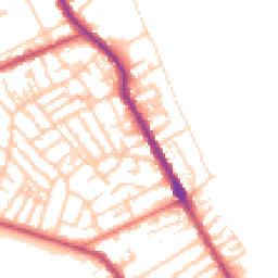
Road Noise
Average road noise levels for this postcode
Daytime
07:00 – 23:00
50.2dB
Low
Night-time
23:00 – 07:00
40.5dB
Low55 dB
60 dB
65 dB
70 dB
75 dB
80 dB
Defra Road Noise Strategic Mapping, Round 4Crime Analysis
6 months of data for Wallasey
Total Crimes
35
Monthly Avg
6
Recent Trend
Stable
Most Common
Violence & Sexual
Crime by Category
Violence & Sexual14(40%)
Criminal Damage & Arson5(14%)
Public Order5(14%)
Drugs4(11%)
Other Crime2(6%)
Weapons1(3%)
Vehicle Crime1(3%)
Shoplifting1(3%)
Other Theft1(3%)
Burglary1(3%)
Recent Incidents
Violence & Sexual
Nov 2025On or near Littledale Road
Weapons
Nov 2025On or near The Birches
Violence & Sexual
Nov 2025On or near The Birches
Criminal Damage & Arson
Nov 2025On or near Hawarden Avenue
Vehicle Crime
Nov 2025On or near Hawarden Avenue
Violence & Sexual
Nov 2025On or near Hawarden Avenue
Data from Police UK • Updated monthly
Local Amenities
Schools and transport links nearby
Nearby Schools
21 within 3kmP
Egremont Primary School
349m
4 mins
P
Liscard Primary School
669m
8 mins
P
Somerville Primary School
864m
10 mins
S
The Oldershaw School
1.4km
17 mins
S
Weatherhead High School
2.0km
24 mins
S
St Mary's Catholic College, A Voluntary Academy
2.4km
29 mins
Transport Links
30 within 3kmRice Lane
Bus Stop137m
2 mins
St Brides Road
Bus Stop148m
2 mins
Union Street
Bus Stop165m
2 mins
Stringhey Road
Bus Stop251m
3 mins
Lea Road
Bus Stop276m
3 mins
Church Lane
Bus Stop351m
4 mins
School data from Dept. for Education • Transport data from NaPTAN
Nearby Property Businesses
Local professionals serving this area
Map
51 points of interest nearby
Map data from OpenStreetMap • Transport data from NaPTAN • School data from Dept. for Education • Scenic data from Beautifulplaces.ai
Frequently Asked Questions
Common questions about this property