Are you a property professional?Get qualified leads from motivated homeowners.
Get started1 Glamis Close, Vicars Cross, Chester, CH3 5PY
This 64 square metre property in Vicars Cross, Chester, Chester carries an energy performance rating of D, in line with typical UK homes. It is heated by a gas central heating system and is currently listed as social housing.
Property Type
End-Terrace Bungalow
Bedrooms
2
Floor Area
64 m²
Council Tax
Band B
Property Features
Built 1983–1990
Get started
Ready to take the next step? Find the right professionals for your property journey.
Energy Performance
EPC rating and efficiency details
Current Certificate(1 of 2)
Sept 2024
EPC Rating
A
B
C
D
D68
E
F
G
Main Heating
Gas
Main Fuel
Gas
Hot Water
Good
Windows
Average
CO2 Emissions
2.5 t/year
Tenure
Rented
Property Improvements
Changes detected from historical EPC data
Sept 2024from Nov 2011
Hot Water
AverageGood
Hot water efficiency improved
Roof Insulation
InsulatedWell Insulated
Loft insulation upgraded to recommended levels
Low Energy Lighting
38%100%
More low energy lighting installed
Are we missing something? Tell us about home improvements to help adjust your valuation.
Price & History
Transactions and market trends
Estimated value
£194,000
How our AI predicts property prices · Accurate to within 10%
Automated estimate only. For an accurate valuation, consult a surveyor or estate agent.
Transaction history
No sales history found
Nearby in CH3 5PY
No nearby sales found
House Price Index
England+3.3%
101.6
Jan 26
UK HPI from HM Land Registry. Baseline: Jan 2015 = 100.
How This Property Compares on Glamis Close
See how this property stacks up against others nearby
Comparing to 12 other houses on this street
EPC Rating
Government energy efficiency score (1–100)
68 (D)/77 (C) avg
Less efficientMore efficient
More efficient than only 13% of similar properties
Floor Area
Total internal floor space
64 m²/64 m² avg
SmallerLarger
Around average
CO₂ Emissions
Annual carbon output from heating, hot water & lighting
2.5 t/year/1.9 t/year avg
Higher emissionsLower emissions
Lower emissions than only 8% of similar properties
Habitable Rooms
Living spaces like bedrooms & living rooms
3 rooms/4 rooms avg
FewerMore
More rooms than only 25% of similar properties
Comparisons are based on the most recent EPC data for each property in this postcode. Only similar property types (houses) are compared.
Get alerts for CH3 5PY
New sales, price changes, and market updates in this area
About Vicars Cross, Chester
This property is located in Vicars Cross, a sizable suburb on the eastern side of Chester, within the unitary authority of Cheshire West and Chester.
Vicars Cross (originally "Vicar's Cross") is a large residential suburb constituting the civil parish of Great Boughton, situated on the eastern side of Chester. It is located in the unitary authority of Cheshire West and Chester and the ceremonial county of Cheshire, England, United Kingdom. At the 2011 Census the area contained a population of about 8,984.
Places to visit
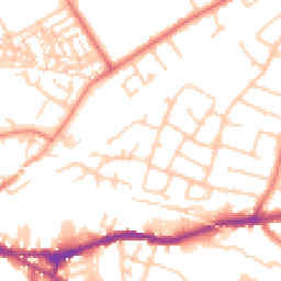
Road Noise
Average road noise levels for this postcode
Daytime
07:00 – 23:00
52.3dB
Low
Night-time
23:00 – 07:00
41.9dB
Low55 dB
60 dB
65 dB
70 dB
75 dB
80 dB
Defra Road Noise Strategic Mapping, Round 4Crime Analysis
4 months of data for Chester
Total Crimes
5
Monthly Avg
1
Recent Trend
Stable
Most Common
Public Order
Crime by Category
Public Order3(60%)
Other Crime1(20%)
Violence & Sexual1(20%)
Recent Incidents
Other Crime
Nov 2025On or near Hockenhull Avenue
Public Order
Oct 2025On or near Strawberry Close
Public Order
Oct 2025On or near Gibson Close
Public Order
Aug 2025On or near Petrol Station
Violence & Sexual
Feb 2025On or near Bolesworth Road
Data from Police UK • Updated monthly
Local Amenities
Schools and transport links nearby
Nearby Schools
22 within 3kmP
Hoole Church of England Primary School
252m
3 mins
P
Cherry Grove Primary School
550m
7 mins
P
St Werburgh's and St Columba's Catholic Primary School
653m
8 mins
S
The Bishops' Blue Coat Church of England High School
1.3km
16 mins
S
Chester International School
1.8km
22 mins
S
Queen's Park High School
1.9km
23 mins
Transport Links
30 within 3kmBarkhill Road/Cowdor Drive
Bus Stop80m
1 min
Barkhill Road/Crathie Road
Bus Stop96m
1 min
Queens Road
Bus Stop262m
3 mins
Melrose Avenue/Ballater Crescent
Bus Stop265m
3 mins
Canadian Avenue
Bus Stop292m
4 mins
Canadian Ave
Bus Stop351m
4 mins
School data from Dept. for Education • Transport data from NaPTAN
Nearby Property Businesses
Local professionals serving this area
Surveyor
Legat Owen
Chester
RICS

DEESURVEYS LIMITED
Chester
RICSResidential

Rockall Building Surveyors Ltd
Chester
RICSResidential
Surveyor
Manchester Party Wall Surveyors
Chester
RICS

Chesterbridge Surveyors Limited
Chester
RICSResidential
Surveyor
Survices First Limited
Chester
RICS
Surveyor
Rostons Ltd
Chester
RICS
Surveyor
De Novo
Chester
RICS
Map
52 points of interest nearby
Map data from OpenStreetMap • Transport data from NaPTAN • School data from Dept. for Education • Scenic data from Beautifulplaces.ai
Frequently Asked Questions
Common questions about this property