Are you a property professional?Get qualified leads from motivated homeowners.
Get started53 Vale Street, Ettingshall, Wolverhampton, WV2 2EH
This property in Ettingshall, Wolverhampton, Wolverhampton. Records show the property last changed hands for £52,000 back in 2013.
Property Type
Property
Bedrooms
—
Floor Area
— m²
Council Tax
Band A
Get started
Ready to take the next step? Find the right professionals for your property journey.
Energy Performance
EPC rating and efficiency details
A
B
C
D
E
F
G
No EPC on record
This property doesn't have an Energy Performance Certificate yet. An EPC helps us give a more accurate valuation and is required to sell or let.
Price & History
Transactions and market trends
Transaction history
£52,000Latest
May 2013Source: HM Land Registry
Nearby in WV2 2EH
2 Vale Street Ettingshall Wolverhampton WV2 2EH
Sept 2020
£70,000
19 Vale Street Ettingshall Wolverhampton WV2 2EH
Jun 2019
£59,000
10 Vale Street Ettingshall Wolverhampton WV2 2EH
Jan 2019
£85,000
23 Vale Street Ettingshall Wolverhampton WV2 2EH
May 2007
£50,000
4 Vale Street Ettingshall Wolverhampton WV2 2EH
Feb 2003
£14,400
35 Vale Street Ettingshall Wolverhampton WV2 2EH
Jun 1997
£21,000
House Price Index
Wolverhampton+5.1%
105.6
Jan 26
UK HPI from HM Land Registry. Baseline: Jan 2015 = 100.
How This Property Compares on Vale Street
See how this property stacks up against others nearby
Not enough similar properties in this postcode to make meaningful comparisons.
Get alerts for WV2 2EH
New sales, price changes, and market updates in this area
About Ettingshall, Wolverhampton
This property is located in Ettingshall, a neighbourhood within Wolverhampton’s WV 4 postal district, and falls under the jurisdiction of the local city council wards of Ettingshall North, Ettingshall South, and Spring Vale.
Ettingshall is an area of Wolverhampton, England. It lies within two wards of Wolverhampton City Council: Ettingshall North and Ettingshall South and Spring Vale. The population of Ettingshall taken at the 2011 census was 13,482. The locality is part of the West Midlands region and is identified by the postal district WV 4. The area is governed locally by the city council and is described as a residential neighbourhood within the larger city of Wolverhampton.
Places to visit
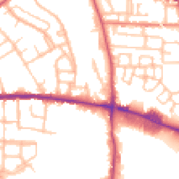
Road Noise
Average road noise levels for this postcode
Daytime
07:00 – 23:00
52.1dB
Low
Night-time
23:00 – 07:00
42.5dB
Low55 dB
60 dB
65 dB
70 dB
75 dB
80 dB
Defra Road Noise Strategic Mapping, Round 4Crime Analysis
8 months of data for Wolverhampton
Total Crimes
40
Monthly Avg
5
Recent Trend
Stable
Most Common
Violence & Sexual
Crime by Category
Violence & Sexual26(65%)
Criminal Damage & Arson3(8%)
Other Theft3(8%)
Shoplifting2(5%)
Public Order2(5%)
Vehicle Crime2(5%)
Weapons1(3%)
Theft from Person1(3%)
Recent Incidents
Criminal Damage & Arson
Dec 2025On or near Joan Street
Violence & Sexual
Nov 2025On or near Wanderers Avenue
Violence & Sexual
Nov 2025On or near Wanderers Avenue
Violence & Sexual
Nov 2025On or near Tolworth Gardens
Criminal Damage & Arson
Nov 2025On or near Tolworth Gardens
Shoplifting
Nov 2025On or near Grove Street
Data from Police UK • Updated monthly
Local Amenities
Schools and transport links nearby
Nearby Schools
35 within 3kmP
Parkfield Primary School
591m
7 mins
P
Bilston Church of England Primary School
842m
10 mins
P
St Teresa's Catholic Primary Academy
966m
12 mins
S
The Khalsa Academy Wolverhampton
1.1km
13 mins
S
Ormiston SWB Academy
1.8km
22 mins
S
St Matthias School
2.3km
28 mins
Transport Links
10 within 3kmPriestfield (West Midlands Metro)
Underground629m
8 mins
The Crescent (West Midlands Metro)
Underground1.5km
19 mins
The Royal (West Midlands Metro)
Underground1.8km
22 mins
Bilston Central (West Midlands Metro)
Underground1.9km
23 mins
Wolverhampton St George's (West Midlands Metro)
Underground2.3km
28 mins
Wolverhampton Rail Station
Rail2.5km
30 mins
School data from Dept. for Education • Transport data from NaPTAN
Nearby Property Businesses
Local professionals serving this area
Surveyor
Houzecheck Surveying Ltd
Wolverhampton
RICSResidential
Surveyor
Anthony J Stirk
Wolverhampton
RICS
Surveyor
MS Surveying Consultant
Wolverhampton
RICS
Surveyor
Stephen Berg Associates
Wolverhampton
RICSResidentialFree Advice
Surveyor
Haston Reynolds
Wolverhampton
RICSResidential

Assurvey
Wolverhampton
RICSResidential
Surveyor
RES Property Surveyors
Wolverhmapton
RICSResidential
Surveyor
Cosey Homes Chartered Surveyors
Wolverhampton
RICSResidential
Map
45 points of interest nearby
Map data from OpenStreetMap • Transport data from NaPTAN • School data from Dept. for Education • Scenic data from Beautifulplaces.ai
Frequently Asked Questions
Common questions about this property