Are you a property professional?Get qualified leads from motivated homeowners.
Get started5 Brown Street, Wolverhampton, WV2 1HR
This property in Wolverhampton. Explore detailed information about this Wolverhampton property including energy performance, price history, local schools, transport links and crime statistics.
Property Type
Property
Bedrooms
—
Floor Area
— m²
Council Tax
Band A
Get started
Ready to take the next step? Find the right professionals for your property journey.
Energy Performance
EPC rating and efficiency details
A
B
C
D
E
F
G
No EPC on record
This property doesn't have an Energy Performance Certificate yet. An EPC helps us give a more accurate valuation and is required to sell or let.
Price & History
Transactions and market trends
Transaction history
No sales history found
Nearby in WV2 1HR
19 Brown Street Wolverhampton WV2 1HR
Apr 2025
£110,000
9 Brown Street Wolverhampton WV2 1HR
Jan 2025
£140,000
49 Brown Street Wolverhampton WV2 1HR
Jan 2024
£115,000
12 Brown Street Wolverhampton WV2 1HR
Feb 2022
£125,000
25 Brown Street Wolverhampton WV2 1HR
Jun 2019
£99,500
20 Brown Street Wolverhampton WV2 1HR
Apr 2019
£75,000
1 / 6
House Price Index
Wolverhampton+5.1%
105.6
Jan 26
UK HPI from HM Land Registry. Baseline: Jan 2015 = 100.
How This Property Compares on Brown Street
See how this property stacks up against others nearby
Not enough similar properties in this postcode to make meaningful comparisons.
Get alerts for WV2 1HR
New sales, price changes, and market updates in this area
Places to visit
Road Noise
Average road noise levels for this postcode
Daytime
07:00 – 23:00
54.5dB
Low
Night-time
23:00 – 07:00
44.0dB
Low55 dB
60 dB
65 dB
70 dB
75 dB
80 dB
Defra Road Noise Strategic Mapping, Round 4Crime Analysis
8 months of data for Wolverhampton
Total Crimes
40
Monthly Avg
5
Recent Trend
Stable
Most Common
Violence & Sexual
Crime by Category
Violence & Sexual26(65%)
Criminal Damage & Arson3(8%)
Other Theft3(8%)
Shoplifting2(5%)
Public Order2(5%)
Vehicle Crime2(5%)
Weapons1(3%)
Theft from Person1(3%)
Recent Incidents
Criminal Damage & Arson
Dec 2025On or near Joan Street
Violence & Sexual
Nov 2025On or near Wanderers Avenue
Violence & Sexual
Nov 2025On or near Wanderers Avenue
Violence & Sexual
Nov 2025On or near Tolworth Gardens
Criminal Damage & Arson
Nov 2025On or near Tolworth Gardens
Shoplifting
Nov 2025On or near Grove Street
Data from Police UK • Updated monthly
Local Amenities
Schools and transport links nearby
Nearby Schools
35 within 3kmP
SS Mary and John's Catholic Primary Academy
205m
2 mins
P
Grove Primary Academy
282m
3 mins
P
St Luke's Church of England Aided Primary School
620m
7 mins
S
The Royal School, Wolverhampton
1.1km
13 mins
S
The Khalsa Academy Wolverhampton
1.4km
17 mins
S
Colton Hills Community School
1.8km
22 mins
Transport Links
7 within 3kmThe Royal (West Midlands Metro)
Underground756m
9 mins
Wolverhampton St George's (West Midlands Metro)
Underground991m
12 mins
Pipers Row (West Midlands Metro)
Underground1.1km
13 mins
Wolverhampton Station (West Midlands Metro)
Underground1.4km
16 mins
Wolverhampton Rail Station
Rail1.4km
17 mins
Priestfield (West Midlands Metro)
Underground1.7km
21 mins
School data from Dept. for Education • Transport data from NaPTAN
Nearby Property Businesses
Local professionals serving this area
Surveyor
Houzecheck Surveying Ltd
Wolverhampton
RICSResidential
Surveyor
Anthony J Stirk
Wolverhampton
RICS
Surveyor
MS Surveying Consultant
Wolverhampton
RICS
Surveyor
Stephen Berg Associates
Wolverhampton
RICSResidentialFree Advice
Surveyor
Haston Reynolds
Wolverhampton
RICSResidential

Assurvey
Wolverhampton
RICSResidential
Surveyor
RES Property Surveyors
Wolverhmapton
RICSResidential
Surveyor
Cosey Homes Chartered Surveyors
Wolverhampton
RICSResidential
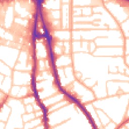
Map
42 points of interest nearby
Map data from OpenStreetMap • Transport data from NaPTAN • School data from Dept. for Education • Scenic data from Beautifulplaces.ai
Frequently Asked Questions
Common questions about this property