Are you a property professional?Get qualified leads from motivated homeowners.
Get startedLong-term Owner
1 Delamere Way, Upholland, Skelmersdale, WN8 0HP
This property in Upholland, Skelmersdale, Skelmersdale. Records show the property last changed hands for £43,000 back in 2000.
Property Type
Property
Bedrooms
—
Floor Area
— m²
Council Tax
Band A
Get started
Ready to take the next step? Find the right professionals for your property journey.
Energy Performance
EPC rating and efficiency details
A
B
C
D
E
F
G
No EPC on record
This property doesn't have an Energy Performance Certificate yet. An EPC helps us give a more accurate valuation and is required to sell or let.
Price & History
Transactions and market trends
Transaction history
+28.4%(4y)
£43,000Latest
Oct 2000£33,500
Aug 1996Source: HM Land Registry
Nearby in WN8 0HP
52 Delamere Way Upholland Skelmersdale WN8 0HP
Dec 2021
£130,000
54 Delamere Way Upholland Skelmersdale WN8 0HP
May 2020
£93,000
36 Delamere Way Upholland Skelmersdale WN8 0HP
Mar 2020
£83,000
25 Delamere Way Upholland Skelmersdale WN8 0HP
Oct 2019
£86,000
64 Delamere Way Upholland Skelmersdale WN8 0HP
Sept 2019
£97,000
21 Delamere Way Upholland Skelmersdale WN8 0HP
Jan 2018
£95,000
1 / 3
House Price Index
England+1.5%
101.6
Jan 26
UK HPI from HM Land Registry. Baseline: Jan 2015 = 100.
How This Property Compares on Delamere Way
See how this property stacks up against others nearby
Not enough similar properties in this postcode to make meaningful comparisons.
Get alerts for WN8 0HP
New sales, price changes, and market updates in this area
About Upholland, Skelmersdale
This property is located in Upholland, a neighbourhood within Skelmersdale, a town in the West Lancashire district. It lies on the River Tawd and is within commuting distance of Wigan, Liverpool and Preston.
Upholland is a locality within the town of Skelmersdale in Lancashire, England. Skelmersdale is a town in the West Lancashire district. It sits on the River Tawd, 6 miles (10 km) west of Wigan, 13 miles (21 km) north‑east of Liverpool and 15 miles (24 km) south‑west of Preston. In 2006, Skelmersdale had a population of 38,813. The town is known locally as Skem.
Places to visit
Road Noise
Average road noise levels for this postcode
Daytime
07:00 – 23:00
51.2dB
Low
Night-time
23:00 – 07:00
40.7dB
Low55 dB
60 dB
65 dB
70 dB
75 dB
80 dB
Defra Road Noise Strategic Mapping, Round 4Crime Analysis
7 months of data for Skelmersdale
Total Crimes
57
Monthly Avg
8
Recent Trend
Stable
Most Common
Violence & Sexual
Crime by Category
Violence & Sexual32(56%)
Criminal Damage & Arson5(9%)
Burglary4(7%)
Vehicle Crime3(5%)
Drugs3(5%)
Public Order3(5%)
Other Crime2(4%)
Other Theft2(4%)
Robbery2(4%)
Weapons1(2%)
Recent Incidents
Violence & Sexual
Nov 2025On or near Potter Close
Violence & Sexual
Nov 2025On or near Ludlow
Violence & Sexual
Nov 2025On or near Ulverston Drive
Violence & Sexual
Nov 2025On or near Abbeywood
Vehicle Crime
Nov 2025On or near Abbeywood
Other Crime
Nov 2025On or near Parking Area
Data from Police UK • Updated monthly
Local Amenities
Schools and transport links nearby
Nearby Schools
19 within 3kmP
St Thomas the Martyr Voluntary Aided Church of England Primary School
322m
4 mins
P
St Teresa's Catholic Primary School
813m
10 mins
P
Holland Moor Primary School
943m
11 mins
S
Up Holland High School
2.0km
24 mins
S
St Peter's Catholic High School
2.3km
28 mins
S
St John Rigby RC Sixth Form College
2.7km
33 mins
Transport Links
30 within 3kmMillgreen Close
Bus Stop151m
2 mins
Mayfield Road
Bus Stop218m
3 mins
Dearden Way
Bus Stop322m
4 mins
Ormskirk Road
Bus Stop356m
4 mins
Victoria Hotel
Bus Stop474m
6 mins
Denshaw
Bus Stop525m
6 mins
School data from Dept. for Education • Transport data from NaPTAN
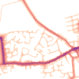
Map
49 points of interest nearby
Map data from OpenStreetMap • Transport data from NaPTAN • School data from Dept. for Education • Scenic data from Beautifulplaces.ai
Frequently Asked Questions
Common questions about this property