Are you a property professional?Get qualified leads from motivated homeowners.
Get started48 Gledwood Gardens, Hayes, UB4 0AU
This property in Hayes. Explore detailed information about this Hayes property including energy performance, price history, local schools, transport links and crime statistics.
Property Type
Property
Bedrooms
—
Floor Area
— m²
Council Tax
Band D
Get started
Ready to take the next step? Find the right professionals for your property journey.
Energy Performance
EPC rating and efficiency details
A
B
C
D
E
F
G
No EPC on record
This property doesn't have an Energy Performance Certificate yet. An EPC helps us give a more accurate valuation and is required to sell or let.
Price & History
Transactions and market trends
Transaction history
No sales history found
Nearby in UB4 0AU
69 Gledwood Gardens Hayes UB4 0AU
Mar 2025
£625,000
32 Gledwood Gardens Hayes UB4 0AU
Oct 2019
£380,000
50 Gledwood Gardens Hayes UB4 0AU
Jul 2017
£457,000
30 Gledwood Gardens Hayes UB4 0AU
Jul 2014
£300,000
44 Gledwood Gardens Hayes UB4 0AU
Aug 2012
£310,000
54 Gledwood Gardens Hayes UB4 0AU
Sept 2008
£248,000
1 / 4
House Price Index
England+1.5%
101.6
Jan 26
UK HPI from HM Land Registry. Baseline: Jan 2015 = 100.
How This Property Compares on Gledwood Gardens
See how this property stacks up against others nearby
Not enough similar properties in this postcode to make meaningful comparisons.
Get alerts for UB4 0AU
New sales, price changes, and market updates in this area
Places to visit
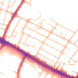
Road Noise
Average road noise levels for this postcode
Daytime
07:00 – 23:00
51.4dB
Low
Night-time
23:00 – 07:00
41.7dB
Low55 dB
60 dB
65 dB
70 dB
75 dB
80 dB
Defra Road Noise Strategic Mapping, Round 4Crime Analysis
12 months of data for Hayes
Total Crimes
247
Monthly Avg
21
Recent Trend
Rising
Most Common
Shoplifting
Crime by Category
Shoplifting107(43%)
Violence & Sexual45(18%)
Theft from Person21(9%)
Vehicle Crime17(7%)
Other Theft13(5%)
Public Order12(5%)
Robbery8(3%)
Criminal Damage & Arson7(3%)
Burglary6(2%)
Bicycle Theft4(2%)
Drugs4(2%)
Weapons2(1%)
Other Crime1(0%)
Recent Incidents
Shoplifting
Dec 2025On or near Supermarket
Shoplifting
Dec 2025On or near Supermarket
Shoplifting
Dec 2025On or near Supermarket
Shoplifting
Dec 2025On or near Supermarket
Shoplifting
Dec 2025On or near Supermarket
Robbery
Dec 2025On or near Supermarket
Data from Police UK • Updated monthly
Local Amenities
Schools and transport links nearby
Nearby Schools
38 within 3kmP
Grange Park School
464m
6 mins
P
Dr Triplett's CofE Primary School
588m
7 mins
P
Hayes Park School
767m
9 mins
S
Parkside Studio College
1.1km
13 mins
S
Rosedale College
1.1km
13 mins
S
Barnhill Community High School
1.4km
16 mins
Transport Links
30 within 3kmChurch Road (UB3)
Bus Stop306m
4 mins
Church Road / Swift Close
Bus Stop322m
4 mins
Belmore Parade
Bus Stop373m
4 mins
Uxbridge County Court
Bus Stop397m
5 mins
Balmoral Drive
Bus Stop468m
6 mins
Whittington Avenue
Bus Stop503m
6 mins
School data from Dept. for Education • Transport data from NaPTAN
Nearby Property Businesses
Local professionals serving this area
Map
68 points of interest nearby
Map data from OpenStreetMap • Transport data from NaPTAN • School data from Dept. for Education • Scenic data from Beautifulplaces.ai
Frequently Asked Questions
Common questions about this property