Are you a property professional?Get qualified leads from motivated homeowners.
Get startedExtended
3 The Larches, Uxbridge, UB10 0DJ
This 105 square metre property in Uxbridge carries an energy performance rating of D, in line with typical UK homes. It is heated by a gas central heating system and is currently listed as a private rental.
Property Type
Semi-Detached House
Bedrooms
3
Floor Area
105 m²
Council Tax
Band D
Property Features
Built 1930–1949
Get started
Ready to take the next step? Find the right professionals for your property journey.
Energy Performance
EPC rating and efficiency details
EPC Rating
A
B
C
D
D63
E
F
G
Main Heating
Gas
Main Fuel
Gas
Hot Water
Good
Windows
Average
CO2 Emissions
4.5 t/year
Tenure
Rented
Price & History
Transactions and market trends
Estimated value
£553,000
How our AI predicts property prices · Accurate to within 10%
Automated estimate only. For an accurate valuation, consult a surveyor or estate agent.
Transaction history
No sales history found
Nearby in UB10 0DJ
1 The Larches Uxbridge UB10 0DJ
Aug 2025
£860,000
1a The Larches Uxbridge UB10 0DJ
Dec 2024
£482,000
34 The Larches Uxbridge UB10 0DJ
Jul 2024
£565,000
29 The Larches Uxbridge UB10 0DJ
Nov 2022
£365,000
17 The Larches Uxbridge UB10 0DJ
Jul 2022
£315,000
23 The Larches Uxbridge UB10 0DJ
Mar 2022
£315,000
1 / 5
House Price Index
England+1.5%
101.6
Jan 26
UK HPI from HM Land Registry. Baseline: Jan 2015 = 100.
How This Property Compares on The Larches
See how this property stacks up against others nearby
Comparing to 13 other houses on this street
EPC Rating
Government energy efficiency score (1–100)
63 (D)/66 (D) avg
Less efficientMore efficient
Around average
Floor Area
Total internal floor space
105 m²/106 m² avg
SmallerLarger
Larger than 65% of similar properties
CO₂ Emissions
Annual carbon output from heating, hot water & lighting
4.5 t/year/4.0 t/year avg
Higher emissionsLower emissions
Lower emissions than only 31% of similar properties
Habitable Rooms
Living spaces like bedrooms & living rooms
5 rooms/6 rooms avg
FewerMore
More rooms than only 38% of similar properties
Comparisons are based on the most recent EPC data for each property in this postcode. Only similar property types (houses) are compared.
Get alerts for UB10 0DJ
New sales, price changes, and market updates in this area
Places to visit
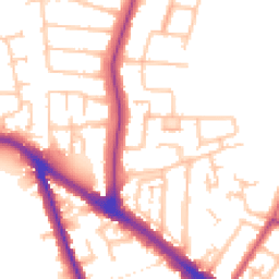
Road Noise
Average road noise levels for this postcode
Daytime
07:00 – 23:00
52.6dB
Low
Night-time
23:00 – 07:00
43.5dB
Low55 dB
60 dB
65 dB
70 dB
75 dB
80 dB
Defra Road Noise Strategic Mapping, Round 4Crime Analysis
10 months of data for Uxbridge
Total Crimes
34
Monthly Avg
3
Recent Trend
Stable
Most Common
Violence & Sexual
Crime by Category
Violence & Sexual9(26%)
Criminal Damage & Arson7(21%)
Burglary5(15%)
Other Theft4(12%)
Other Crime2(6%)
Drugs2(6%)
Theft from Person2(6%)
Vehicle Crime2(6%)
Public Order1(3%)
Recent Incidents
Criminal Damage & Arson
Dec 2025On or near Gresham Road
Violence & Sexual
Dec 2025On or near Gresham Road
Other Crime
Nov 2025On or near Hazeldene Gardens
Criminal Damage & Arson
Nov 2025On or near Hornchurch Road
Other Theft
Nov 2025On or near Russet Close
Criminal Damage & Arson
Oct 2025On or near Roker Park Avenue
Data from Police UK • Updated monthly
Local Amenities
Schools and transport links nearby
Nearby Schools
34 within 3kmP
Highfield Primary School
413m
5 mins
P
Hillingdon Primary School
420m
5 mins
P
St Bernadette Catholic Primary School
538m
6 mins
S
Oak Wood School
370m
4 mins
S
Swakeleys School for Girls
475m
6 mins
S
Bishopshalt School
668m
8 mins
Transport Links
30 within 3kmCrescent Parade
Bus Stop250m
3 mins
Long Lane (UB10)
Bus Stop312m
4 mins
Hillingdon School
Bus Stop352m
4 mins
Clifton Gardens (UB10)
Bus Stop392m
5 mins
Clifton Gardens (UB10)
Bus Stop399m
5 mins
Hilliers Avenue
Bus Stop421m
5 mins
School data from Dept. for Education • Transport data from NaPTAN
Nearby Property Businesses
Local professionals serving this area

Map
64 points of interest nearby
Map data from OpenStreetMap • Transport data from NaPTAN • School data from Dept. for Education • Scenic data from Beautifulplaces.ai
Frequently Asked Questions
Common questions about this property