Are you a property professional?Get qualified leads from motivated homeowners.
Get startedEPC B RatedDetachedLong-term Owner
32 Vine Lane, Uxbridge, UB10 0BA
This 372 square metre property in Uxbridge carries an energy performance rating of B, indicating very good energy efficiency standards. The property is heated by a gas central heating system. Records show the property last changed hands for £485,000 back in 2006.
Property Type
Detached House
Bedrooms
6
Floor Area
372 m²
Council Tax
Band N/A
Get started
Ready to take the next step? Find the right professionals for your property journey.
Energy Performance
EPC rating and efficiency details
EPC Expired
This certificate is over 10 years old and is no longer valid.Expired 11 Aug 2024
EPC Rating
A
B
B89
C
D
E
F
G
Main Heating
Electric & Gas
Main Fuel
Gas
Hot Water
Good
Windows
Good
CO2 Emissions
3.7 t/year
Tenure
—
Price & History
Transactions and market trends
Estimated value
£1,156,000
How our AI predicts property prices · Accurate to within 10%
Automated estimate only. For an accurate valuation, consult a surveyor or estate agent.
Transaction history
£485,000Latest
Mar 2006Source: HM Land Registry
Nearby in UB10 0BA
40a Vine Lane Uxbridge UB10 0BA
Dec 2023
£1,675,000
37 Vine Lane Uxbridge UB10 0BA
Aug 2022
£815,000
36 Vine Lane Uxbridge UB10 0BA
Mar 2020
£995,000
31 Vine Lane Uxbridge UB10 0BA
Sept 2016
£605,000
33 Vine Lane Uxbridge UB10 0BA
Aug 2016
£575,000
35 Vine Lane Uxbridge UB10 0BA
Dec 2011
£444,950
1 / 3
House Price Index
England+1.5%
101.6
Jan 26
UK HPI from HM Land Registry. Baseline: Jan 2015 = 100.
How This Property Compares on Vine Lane
See how this property stacks up against others nearby
Comparing to 13 other houses on this street
Price per m²
Property value per square metre of floor space
£1,304/£3,952 avg
LowerHigher
Higher than only 9% of similar properties
Years Held
Time since last sale — indicates ownership stability
20 years/14 years avg
ShorterLonger
Held longer than 73% of similar properties
EPC Rating
Government energy efficiency score (1–100)
89 (B)/67 (D) avg
Less efficientMore efficient
More efficient than 88% of similar properties
Floor Area
Total internal floor space
372 m²/221 m² avg
SmallerLarger
Larger than 69% of similar properties
CO₂ Emissions
Annual carbon output from heating, hot water & lighting
3.7 t/year/6.3 t/year avg
Higher emissionsLower emissions
Lower emissions than 73% of similar properties
Comparisons are based on the most recent EPC data for each property in this postcode. Only similar property types (houses) are compared.
Get alerts for UB10 0BA
New sales, price changes, and market updates in this area
Places to visit
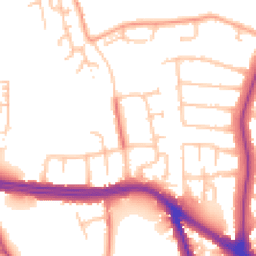
Road Noise
Average road noise levels for this postcode
Daytime
07:00 – 23:00
52.8dB
Low
Night-time
23:00 – 07:00
43.9dB
Low55 dB
60 dB
65 dB
70 dB
75 dB
80 dB
Defra Road Noise Strategic Mapping, Round 4Crime Analysis
10 months of data for Uxbridge
Total Crimes
34
Monthly Avg
3
Recent Trend
Stable
Most Common
Violence & Sexual
Crime by Category
Violence & Sexual9(26%)
Criminal Damage & Arson7(21%)
Burglary5(15%)
Other Theft4(12%)
Other Crime2(6%)
Drugs2(6%)
Theft from Person2(6%)
Vehicle Crime2(6%)
Public Order1(3%)
Recent Incidents
Criminal Damage & Arson
Dec 2025On or near Gresham Road
Violence & Sexual
Dec 2025On or near Gresham Road
Other Crime
Nov 2025On or near Hazeldene Gardens
Criminal Damage & Arson
Nov 2025On or near Hornchurch Road
Other Theft
Nov 2025On or near Russet Close
Criminal Damage & Arson
Oct 2025On or near Roker Park Avenue
Data from Police UK • Updated monthly
Local Amenities
Schools and transport links nearby
Nearby Schools
33 within 3kmP
St Bernadette Catholic Primary School
657m
8 mins
P
John Locke Academy
883m
11 mins
P
Hillingdon Primary School
925m
11 mins
S
Bishopshalt School
571m
7 mins
S
Oak Wood School
879m
11 mins
S
Uxbridge High School
913m
11 mins
Transport Links
30 within 3kmSt John's Church
Bus Stop252m
3 mins
Harlington Road
Bus Stop310m
4 mins
Hillingdon Hill
Bus Stop357m
4 mins
Coney Green
Bus Stop374m
5 mins
Hillingdon Cemetery
Bus Stop428m
5 mins
Clifton Gardens (UB10)
Bus Stop525m
6 mins
School data from Dept. for Education • Transport data from NaPTAN
Nearby Property Businesses
Local professionals serving this area

Map
63 points of interest nearby
Map data from OpenStreetMap • Transport data from NaPTAN • School data from Dept. for Education • Scenic data from Beautifulplaces.ai
Frequently Asked Questions
Common questions about this property