Are you a property professional?Get qualified leads from motivated homeowners.
Get startedExtended
1 Ensign Close, Stanwell, Staines Upon Thames, TW19 7RF
This 118 square metre property in Stanwell, Staines-upon-thames, Staines Upon Thames carries an energy performance rating of C, which is above the national average. It is heated by a gas central heating system and is currently listed as a private rental. Records show the property last changed hands for £250,000 back in 2012.
Property Type
Semi-Detached House
Bedrooms
3
Floor Area
118 m²
Council Tax
Band D
Property Features
Built 1950–1966
Garden
South West-facing
Cul-de-sac
Quiet, low-traffic location
Get started
Ready to take the next step? Find the right professionals for your property journey.
Energy Performance
EPC rating and efficiency details
Current Certificate(1 of 5)
Feb 2026
EPC Rating
A
B
C
C69
D
E
F
G
Main Heating
Gas
Main Fuel
Gas
Hot Water
Good
Windows
Poor
CO2 Emissions
3.7 t/year
Tenure
Rented
Property Improvements
Changes detected from historical EPC data
Nov 2013from Oct 2011
EPC improved fromE44toD63
Roof Insulation
UninsulatedPartial
Roof insulation improved
Jun 2014from Nov 2013
Windows
Mostly DoubleFull Double
Windows upgraded, improving insulation
Wall Insulation
UninsulatedInsulated Cavity
Cavity wall insulation installed
Nov 2016from Jun 2014
Roof Insulation
UninsulatedWell Insulated
Loft insulation installed or upgraded to 250mm+
Low Energy Lighting
17%100%
More low energy lighting installed
Feb 2026from Nov 2016
EPC improved fromD68toC69
Are we missing something? Tell us about home improvements to help adjust your valuation.
Price & History
Transactions and market trends
Estimated value
£447,000
How our AI predicts property prices · Accurate to within 10%
Automated estimate only. For an accurate valuation, consult a surveyor or estate agent.
Transaction history
+125.2%(12y)
£250,000Latest
Aug 2012£111,000
Mar 2000Source: HM Land Registry
Nearby in TW19 7RF
10 Ensign Close Stanwell Staines Upon Thames TW19 7RF
Mar 2025
£480,000
11 Ensign Close Stanwell Staines Upon Thames TW19 7RF
Feb 2022
£402,000
15 Ensign Close Stanwell Staines Upon Thames TW19 7RF
Oct 2017
£280,000
17 Ensign Close Stanwell Staines Upon Thames TW19 7RF
Mar 2016
£222,000
18 Ensign Close Stanwell Staines Upon Thames TW19 7RF
Nov 2012
£140,000
12 Ensign Close Stanwell Staines Upon Thames TW19 7RF
Aug 2001
£160,000
House Price Index
England+1.5%
101.6
Jan 26
UK HPI from HM Land Registry. Baseline: Jan 2015 = 100.
How This Property Compares on Ensign Close
See how this property stacks up against others nearby
Comparing to 5 other houses on this street
Price per m²
Property value per square metre of floor space
£2,119/£3,455 avg
LowerHigher
Higher than only 33% of similar properties
Years Held
Time since last sale — indicates ownership stability
14 years/10 years avg
ShorterLonger
Held longer than 67% of similar properties
EPC Rating
Government energy efficiency score (1–100)
69 (C)/61 (D) avg
Less efficientMore efficient
More efficient than 80% of similar properties
Floor Area
Total internal floor space
118 m²/95 m² avg
SmallerLarger
Larger than 80% of similar properties
CO₂ Emissions
Annual carbon output from heating, hot water & lighting
3.7 t/year/4.2 t/year avg
Higher emissionsLower emissions
Lower emissions than 60% of similar properties
Habitable Rooms
Living spaces like bedrooms & living rooms
6 rooms/5 rooms avg
FewerMore
More rooms than all similar properties
Comparisons are based on the most recent EPC data for each property in this postcode. Only similar property types (houses) are compared.
Get alerts for TW19 7RF
New sales, price changes, and market updates in this area
About Stanwell, Staines-upon-thames
This property is located in Stanwell, a locality within the town of Staines‑upon‑Thames, Surrey, which lies near the junction of the M25 and M3 motorways and close to Heathrow Airport.
Stanwell is part of the town of Staines‑upon‑Thames, a market town in northwest Surrey, England. The town lies approximately 17 miles west of central London and sits at the confluence of the River Thames and the River Colne. Historically part of Middlesex, Staines was transferred to Surrey in 1965. It is within the Borough of Spelthorne and is linked to the national motorway network by the M25 and M3. Staines‑upon‑Thames is part of the Greater London Built‑up Area. The locality of Stanwell therefore benefits from its proximity to these transport links and to Heathrow Airport, while remaining within the character of a market town in Surrey.
Places to visit
Road Noise
Average road noise levels for this postcode
Daytime
07:00 – 23:00
52.0dB
Low
Night-time
23:00 – 07:00
43.1dB
Low55 dB
60 dB
65 dB
70 dB
75 dB
80 dB
Defra Road Noise Strategic Mapping, Round 4Crime Analysis
8 months of data for Staines Upon Thames
Total Crimes
32
Monthly Avg
4
Recent Trend
Stable
Most Common
Violence & Sexual
Crime by Category
Violence & Sexual11(34%)
Criminal Damage & Arson7(22%)
Vehicle Crime6(19%)
Public Order3(9%)
Other Theft1(3%)
Burglary1(3%)
Weapons1(3%)
Robbery1(3%)
Theft from Person1(3%)
Recent Incidents
Vehicle Crime
Dec 2025On or near Clay Lane
Violence & Sexual
Nov 2025On or near Argosy Lane
Vehicle Crime
Nov 2025On or near Stone Well Road
Violence & Sexual
Oct 2025On or near St Mary's Crescent
Other Theft
Oct 2025On or near Argosy Lane
Burglary
Oct 2025On or near St Mary's Crescent
Data from Police UK • Updated monthly
Local Amenities
Schools and transport links nearby
Nearby Schools
9 within 3kmP
Town Farm Primary School & Nursery
526m
6 mins
P
Stanwell Fields CofE Primary School
620m
7 mins
P
Ashford Park Primary School
1.4km
17 mins
S
Thomas Knyvett College
1.2km
14 mins
S
The Matthew Arnold School
2.7km
32 mins
Transport Links
30 within 3kmViscount Road
Bus Stop119m
1 min
Hadrian Close
Bus Stop163m
2 mins
St Annes Avenue
Bus Stop182m
2 mins
Hadrian Way
Bus Stop262m
3 mins
Scots Close
Bus Stop365m
4 mins
Caledonia Road
Bus Stop375m
5 mins
School data from Dept. for Education • Transport data from NaPTAN
Nearby Property Businesses
Local professionals serving this area
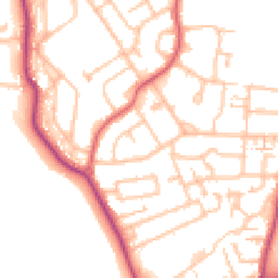
Map
39 points of interest nearby
Map data from OpenStreetMap • Transport data from NaPTAN • School data from Dept. for Education • Scenic data from Beautifulplaces.ai
Frequently Asked Questions
Common questions about this property