Are you a property professional?Get qualified leads from motivated homeowners.
Get started9 Cordelia Gardens, Staines Upon Thames, TW19 7EP
This property in Staines Upon Thames. Explore detailed information about this Staines Upon Thames property including energy performance, price history, local schools, transport links and crime statistics.
Property Type
Property
Bedrooms
—
Floor Area
— m²
Council Tax
Band D
Get started
Ready to take the next step? Find the right professionals for your property journey.
Energy Performance
EPC rating and efficiency details
A
B
C
D
E
F
G
No EPC on record
This property doesn't have an Energy Performance Certificate yet. An EPC helps us give a more accurate valuation and is required to sell or let.
Price & History
Transactions and market trends
Transaction history
No sales history found
Nearby in TW19 7EP
7 Cordelia Gardens Staines Upon Thames TW19 7EP
Sept 2023
£415,000
1 Cordelia Gardens Staines Upon Thames TW19 7EP
Dec 2018
£358,000
11 Cordelia Gardens Staines Upon Thames TW19 7EP
Jan 2015
£320,000
4 Cordelia Gardens Staines Upon Thames TW19 7EP
Oct 2011
£250,000
6 Cordelia Gardens Staines Upon Thames TW19 7EP
Mar 2000
£119,000
House Price Index
England+1.5%
101.6
Jan 26
UK HPI from HM Land Registry. Baseline: Jan 2015 = 100.
How This Property Compares on Cordelia Gardens
See how this property stacks up against others nearby
Not enough similar properties in this postcode to make meaningful comparisons.
Get alerts for TW19 7EP
New sales, price changes, and market updates in this area
Places to visit
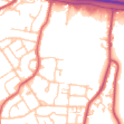
Road Noise
Average road noise levels for this postcode
Daytime
07:00 – 23:00
52.9dB
Low
Night-time
23:00 – 07:00
43.9dB
Low55 dB
60 dB
65 dB
70 dB
75 dB
80 dB
Defra Road Noise Strategic Mapping, Round 4Crime Analysis
8 months of data for Staines Upon Thames
Total Crimes
32
Monthly Avg
4
Recent Trend
Stable
Most Common
Violence & Sexual
Crime by Category
Violence & Sexual11(34%)
Criminal Damage & Arson7(22%)
Vehicle Crime6(19%)
Public Order3(9%)
Other Theft1(3%)
Burglary1(3%)
Weapons1(3%)
Robbery1(3%)
Theft from Person1(3%)
Recent Incidents
Vehicle Crime
Dec 2025On or near Clay Lane
Violence & Sexual
Nov 2025On or near Argosy Lane
Vehicle Crime
Nov 2025On or near Stone Well Road
Violence & Sexual
Oct 2025On or near St Mary's Crescent
Other Theft
Oct 2025On or near Argosy Lane
Burglary
Oct 2025On or near St Mary's Crescent
Data from Police UK • Updated monthly
Local Amenities
Schools and transport links nearby
Nearby Schools
9 within 3kmP
Stanwell Fields CofE Primary School
193m
2 mins
P
Town Farm Primary School & Nursery
660m
8 mins
P
Ashford Park Primary School
1.9km
22 mins
S
Thomas Knyvett College
1.5km
18 mins
Transport Links
30 within 3kmCordelia Road
Bus Stop203m
2 mins
Everest Road
Bus Stop305m
4 mins
Caledonia Road
Bus Stop387m
5 mins
Short Lane
Bus Stop396m
5 mins
Hadrian Way
Bus Stop399m
5 mins
Hadrian Close
Bus Stop410m
5 mins
School data from Dept. for Education • Transport data from NaPTAN
Nearby Property Businesses
Local professionals serving this area
Map
39 points of interest nearby
Map data from OpenStreetMap • Transport data from NaPTAN • School data from Dept. for Education • Scenic data from Beautifulplaces.ai
Frequently Asked Questions
Common questions about this property