Are you a property professional?Get qualified leads from motivated homeowners.
Get startedDetached
1 Riverside, Wraysbury, Staines Upon Thames, TW19 5JN
This 134 square metre property in Wraysbury, Staines-upon-thames, Staines Upon Thames carries an energy performance rating of D, in line with typical UK homes. It is heated by a gas central heating system and is currently listed as owner-occupied. Records show the property last changed hands for £410,000 back in 2013.
Property Type
Detached Bungalow
Bedrooms
3
Floor Area
134 m²
Council Tax
Band E
Flood Risk
Medium
Property Features
Built 1950–1966
Private Garden
Enclosed private garden
Garage
Off-street covered parking
Dining Room
Separate dining space
Conservatory
Glass-enclosed garden room
Get started
Ready to take the next step? Find the right professionals for your property journey.
Energy Performance
EPC rating and efficiency details
EPC Expired
This certificate is over 10 years old and is no longer valid.Expired 06 Feb 2024
Current Certificate(1 of 3)
Feb 2014
EPC Rating
A
B
C
D
D57
E
F
G
Main Heating
Gas
Main Fuel
Gas
Hot Water
Good
Windows
Average
CO2 Emissions
6.1 t/year
Tenure
Owner Occupied
Property Improvements
Changes detected from historical EPC data
Sept 2013from Apr 2012
EPC improved fromE40toD55
Hot Water
Main (No Stat)Main System
Hot water system upgraded
Windows
Mostly DoubleFull Double
Windows upgraded, improving insulation
Feb 2014from Sept 2013
Wall Insulation
UninsulatedInsulated Cavity
Cavity wall insulation installed
Roof Insulation
UninsulatedWell Insulated
Loft insulation installed or upgraded to 250mm+
Are we missing something? Tell us about home improvements to help adjust your valuation.
Price & History
Transactions and market trends
Estimated value
£654,000
How our AI predicts property prices · Accurate to within 10%
Automated estimate only. For an accurate valuation, consult a surveyor or estate agent.
Transaction history
+86.4%(13y)
£410,000Latest
Apr 2013£220,000
May 2000Source: HM Land Registry
Nearby in TW19 5JN
Jour De Fete Riverside Wraysbury Staines Upon Thames TW19 5JN
Feb 2023
£600,000
38 Riverside Wraysbury Staines Upon Thames TW19 5JN
Jul 2022
£492,000
40 Riverside Wraysbury Staines Upon Thames TW19 5JN
Jun 2021
£1,031,000
20 Riverside Wraysbury Staines Upon Thames TW19 5JN
Mar 2021
£1,150,000
15 Riverside Wraysbury Staines Upon Thames TW19 5JN
Oct 2020
£785,000
12 Riverside Wraysbury Staines Upon Thames TW19 5JN
Mar 2020
£770,000
1 / 4
House Price Index
England+1.5%
101.6
Jan 26
UK HPI from HM Land Registry. Baseline: Jan 2015 = 100.
How This Property Compares on Riverside
See how this property stacks up against others nearby
Comparing to 19 other houses on this street
Price per m²
Property value per square metre of floor space
£3,060/£4,042 avg
LowerHigher
Higher than only 17% of similar properties
Years Held
Time since last sale — indicates ownership stability
13 years/11 years avg
ShorterLonger
Held longer than 72% of similar properties
EPC Rating
Government energy efficiency score (1–100)
57 (D)/64 (D) avg
Less efficientMore efficient
More efficient than only 29% of similar properties
Floor Area
Total internal floor space
134 m²/169 m² avg
SmallerLarger
Larger than only 32% of similar properties
CO₂ Emissions
Annual carbon output from heating, hot water & lighting
6.1 t/year/6.1 t/year avg
Higher emissionsLower emissions
Around average
Habitable Rooms
Living spaces like bedrooms & living rooms
4 rooms/7 rooms avg
FewerMore
More rooms than only 6% of similar properties
Comparisons are based on the most recent EPC data for each property in this postcode. Only similar property types (houses) are compared.
Get alerts for TW19 5JN
New sales, price changes, and market updates in this area
About Wraysbury, Staines-upon-thames
This property is located in Wraysbury, a part of the town of Staines‑upon‑Thames, within the TW19 postal district of Surrey.
Wraysbury is a small locality that falls within the town of Staines‑upon‑Thames, located in Surrey, England. Staines‑upon‑Thames is a market town situated in the Borough of Spelthorne, about 17 miles west of central London, and lies at the confluence of the River Thames and the River Colne. Historically part of Middlesex, the town became part of Surrey in 1965. Staines is close to Heathrow Airport and is connected to the national motorway network via the M25 and M3. The town is part of the Greater London Built‑up Area. Wraysbury, as a locality within this town, shares these geographic and administrative characteristics and is identified by the postal district TW19.
Places to visit
Road Noise
Average road noise levels for this postcode
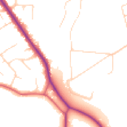
Daytime
07:00 – 23:00
49.1dB
Low
Night-time
23:00 – 07:00
41.6dB
Low55 dB
60 dB
65 dB
70 dB
75 dB
80 dB
Defra Road Noise Strategic Mapping, Round 4Crime Analysis
8 months of data for Staines Upon Thames
Total Crimes
32
Monthly Avg
4
Recent Trend
Stable
Most Common
Violence & Sexual
Crime by Category
Violence & Sexual11(34%)
Criminal Damage & Arson7(22%)
Vehicle Crime6(19%)
Public Order3(9%)
Other Theft1(3%)
Burglary1(3%)
Weapons1(3%)
Robbery1(3%)
Theft from Person1(3%)
Recent Incidents
Vehicle Crime
Dec 2025On or near Clay Lane
Violence & Sexual
Nov 2025On or near Argosy Lane
Vehicle Crime
Nov 2025On or near Stone Well Road
Violence & Sexual
Oct 2025On or near St Mary's Crescent
Other Theft
Oct 2025On or near Argosy Lane
Burglary
Oct 2025On or near St Mary's Crescent
Data from Police UK • Updated monthly
Local Amenities
Schools and transport links nearby
Nearby Schools
4 within 3kmP
King's Court First School
618m
7 mins
P
Wraysbury Primary School
929m
11 mins
P
St Jude's CofE Infant School
2.5km
30 mins
S
St Peter's Church of England Middle School
1.4km
17 mins
Transport Links
30 within 3kmBells of Ouzeley
Bus Stop225m
3 mins
Malt House Close
Bus Stop273m
3 mins
Ouseley Road
Bus Stop308m
4 mins
Orchard Road
Bus Stop546m
7 mins
Pelling Hill
Bus Stop610m
7 mins
Priest Hill Kennels
Bus Stop797m
10 mins
School data from Dept. for Education • Transport data from NaPTAN
Nearby Property Businesses
Local professionals serving this area
Map
34 points of interest nearby
Map data from OpenStreetMap • Transport data from NaPTAN • School data from Dept. for Education • Scenic data from Beautifulplaces.ai
Frequently Asked Questions
Common questions about this property