Are you a property professional?Get qualified leads from motivated homeowners.
Get started1 Albain Crescent, Ashford, TW15 3AN
This property in Ashford. Records show the property last changed hands for £320,000 back in 2014.
Property Type
Property
Bedrooms
3
Floor Area
— m²
Council Tax
Band E
Property Features
Garage
Off-street covered parking
Dining Room
Separate dining space
Corner Plot
Positioned on a corner with extra frontage
Get started
Ready to take the next step? Find the right professionals for your property journey.
Energy Performance
EPC rating and efficiency details
A
B
C
D
E
F
G
No EPC on record
This property doesn't have an Energy Performance Certificate yet. An EPC helps us give a more accurate valuation and is required to sell or let.
Price & History
Transactions and market trends
Transaction history
£320,000Latest
Jan 2014Source: HM Land Registry
Nearby in TW15 3AN
6 Albain Crescent Ashford TW15 3AN
Mar 2025
£425,000
4 Albain Crescent Ashford TW15 3AN
Mar 2024
£420,000
12 Albain Crescent Ashford TW15 3AN
Aug 2022
£375,000
11 Albain Crescent Ashford TW15 3AN
May 2022
£385,000
5 Albain Crescent Ashford TW15 3AN
Apr 2022
£415,000
13 Albain Crescent Ashford TW15 3AN
Dec 2021
£337,500
1 / 3
House Price Index
Ashford+0.1%
99.2
Jan 26
UK HPI from HM Land Registry. Baseline: Jan 2015 = 100.
How This Property Compares on Albain Crescent
See how this property stacks up against others nearby
Not enough similar properties in this postcode to make meaningful comparisons.
Get alerts for TW15 3AN
New sales, price changes, and market updates in this area
Places to visit
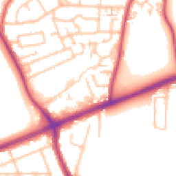
Road Noise
Average road noise levels for this postcode
Daytime
07:00 – 23:00
53.5dB
Low
Night-time
23:00 – 07:00
44.7dB
Low55 dB
60 dB
65 dB
70 dB
75 dB
80 dB
Defra Road Noise Strategic Mapping, Round 4Crime Analysis
8 months of data for Ashford
Total Crimes
29
Monthly Avg
4
Recent Trend
Stable
Most Common
Violence & Sexual
Crime by Category
Violence & Sexual11(38%)
Public Order6(21%)
Criminal Damage & Arson3(10%)
Drugs3(10%)
Burglary2(7%)
Other Crime1(3%)
Other Theft1(3%)
Vehicle Crime1(3%)
Bicycle Theft1(3%)
Recent Incidents
Public Order
Nov 2025On or near Sundown Road
Criminal Damage & Arson
Nov 2025On or near Percy Avenue
Drugs
Nov 2025On or near Percy Avenue
Violence & Sexual
Nov 2025On or near Percy Avenue
Violence & Sexual
Nov 2025On or near Percy Avenue
Violence & Sexual
Nov 2025On or near Feltham Road
Data from Police UK • Updated monthly
Local Amenities
Schools and transport links nearby
Nearby Schools
12 within 3kmP
Clarendon Primary School
1.0km
12 mins
P
Ashford Park Primary School
1.0km
12 mins
P
Stanwell Fields CofE Primary School
1.1km
13 mins
S
Thomas Knyvett College
605m
7 mins
S
The Matthew Arnold School
2.4km
28 mins
Transport Links
30 within 3kmAshford Hospital Shuttle
Bus Stop127m
2 mins
Long Lane
Bus Stop226m
3 mins
Ashford Hospital Entrance
Bus Stop278m
3 mins
Ashford Hospital
Bus Stop353m
4 mins
Bulldog
Bus Stop369m
4 mins
Ashford (Surrey) Rail Station
Rail947m
11 mins
School data from Dept. for Education • Transport data from NaPTAN
Nearby Property Businesses
Local professionals serving this area
Surveyor
Ashley James Building Consultants Limited
Kent
RICS
Surveyor
Hollis
Ashford
RICSResidential
Surveyor
Marion Weatherhead Consulting Ltd
Ashford
RICS
Surveyor
Osbourn White Ltd
Ashford
RICSResidential

Costplan Services Ltd
Ashford
RICSResidential
Surveyor
RES Property Surveyors
RICSResidential
Surveyor
Maitlands Acorn Professional Limited
Ashford
RICSResidential
Surveyor
Cubic Retail
Ashford
RICS
Map
42 points of interest nearby
Map data from OpenStreetMap • Transport data from NaPTAN • School data from Dept. for Education • Scenic data from Beautifulplaces.ai
Frequently Asked Questions
Common questions about this property