Are you a property professional?Get qualified leads from motivated homeowners.
Get startedExtendedTop Floor
Flat 4, 10 Newton Road, Kingsteignton, Newton Abbot, TQ12 3AJ
This 35 square metre property in Kingsteignton, Newton Abbot, Newton Abbot carries an energy performance rating of D, in line with typical UK homes. It is heated by electric heating and is currently listed as a private rental.
Property Type
2nd Floor Flat
Bedrooms
1
Floor Area
35 m²
Council Tax
Band A
Flood Risk
Low
Property Features
Built 1976–1982
Get started
Ready to take the next step? Find the right professionals for your property journey.
Energy Performance
EPC rating and efficiency details
EPC Rating
A
B
C
D
D57
E
F
G
Main Heating
Electric
Main Fuel
Electric
Hot Water
Very Poor
Windows
Average
CO2 Emissions
2.0 t/year
Tenure
Rented
Price & History
Transactions and market trends
Estimated value
£125,000
How our AI predicts property prices · Accurate to within 10%
Automated estimate only. For an accurate valuation, consult a surveyor or estate agent.
Transaction history
No sales history found
Nearby in TQ12 3AJ
No nearby sales found
House Price Index
England+1.5%
101.6
Jan 26
UK HPI from HM Land Registry. Baseline: Jan 2015 = 100.
How This Property Compares on Newton Road
See how this property stacks up against others nearby
Comparing to 5 other flats on this street
EPC Rating
Government energy efficiency score (1–100)
57 (D)/51 (E) avg
Less efficientMore efficient
More efficient than 80% of similar properties
Floor Area
Total internal floor space
35 m²/44 m² avg
SmallerLarger
Around average
CO₂ Emissions
Annual carbon output from heating, hot water & lighting
2.0 t/year/1.6 t/year avg
Higher emissionsLower emissions
Around average
Habitable Rooms
Living spaces like bedrooms & living rooms
2 rooms/2 rooms avg
FewerMore
Around average
Comparisons are based on the most recent EPC data for each property in this postcode. Only similar property types (flats) are compared.
Get alerts for TQ12 3AJ
New sales, price changes, and market updates in this area
About Kingsteignton, Newton Abbot
This property is located in Kingsteignton, a town in the Teignbridge district of Devon, within the TQ 12 postal district.
Kingsteignton, a town and civil parish in south Devon, England, lies at the head of the Teign Estuary to the west of Teignmouth in the Teignbridge district. The town is bypassed by the A380 and is also on the A383, A381, B3193 and B3195. It is represented in Parliament by Martin Wrigley as part of the Newton Abbot constituency. Local schools include Rydon Primary School, Teign School, Kingsteignton School and Saint Michael's Church of England School.
Places to visit
Road Noise
Average road noise levels for this postcode
Daytime
07:00 – 23:00
51.1dB
Low
Night-time
23:00 – 07:00
41.3dB
Low55 dB
60 dB
65 dB
70 dB
75 dB
80 dB
Defra Road Noise Strategic Mapping, Round 4Crime Analysis
13 months of data for Newton Abbot
Total Crimes
57
Monthly Avg
4
Recent Trend
Stable
Most Common
Shoplifting
Crime by Category
Shoplifting22(39%)
Violence & Sexual14(25%)
Other Theft5(9%)
Public Order5(9%)
Drugs4(7%)
Burglary3(5%)
Robbery1(2%)
Theft from Person1(2%)
Criminal Damage & Arson1(2%)
Weapons1(2%)
Recent Incidents
Violence & Sexual
Nov 2025On or near The Knowle
Violence & Sexual
Nov 2025On or near The Knowle
Robbery
Nov 2025On or near Oakford
Drugs
Nov 2025On or near Oakford
Violence & Sexual
Nov 2025On or near Shopping Area
Shoplifting
Nov 2025On or near Shopping Area
Data from Police UK • Updated monthly
Local Amenities
Schools and transport links nearby
Nearby Schools
15 within 3kmP
St Michael's Church of England Primary School
55m
1 min
P
Rydon Primary School
873m
11 mins
P
Kingsteignton School
1.0km
12 mins
S
Teign School
900m
11 mins
S
South Devon UTC
1.5km
19 mins
S
Newton Abbot College
1.9km
23 mins
Transport Links
30 within 3kmThe Fountain
Bus Stop67m
1 min
Lidl
Bus Stop78m
1 min
Andor Avenue
Bus Stop312m
4 mins
Homebase
Bus Stop341m
4 mins
Health Centre
Bus Stop346m
4 mins
Tarr's Avenue
Bus Stop354m
4 mins
School data from Dept. for Education • Transport data from NaPTAN
Nearby Property Businesses
Local professionals serving this area
Surveyor
Kendalls Chartered Surveyors
Devon
RICS
Surveyor
Rendells
Newton Abbot
RICS

Dart Surveys
Newton Abbot
RICSResidential
Surveyor
Randall Simmonds LLP
Newton Abbot
RICSResidential
Surveyor
A C Valuations
Devon
RICS

E C Surveyors LLP
Newton Abbot
RICSResidential
Surveyor
Sawdye & Harris
Newton Abbot
RICSResidential
Surveyor
Abbots Surveyors Ltd
Newton Abbot
RICSResidential
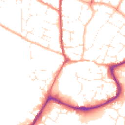
Map
45 points of interest nearby
Map data from OpenStreetMap • Transport data from NaPTAN • School data from Dept. for Education • Scenic data from Beautifulplaces.ai
Frequently Asked Questions
Common questions about this property