Are you a property professional?Get qualified leads from motivated homeowners.
Get startedExtendedVictorianCharacter Fireplace
3 High Street, Robertsbridge, TN32 5AA
This 54 square metre property in Robertsbridge carries an energy performance rating of G. It is heated by electric heating and is currently listed as owner-occupied. Records show the property last changed hands for £165,000 back in 2014.
Property Type
End-Terrace House
Bedrooms
1
Floor Area
54 m²
Council Tax
Band C
Flood Risk
Low
Property Features
Built Before 1900
Get started
Ready to take the next step? Find the right professionals for your property journey.
Energy Performance
EPC rating and efficiency details
EPC Expired
This certificate is over 10 years old and is no longer valid.Expired 09 Oct 2018
EPC Rating
A
B
C
D
E
F
G
G19
Main Heating
Electric
Main Fuel
Electric
Hot Water
Very Poor
Windows
Poor
CO2 Emissions
7.8 t/year
Tenure
Owner Occupied
Price & History
Transactions and market trends
Estimated value
£238,000
How our AI predicts property prices · Accurate to within 10%
Automated estimate only. For an accurate valuation, consult a surveyor or estate agent.
Transaction history
+23.1%(5y)
£165,000Latest
Oct 2014£134,000
Dec 2009Source: HM Land Registry
Nearby in TN32 5AA
6 High Street Robertsbridge TN32 5AA
Sept 2023
£325,000
10d High Street Robertsbridge TN32 5AA
Jan 2018
£263,000
5 High Street Robertsbridge TN32 5AA
Feb 2014
£248,500
10a High Street Robertsbridge TN32 5AA
Dec 2013
£227,500
Glydes High Street Robertsbridge TN32 5AA
Nov 2010
£362,500
10c High Street Robertsbridge TN32 5AA
Jun 2007
£185,000
1 / 2
House Price Index
England+1.5%
101.6
Jan 26
UK HPI from HM Land Registry. Baseline: Jan 2015 = 100.
How This Property Compares on High Street
See how this property stacks up against others nearby
Comparing to 7 other houses on this street
Price per m²
Property value per square metre of floor space
£3,050/£3,464 avg
LowerHigher
Higher than only 20% of similar properties
Years Held
Time since last sale — indicates ownership stability
11 years/12 years avg
ShorterLonger
Around average
EPC Rating
Government energy efficiency score (1–100)
19 (G)/59 (D) avg
Less efficientMore efficient
Lowest among similar properties
Floor Area
Total internal floor space
54 m²/79 m² avg
SmallerLarger
Lowest among similar properties
CO₂ Emissions
Annual carbon output from heating, hot water & lighting
7.8 t/year/3.6 t/year avg
Higher emissionsLower emissions
Lowest among similar properties
Habitable Rooms
Living spaces like bedrooms & living rooms
3 rooms/4 rooms avg
FewerMore
More rooms than only 7% of similar properties
Comparisons are based on the most recent EPC data for each property in this postcode. Only similar property types (houses) are compared.
Get alerts for TN32 5AA
New sales, price changes, and market updates in this area
Places to visit
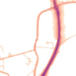
Road Noise
Average road noise levels for this postcode
Daytime
07:00 – 23:00
48.2dB
Low
Night-time
23:00 – 07:00
40.6dB
Low55 dB
60 dB
65 dB
70 dB
75 dB
80 dB
Defra Road Noise Strategic Mapping, Round 4Crime Analysis
7 months of data for Robertsbridge
Total Crimes
14
Monthly Avg
2
Recent Trend
Stable
Most Common
Violence & Sexual
Crime by Category
Violence & Sexual7(50%)
Public Order3(21%)
Criminal Damage & Arson2(14%)
Shoplifting1(7%)
Vehicle Crime1(7%)
Recent Incidents
Violence & Sexual
Nov 2025On or near High Street
Criminal Damage & Arson
Oct 2025On or near Coronation Cottages
Violence & Sexual
Sept 2025On or near High Street
Violence & Sexual
Sept 2025On or near Coronation Cottages
Public Order
Sept 2025On or near High Street
Shoplifting
Sept 2025On or near High Street
Data from Police UK • Updated monthly
Local Amenities
Schools and transport links nearby
Nearby Schools
2 within 3kmP
Salehurst Church of England Primary School
235m
3 mins
S
Robertsbridge Community College
925m
11 mins
Transport Links
12 within 3kmThe George
Bus Stop224m
3 mins
Rutley Close
Bus Stop436m
5 mins
Robertsbridge Rail Station
Rail490m
6 mins
Railway Station
Bus Stop493m
6 mins
Heathfield Gardens
Bus Stop575m
7 mins
Community College
Bus Stop896m
11 mins
School data from Dept. for Education • Transport data from NaPTAN
Nearby Property Businesses
Local professionals serving this area
Map
14 points of interest nearby
Map data from OpenStreetMap • Transport data from NaPTAN • School data from Dept. for Education • Scenic data from Beautifulplaces.ai
Frequently Asked Questions
Common questions about this property