Are you a property professional?Get qualified leads from motivated homeowners.
Get startedEdwardian
3 Groton Road, Wandsworth, London, SW18 4ER
This 73 square metre property in Wandsworth, London, London carries an energy performance rating of D, in line with typical UK homes. It is heated by a gas central heating system and is currently listed as owner-occupied.
Property Type
Mid-Terrace House
Bedrooms
2
Floor Area
73 m²
Council Tax
Band D
Flood Risk
Low
Property Features
Built 1900–1929
Get started
Ready to take the next step? Find the right professionals for your property journey.
Energy Performance
EPC rating and efficiency details
Current Certificate(1 of 2)
Nov 2022
EPC Rating
A
B
C
D
D55
E
F
G
Main Heating
Gas
Main Fuel
Gas
Hot Water
Average
Windows
Very Poor
CO2 Emissions
4.1 t/year
Tenure
Owner Occupied
Property Improvements
Changes detected from historical EPC data
Nov 2022from May 2009
EPC improved fromE48toD55
Low Energy Lighting
0%100%
More low energy lighting installed
Are we missing something? Tell us about home improvements to help adjust your valuation.
Price & History
Transactions and market trends
Estimated value
£636,000
How our AI predicts property prices · Accurate to within 10%
Automated estimate only. For an accurate valuation, consult a surveyor or estate agent.
Transaction history
No sales history found
House Price Index
London-1.9%
97.1
Jan 26
UK HPI from HM Land Registry. Baseline: Jan 2015 = 100.
How This Property Compares on Groton Road
See how this property stacks up against others nearby
Not enough similar properties in this postcode to make meaningful comparisons.
Get alerts for SW18 4ER
New sales, price changes, and market updates in this area
About Wandsworth, London
This property is located in Wandsworth, London, a district within the London Borough of Wandsworth that is identified as a major centre in the London Plan.
Wandsworth London Borough Council, also known as Wandsworth Council, is the local authority for the London Borough of Wandsworth in Greater London, England. Wandsworth Town is a district of South London, within the London Borough of Wandsworth 4.2 miles (6.8 km) southwest of Charing Cross. The area is identified in the London Plan as one of 35 major centres in Greater London.
Places to visit
Road Noise
Average road noise levels for this postcode
Daytime
07:00 – 23:00
52.0dB
Low
Night-time
23:00 – 07:00
41.3dB
Low55 dB
60 dB
65 dB
70 dB
75 dB
80 dB
Defra Road Noise Strategic Mapping, Round 4Crime Analysis
15 months of data for London
Total Crimes
119
Monthly Avg
8
Recent Trend
Rising
Most Common
Violence & Sexual
Crime by Category
Violence & Sexual47(39%)
Vehicle Crime17(14%)
Other Theft14(12%)
Criminal Damage & Arson12(10%)
Public Order9(8%)
Burglary7(6%)
Theft from Person3(3%)
Robbery3(3%)
Bicycle Theft3(3%)
Drugs3(3%)
Other Crime1(1%)
Recent Incidents
Violence & Sexual
Jan 2026On or near Hanford Close
Violence & Sexual
Jan 2026On or near Hanford Close
Violence & Sexual
Jan 2026On or near Hanford Close
Violence & Sexual
Jan 2026On or near Hanford Close
Criminal Damage & Arson
Jan 2026On or near Hanford Close
Vehicle Crime
Jan 2026On or near Hanford Close
Data from Police UK • Updated monthly
Local Amenities
Schools and transport links nearby
Nearby Schools
55 within 3kmP
Earlsfield Primary School
185m
2 mins
P
Beatrix Potter Primary School
488m
6 mins
P
Floreat Wandsworth Primary School
576m
7 mins
S
Southfields Academy
680m
8 mins
S
Burntwood School
762m
9 mins
S
Saint Cecilia's Church of England School
1.5km
18 mins
Transport Links
30 within 3kmEarlsfield Station
Rail60m
1 min
Earlsfield Rail Station
Rail72m
1 min
Penwith Road
Bus Stop106m
1 min
Earlsfield Road
Bus Stop130m
2 mins
Earlsfield Station
Bus Stop142m
2 mins
Isis Street
Bus Stop374m
5 mins
School data from Dept. for Education • Transport data from NaPTAN
Nearby Property Businesses
Local professionals serving this area

Templar Consultants
London
RICSResidential
Surveyor
RES Property Surveyors
London
RICSResidential
Surveyor
RES Property Surveyors
London
RICSResidential
Surveyor
Tate Woodburn Chartered Surveyors
London
RICS
Surveyor
Novello Chartered Surveyors
London
RICSResidential
Surveyor
RES Property Surveyors
Stoke
RICSResidential
Surveyor
Scott Davidson
London
RICSResidential
Surveyor
Silver
London
RICSResidential
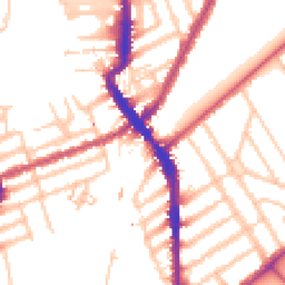
Map
85 points of interest nearby
Map data from OpenStreetMap • Transport data from NaPTAN • School data from Dept. for Education • Scenic data from Beautifulplaces.ai
Frequently Asked Questions
Common questions about this property