Are you a property professional?Get qualified leads from motivated homeowners.
Get startedLong-term Owner
1 Holroyd Road, Wandsworth, London, SW15 6LN
This property in Wandsworth, London, London. Records show the property last changed hands for £431,000 back in 1995.
Property Type
Property
Bedrooms
1
Bathrooms
1
Floor Area
— m²
Council Tax
Band H
Property Features
Private Garden
Enclosed private garden
Lpg Heating
Dining Room
Separate dining space
Recently Refurbished
Renovated and updated
Get started
Ready to take the next step? Find the right professionals for your property journey.
Energy Performance
EPC rating and efficiency details
A
B
C
D
E
F
G
No EPC on record
This property doesn't have an Energy Performance Certificate yet. An EPC helps us give a more accurate valuation and is required to sell or let.
Price & History
Transactions and market trends
Transaction history
£431,000Latest
Dec 1995Source: HM Land Registry
Nearby in SW15 6LN
Flat 3 26 Holroyd Road Wandsworth London SW15 6LN
May 2025
£442,500
9 Holroyd Road Wandsworth London SW15 6LN
May 2024
£2,225,000
Flat 2 26 Holroyd Road Wandsworth London SW15 6LN
Oct 2023
£640,000
Flat 1 26 Holroyd Road Wandsworth London SW15 6LN
Dec 2021
£850,000
30 Holroyd Road Wandsworth London SW15 6LN
Jul 2020
£2,375,000
5 Holroyd Road Wandsworth London SW15 6LN
Nov 2018
£1,850,000
1 / 5
House Price Index
London-2.1%
97.1
Jan 26
UK HPI from HM Land Registry. Baseline: Jan 2015 = 100.
How This Property Compares on Holroyd Road
See how this property stacks up against others nearby
Not enough similar properties in this postcode to make meaningful comparisons.
Get alerts for SW15 6LN
New sales, price changes, and market updates in this area
About Wandsworth, London
This property is located in Wandsworth, London, a district within the London Borough of Wandsworth that is identified as a major centre in the London Plan.
Wandsworth London Borough Council, also known as Wandsworth Council, is the local authority for the London Borough of Wandsworth in Greater London, England. Wandsworth Town is a district of South London, within the London Borough of Wandsworth 4.2 miles (6.8 km) southwest of Charing Cross. The area is identified in the London Plan as one of 35 major centres in Greater London.
Places to visit
Road Noise
Average road noise levels for this postcode
Daytime
07:00 – 23:00
51.8dB
Low
Night-time
23:00 – 07:00
41.2dB
Low55 dB
60 dB
65 dB
70 dB
75 dB
80 dB
Defra Road Noise Strategic Mapping, Round 4Crime Analysis
11 months of data for London
Total Crimes
76
Monthly Avg
7
Recent Trend
Stable
Most Common
Violence & Sexual
Crime by Category
Violence & Sexual38(50%)
Vehicle Crime13(17%)
Drugs8(11%)
Other Theft4(5%)
Burglary3(4%)
Criminal Damage & Arson3(4%)
Other Crime2(3%)
Weapons2(3%)
Bicycle Theft1(1%)
Theft from Person1(1%)
Public Order1(1%)
Recent Incidents
Violence & Sexual
Dec 2025On or near Grosse Way
Violence & Sexual
Nov 2025On or near Grosse Way
Violence & Sexual
Nov 2025On or near Grosse Way
Violence & Sexual
Nov 2025On or near The Platt
Other Crime
Nov 2025On or near Colebrook Close
Violence & Sexual
Nov 2025On or near Arabella Drive
Data from Police UK • Updated monthly
Local Amenities
Schools and transport links nearby
Nearby Schools
53 within 3kmP
Our Lady of Victories Catholic Primary School
472m
6 mins
P
Hotham Primary School
589m
7 mins
P
Granard Primary School
647m
8 mins
S
Ark Putney Academy
628m
8 mins
S
Ashcroft Technology Academy
1.4km
16 mins
S
Saint Cecilia's Church of England School
1.9km
23 mins
Transport Links
30 within 3kmPutney Methodist Church
Bus Stop362m
4 mins
Putney Leisure Centre
Bus Stop363m
4 mins
Genoa Avenue
Bus Stop402m
5 mins
Westleigh Avenue Putney
Bus Stop476m
6 mins
Putney Arts Theatre
Bus Stop486m
6 mins
Putney Rail Station
Rail673m
8 mins
School data from Dept. for Education • Transport data from NaPTAN
Nearby Property Businesses
Local professionals serving this area
Surveyor
J M Commercial
London
RICSResidential
Surveyor
Vantage Asset Management Ltd
London
RICS
Surveyor
Peter W Gittins & Associates
London
RICSResidential
Surveyor
Novello Chartered Surveyors
London
RICSResidential
Surveyor
RES Property Surveyors
Stoke
RICSResidential
Surveyor
Scott Davidson
London
RICSResidential
Surveyor
Silver
London
RICSResidential
Surveyor
Ondare
London
RICS
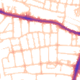
Map
83 points of interest nearby
Map data from OpenStreetMap • Transport data from NaPTAN • School data from Dept. for Education • Scenic data from Beautifulplaces.ai
Frequently Asked Questions
Common questions about this property