Are you a property professional?Get qualified leads from motivated homeowners.
Get startedExtended Twice
1 Herd Lane, Corringham, Stanford Le Hope, SS17 9BQ
This 88 square metre property in Corringham, Stanford-le-hope, Stanford Le Hope carries an energy performance rating of E. It is heated by a gas central heating system and is currently listed as owner-occupied. The property last sold for £307,500 in 2017.
Property Type
Semi-Detached House
Bedrooms
3
Bathrooms
2
Floor Area
88 m²
Council Tax
Band C
Property Features
Built 1930–1949
Off Street Parking
Gas Heating
En-suite Bathroom
Private bathroom attached to bedroom
Get started
Ready to take the next step? Find the right professionals for your property journey.
Energy Performance
EPC rating and efficiency details
Current Certificate(1 of 2)
Jul 2016
EPC Rating
A
B
C
D
E
E53
F
G
Main Heating
Gas
Main Fuel
Gas
Hot Water
Average
Windows
Average
CO2 Emissions
5.2 t/year
Tenure
Owner Occupied
Property Improvements
Changes detected from historical EPC data
Jul 2016from Aug 2010
Heating Controls
FullProg + Stat
Heating controls changed
Roof Insulation
UninsulatedInsulated
Roof insulation improved
Low Energy Lighting
46%14%
Low energy lighting percentage decreased
Are we missing something? Tell us about home improvements to help adjust your valuation.
Price & History
Transactions and market trends
Estimated value
£414,000
How our AI predicts property prices · Accurate to within 10%
Automated estimate only. For an accurate valuation, consult a surveyor or estate agent.
Transaction history
£307,500Latest
Mar 2017Source: HM Land Registry
House Price Index
England+1.5%
101.6
Jan 26
UK HPI from HM Land Registry. Baseline: Jan 2015 = 100.
How This Property Compares on Herd Lane
See how this property stacks up against others nearby
Comparing to 3 other houses on this street
EPC Rating
Government energy efficiency score (1–100)
53 (E)/63 (D) avg
Less efficientMore efficient
Lowest among similar properties
Floor Area
Total internal floor space
88 m²/89 m² avg
SmallerLarger
Larger than 67% of similar properties
CO₂ Emissions
Annual carbon output from heating, hot water & lighting
5.2 t/year/3.4 t/year avg
Higher emissionsLower emissions
Lowest among similar properties
Habitable Rooms
Living spaces like bedrooms & living rooms
5 rooms/5 rooms avg
FewerMore
More rooms than 67% of similar properties
Comparisons are based on the most recent EPC data for each property in this postcode. Only similar property types (houses) are compared.
Get alerts for SS17 9BQ
New sales, price changes, and market updates in this area
About Corringham, Stanford-le-hope
This property is located in Stanford‑le‑Hope, a town in the unitary authority of Thurrock, Essex, within the SS 17 postal district.
Stanford‑le‑Hope is a town, former civil parish and Church of England parish in the unitary authority area of Thurrock, in the ceremonial county of Essex, England. Often known locally simply as Stanford, the town is located 24 miles (38.4 km) east of Charing Cross in London. In 2011 it had a population of 28,765.
Places to visit
Road Noise
Average road noise levels for this postcode
Daytime
07:00 – 23:00
47.1dB
Low
Night-time
23:00 – 07:00
39.0dB
Low55 dB
60 dB
65 dB
70 dB
75 dB
80 dB
Defra Road Noise Strategic Mapping, Round 4Crime Analysis
11 months of data for Stanford Le Hope
Total Crimes
31
Monthly Avg
3
Recent Trend
Stable
Most Common
Violence & Sexual
Crime by Category
Violence & Sexual12(39%)
Drugs4(13%)
Public Order4(13%)
Vehicle Crime3(10%)
Burglary3(10%)
Criminal Damage & Arson3(10%)
Other Crime2(6%)
Recent Incidents
Violence & Sexual
Nov 2025On or near Cornwell Crescent
Violence & Sexual
Nov 2025On or near Cornwell Crescent
Violence & Sexual
Oct 2025On or near Cornwell Crescent
Drugs
Oct 2025On or near Parry Close
Drugs
Oct 2025On or near Parry Close
Drugs
Oct 2025On or near Parry Close
Data from Police UK • Updated monthly
Local Amenities
Schools and transport links nearby
Nearby Schools
9 within 3kmP
Mossbourne Herd Lane Academy
98m
1 min
P
Giffards Primary School
1.2km
15 mins
P
Graham James Primary Academy
1.4km
16 mins
S
Mossbourne Fobbing Academy
1.4km
16 mins
S
Mossbourne Port Side Academy
2.3km
27 mins
Transport Links
30 within 3kmHerd Lane
Bus Stop85m
1 min
Digby Road
Bus Stop224m
3 mins
Church Road
Bus Stop277m
3 mins
Social Club
Bus Stop322m
4 mins
Lampits Hill Central Avenue
Bus Stop539m
6 mins
Chase Road
Bus Stop582m
7 mins
School data from Dept. for Education • Transport data from NaPTAN
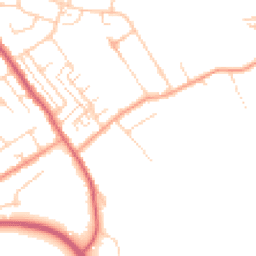
Map
39 points of interest nearby
Map data from OpenStreetMap • Transport data from NaPTAN • School data from Dept. for Education • Scenic data from Beautifulplaces.ai
Frequently Asked Questions
Common questions about this property