Are you a property professional?Get qualified leads from motivated homeowners.
Get startedExtendedVictorian
1 Pounceys Cottages, Upper Clatford, Andover, SP11 7QS
This 75 square metre property in Upper Clatford, Andover, Andover carries an energy performance rating of E. It is heated by electric heating and is currently listed as a private rental. The property last sold for £296,750 in 2018, up from £225,000 previously.
Property Type
Semi-Detached House
Bedrooms
3
Floor Area
75 m²
Council Tax
Band D
Property Features
Built Before 1900
Get started
Ready to take the next step? Find the right professionals for your property journey.
Energy Performance
EPC rating and efficiency details
Current Certificate(1 of 4)
Apr 2018
EPC Rating
A
B
C
D
E
E50
F
G
Main Heating
Electric
Main Fuel
Electric
Hot Water
Very Poor
Windows
Good
CO2 Emissions
6.9 t/year
Tenure
Rented
Property Improvements
Changes detected from historical EPC data
Apr 2018from May 2010
Low Energy Lighting
50%100%
More low energy lighting installed
Apr 2018from Apr 2018
EPC improved fromF37toE50
Are we missing something? Tell us about home improvements to help adjust your valuation.
Price & History
Transactions and market trends
Estimated value
£316,000
How our AI predicts property prices · Accurate to within 10%
Automated estimate only. For an accurate valuation, consult a surveyor or estate agent.
Transaction history
+31.9%(5y)
£296,750Latest
Jan 2018£225,000
Apr 2013£133,000
Sept 2001Source: HM Land Registry
House Price Index
England+1.5%
101.6
Jan 26
UK HPI from HM Land Registry. Baseline: Jan 2015 = 100.
How This Property Compares
See how this property stacks up against others nearby
Not enough similar properties in this postcode to make meaningful comparisons.
Get alerts for SP11 7QS
New sales, price changes, and market updates in this area
About Upper Clatford, Andover
This property is located in Upper Clatford, a village and parish in Hampshire, England, within the SP 11 postal district.
Upper Clatford is a village and civil parish in Hampshire, England. The village is in the valley of the River Anton, 3.5 miles (5.6 km) upstream from the point where it joins the River Test at the south. The setting is characteristic of a rural Hampshire parish, with the River Anton providing a natural landscape feature. The locality’s description highlights its village status and civil parish designation, indicating a small community with local governance. Being in the SP 11 postal district places it within the Andover area of Hampshire, suggesting proximity to the larger town while retaining a distinct village identity.
Places to visit
Road Noise
Average road noise levels for this postcode
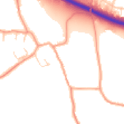
Daytime
07:00 – 23:00
51.3dB
Low
Night-time
23:00 – 07:00
41.8dB
Low55 dB
60 dB
65 dB
70 dB
75 dB
80 dB
Defra Road Noise Strategic Mapping, Round 4Crime Analysis
4 months of data for Andover
Total Crimes
21
Monthly Avg
5
Recent Trend
Stable
Most Common
Violence & Sexual
Crime by Category
Violence & Sexual11(52%)
Criminal Damage & Arson3(14%)
Shoplifting2(10%)
Vehicle Crime1(5%)
Burglary1(5%)
Other Crime1(5%)
Theft from Person1(5%)
Public Order1(5%)
Recent Incidents
Vehicle Crime
Nov 2025On or near School House Drive
Criminal Damage & Arson
Nov 2025On or near Newbury Hill
Shoplifting
Nov 2025On or near Rawlings Court
Violence & Sexual
Nov 2025On or near Parking Area
Violence & Sexual
Oct 2025On or near Blackthorn Road
Criminal Damage & Arson
Oct 2025On or near Bowers Lane
Data from Police UK • Updated monthly
Local Amenities
Schools and transport links nearby
Nearby Schools
13 within 3kmP
Anton Infant School
1.1km
14 mins
P
Anton Junior School
1.2km
14 mins
P
Balksbury Junior School
1.3km
16 mins
S
John Hanson Community School
1.6km
20 mins
S
Harrow Way Community School
2.8km
34 mins
S
Lift Winton
2.9km
35 mins
Transport Links
30 within 3kmVillage Hall
Bus Stop25m
< 1 min
Watery Lane
Bus Stop129m
2 mins
Balksbury Bridge
Bus Stop460m
6 mins
The Old Rectory
Bus Stop532m
6 mins
Murray Close
Bus Stop674m
8 mins
Greenfield Farm Shop
Bus Stop687m
8 mins
School data from Dept. for Education • Transport data from NaPTAN
Nearby Property Businesses
Local professionals serving this area
Map
43 points of interest nearby
Map data from OpenStreetMap • Transport data from NaPTAN • School data from Dept. for Education • Scenic data from Beautifulplaces.ai
Frequently Asked Questions
Common questions about this property