Are you a property professional?Get qualified leads from motivated homeowners.
Get started3 Merrytree Close, West Wellow, Romsey, SO51 6RB
This property in West Wellow, Romsey, Romsey. Explore detailed information about this West Wellow, Romsey property including energy performance, price history, local schools, transport links and crime statistics.
Property Type
Property
Bedrooms
—
Floor Area
— m²
Council Tax
Band F
Get started
Ready to take the next step? Find the right professionals for your property journey.
Energy Performance
EPC rating and efficiency details
A
B
C
D
E
F
G
No EPC on record
This property doesn't have an Energy Performance Certificate yet. An EPC helps us give a more accurate valuation and is required to sell or let.
Price & History
Transactions and market trends
Transaction history
No sales history found
Nearby in SO51 6RB
1 Merrytree Close West Wellow Romsey SO51 6RB
Dec 2020
£525,000
7 Merrytree Close West Wellow Romsey SO51 6RB
Jun 2017
£520,000
8 Merrytree Close West Wellow Romsey SO51 6RB
Apr 2017
£630,000
4 Merrytree Close West Wellow Romsey SO51 6RB
Nov 2013
£415,000
2 Merrytree Close West Wellow Romsey SO51 6RB
Dec 2009
£435,000
11 Merrytree Close West Wellow Romsey SO51 6RB
Oct 1996
£145,000
House Price Index
England+1.5%
101.6
Jan 26
UK HPI from HM Land Registry. Baseline: Jan 2015 = 100.
How This Property Compares on Merrytree Close
See how this property stacks up against others nearby
Not enough similar properties in this postcode to make meaningful comparisons.
Get alerts for SO51 6RB
New sales, price changes, and market updates in this area
About West Wellow, Romsey
This property is located in Wellow, a village and civil parish in Hampshire, England that lies just outside the New Forest and across the main A36 road.
Wellow, Hampshire is a village and civil parish in the Test Valley district of Hampshire, England. The parish sits just outside the New Forest, across the main A36 road which runs from the M27 motorway to Salisbury. The nearest town is Romsey, 4 miles (6.4 km) to the east, and the closest city is Southampton, 9 miles (14 km) to the southeast. According to the 2021 census, the parish had a population of 3,239. The setting offers a rural atmosphere with proximity to larger urban centres and major road links. The village’s location near the New Forest provides access to natural scenery and outdoor activities, while the nearby A36 gives straightforward routes to the M27 motorway and other destinations. Residents can benefit from the village’s community character and the convenience of nearby towns for shopping, services and employment.
Places to visit
Road Noise
Average road noise levels for this postcode
Daytime
07:00 – 23:00
47.6dB
Low
Night-time
23:00 – 07:00
39.4dB
Low55 dB
60 dB
65 dB
70 dB
75 dB
80 dB
Defra Road Noise Strategic Mapping, Round 4Crime Analysis
3 months of data for Romsey
Total Crimes
9
Monthly Avg
3
Recent Trend
Stable
Most Common
Violence & Sexual
Crime by Category
Violence & Sexual7(78%)
Other Theft1(11%)
Public Order1(11%)
Recent Incidents
Violence & Sexual
Oct 2025On or near Dowling Crescent
Violence & Sexual
Oct 2025On or near Parking Area
Violence & Sexual
Oct 2025On or near Parking Area
Violence & Sexual
Oct 2025On or near Dowling Crescent
Other Theft
Oct 2025On or near Butlers Close
Violence & Sexual
Oct 2025On or near Parking Area
Data from Police UK • Updated monthly
Local Amenities
Schools and transport links nearby
Nearby Schools
1 within 3kmP
Wellow Primary School
1.7km
20 mins
Transport Links
18 within 3kmWheatears Drive
Bus Stop158m
2 mins
Gurnays Mead
Bus Stop301m
4 mins
Slab Lane
Bus Stop445m
5 mins
Canada Corner
Bus Stop510m
6 mins
War Memorial
Bus Stop587m
7 mins
Chatmohr
Bus Stop837m
10 mins
School data from Dept. for Education • Transport data from NaPTAN
Nearby Property Businesses
Local professionals serving this area
Surveyor
TPS Estates (Management) Ltd
Romsey
RICSResidential
Surveyor
Robin Austin Property Surveyors LLP
Romsey
RICS
Surveyor
Welling Partnership LLP
Romsey
RICSResidential
Surveyor
Trinity Rose - Chartered Surveyors
Romsey
RICS
Surveyor
Warwick Martel
Romsey
RICSResidential
Surveyor
Robert H Davis
Romsey
RICS
Surveyor
The Brindley Partnership Ltd
Romsey
RICSResidential
Surveyor
John C Haxforth
Romsey
RICS
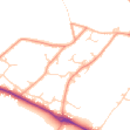
Map
19 points of interest nearby
Map data from OpenStreetMap • Transport data from NaPTAN • School data from Dept. for Education • Scenic data from Beautifulplaces.ai
Frequently Asked Questions
Common questions about this property