Are you a property professional?Get qualified leads from motivated homeowners.
Get startedLong-term Owner
18 Elmers Road, Croydon, London, SE25 5DS
This property in Croydon, London, London. Records show the property last changed hands for £113,500 back in 2001.
Property Type
Property
Bedrooms
2
Bathrooms
1
Floor Area
— m²
Council Tax
Band C
Property Features
Private Garden
Enclosed private garden
Dining Room
Separate dining space
Recently Refurbished
Renovated and updated
Get started
Ready to take the next step? Find the right professionals for your property journey.
Energy Performance
EPC rating and efficiency details
A
B
C
D
E
F
G
No EPC on record
This property doesn't have an Energy Performance Certificate yet. An EPC helps us give a more accurate valuation and is required to sell or let.
Price & History
Transactions and market trends
Transaction history
+89.2%(3y)
£113,500Latest
May 2001£60,000
Dec 1997Source: HM Land Registry
Nearby in SE25 5DS
63 Elmers Road Croydon London SE25 5DS
Sept 2025
£505,000
49 Elmers Road Croydon London SE25 5DS
Jul 2025
£355,000
17 Elmers Road Croydon London SE25 5DS
Jul 2025
£450,000
47 Elmers Road Croydon London SE25 5DS
Mar 2025
£355,000
22 Elmers Road Croydon London SE25 5DS
Dec 2024
£402,000
15 Elmers Road Croydon London SE25 5DS
Jun 2023
£310,000
1 / 9
House Price Index
London-2.1%
97.1
Jan 26
UK HPI from HM Land Registry. Baseline: Jan 2015 = 100.
How This Property Compares on Elmers Road
See how this property stacks up against others nearby
Not enough similar properties in this postcode to make meaningful comparisons.
Get alerts for SE25 5DS
New sales, price changes, and market updates in this area
About Croydon, London
This property is located in Croydon, within the London Borough of Croydon, a local government district of Greater London that hosts one of the largest commercial areas in the city.
Croydon London Borough Council, which styles itself Croydon Council, is the local authority for the London Borough of Croydon in Greater London, England. Croydon is a large town in South London, England, 9.5 miles (15 km) south of Charing Cross. Part of the London Borough of Croydon, a local government district of Greater London; it is one of the largest commercial districts in Greater London, with an extensive shopping area. The entire town had a population of 192,064 as of 2011, whilst the wider borough had a population of 384,837.
Places to visit
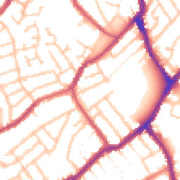
Road Noise
Average road noise levels for this postcode
Daytime
07:00 – 23:00
53.0dB
Low
Night-time
23:00 – 07:00
43.2dB
Low55 dB
60 dB
65 dB
70 dB
75 dB
80 dB
Defra Road Noise Strategic Mapping, Round 4Crime Analysis
13 months of data for London
Total Crimes
156
Monthly Avg
12
Recent Trend
Rising
Most Common
Shoplifting
Crime by Category
Shoplifting51(33%)
Violence & Sexual46(29%)
Other Theft19(12%)
Public Order11(7%)
Robbery8(5%)
Other Crime6(4%)
Drugs5(3%)
Criminal Damage & Arson4(3%)
Theft from Person3(2%)
Burglary2(1%)
Vehicle Crime1(1%)
Recent Incidents
Shoplifting
Nov 2025On or near Supermarket
Shoplifting
Nov 2025On or near Supermarket
Shoplifting
Nov 2025On or near Supermarket
Robbery
Nov 2025On or near Supermarket
Drugs
Nov 2025On or near Supermarket
Other Theft
Nov 2025On or near Supermarket
Data from Police UK • Updated monthly
Local Amenities
Schools and transport links nearby
Nearby Schools
51 within 3kmP
Woodside Primary School
327m
4 mins
P
St Thomas Becket Catholic Primary School
401m
5 mins
P
Oasis Academy Shirley Park Primary
589m
7 mins
S
Oasis Academy Shirley Park
559m
7 mins
S
Oasis Academy Arena
1.0km
12 mins
S
Ark Blake Academy
1.1km
13 mins
Transport Links
30 within 3kmBlackhorse Lane Tram Stop
Underground98m
1 min
Blackhorse Lane
Bus Stop103m
1 min
Blackhorse Lane Tram Stop
Tram118m
1 min
Woodside Green
Bus Stop259m
3 mins
Woodside Tram Stop
Underground366m
4 mins
Brockenhurst Road
Bus Stop372m
4 mins
School data from Dept. for Education • Transport data from NaPTAN
Nearby Property Businesses
Local professionals serving this area
Surveyor
Novello Chartered Surveyors
London
RICSResidential
Surveyor
RES Property Surveyors
Stoke
RICSResidential
Surveyor
Scott Davidson
London
RICSResidential
Surveyor
Silver
London
RICSResidential
Surveyor
Ondare
London
RICS
Surveyor
SRVO Property Limited
London
RICSResidential
Surveyor
Hallas Commercial Ltd
London
RICS
Surveyor
Antony Patrick Associates Ltd
London
RICS
Map
81 points of interest nearby
Map data from OpenStreetMap • Transport data from NaPTAN • School data from Dept. for Education • Scenic data from Beautifulplaces.ai
Frequently Asked Questions
Common questions about this property