Are you a property professional?Get qualified leads from motivated homeowners.
Get startedSold in 2025EdwardianGround Floor
Flat 2, 240 Stanstead Road, London, SE23 1DD
This 54 square metre property in London carries an energy performance rating of D, in line with typical UK homes. It is heated by a gas central heating system and is currently listed as owner-occupied. It changed hands for £398,000 last year, representing a significant increase from its previous sale.
Property Type
Ground Floor Flat
Bedrooms
2
Bathrooms
1
Floor Area
54 m²
Council Tax
Band C
Property Features
Built 1900–1929
Private Garden
Enclosed private garden
Period Features
Original architectural details
Get started
Ready to take the next step? Find the right professionals for your property journey.
Energy Performance
EPC rating and efficiency details
EPC Rating
A
B
C
D
D68
E
F
G
Main Heating
Gas
Main Fuel
Gas
Hot Water
Good
Windows
Very Poor
CO2 Emissions
2.1 t/year
Tenure
Owner Occupied
Price & History
Transactions and market trends
Estimated value
£442,000
How our AI predicts property prices · Accurate to within 10%
Automated estimate only. For an accurate valuation, consult a surveyor or estate agent.
Transaction history
+199.2%(23y)
£398,000Latest
Mar 2025£133,000
May 2002£62,000
Jul 1998£52,950
Apr 1996Source: HM Land Registry
Nearby in SE23 1DD
248c Stanstead Road London SE23 1DD
Oct 2024
£230,000
Flat 6 240 Stanstead Road London SE23 1DD
Nov 2023
£345,000
Flat 3 240 Stanstead Road London SE23 1DD
Jul 2023
£360,000
Flat 3 232 Stanstead Road London SE23 1DD
Nov 2022
£245,000
252b Stanstead Road London SE23 1DD
Sept 2022
£265,000
Flat 5 228 Stanstead Road London SE23 1DD
Jul 2022
£280,000
1 / 6
House Price Index
London-2.1%
97.1
Jan 26
UK HPI from HM Land Registry. Baseline: Jan 2015 = 100.
How This Property Compares on Stanstead Road
See how this property stacks up against others nearby
Comparing to 36 other flats on this street
Price per m²
Property value per square metre of floor space
£7,370/£5,226 avg
LowerHigher
Higher than 85% of similar properties
Years Held
Time since last sale — indicates ownership stability
1 years/12 years avg
ShorterLonger
Lowest among similar properties
EPC Rating
Government energy efficiency score (1–100)
68 (D)/66 (D) avg
Less efficientMore efficient
Around average
Floor Area
Total internal floor space
54 m²/47 m² avg
SmallerLarger
Larger than 74% of similar properties
CO₂ Emissions
Annual carbon output from heating, hot water & lighting
2.1 t/year/2.2 t/year avg
Higher emissionsLower emissions
Around average
Habitable Rooms
Living spaces like bedrooms & living rooms
3 rooms/2 rooms avg
FewerMore
More rooms than 78% of similar properties
Comparisons are based on the most recent EPC data for each property in this postcode. Only similar property types (flats) are compared.
Get alerts for SE23 1DD
New sales, price changes, and market updates in this area
Places to visit
Road Noise
Average road noise levels for this postcode
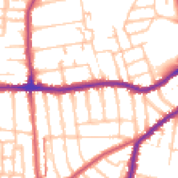
Daytime
07:00 – 23:00
52.5dB
Low
Night-time
23:00 – 07:00
41.8dB
Low55 dB
60 dB
65 dB
70 dB
75 dB
80 dB
Defra Road Noise Strategic Mapping, Round 4Crime Analysis
11 months of data for London
Total Crimes
64
Monthly Avg
6
Recent Trend
Stable
Most Common
Violence & Sexual
Crime by Category
Violence & Sexual26(41%)
Criminal Damage & Arson8(13%)
Vehicle Crime6(9%)
Drugs6(9%)
Other Theft4(6%)
Theft from Person3(5%)
Public Order3(5%)
Burglary3(5%)
Robbery2(3%)
Weapons1(2%)
Other Crime1(2%)
Bicycle Theft1(2%)
Recent Incidents
Violence & Sexual
Jan 2026On or near Whatman Road
Violence & Sexual
Dec 2025On or near Beadnell Road
Violence & Sexual
Dec 2025On or near Beadnell Road
Violence & Sexual
Dec 2025On or near Beadnell Road
Violence & Sexual
Dec 2025On or near Beadnell Road
Vehicle Crime
Dec 2025On or near Montrose Way
Data from Police UK • Updated monthly
Local Amenities
Schools and transport links nearby
Nearby Schools
55 within 3kmP
St William of York Catholic Primary School
283m
3 mins
P
Rathfern Primary School
339m
4 mins
P
Kilmorie Primary School
405m
5 mins
S
Prendergast Ladywell School
1.1km
13 mins
S
Forest Hill School
1.3km
16 mins
S
Sydenham School
1.7km
21 mins
Transport Links
30 within 3kmHurstbourne Road
Bus Stop50m
1 min
Blythe Vale
Bus Stop296m
4 mins
Kilmorie Road Honor Oak Park
Bus Stop302m
4 mins
Brockley Rise / Cranston Road
Bus Stop358m
4 mins
Vancouver Road
Bus Stop423m
5 mins
Catford
Rail800m
10 mins
School data from Dept. for Education • Transport data from NaPTAN
Nearby Property Businesses
Local professionals serving this area
Surveyor
Novello Chartered Surveyors
London
RICSResidential
Surveyor
RES Property Surveyors
Stoke
RICSResidential
Surveyor
Scott Davidson
London
RICSResidential
Surveyor
Silver
London
RICSResidential
Surveyor
Ondare
London
RICS
Surveyor
SRVO Property Limited
London
RICSResidential
Surveyor
Hallas Commercial Ltd
London
RICS
Surveyor
Antony Patrick Associates Ltd
London
RICS
Map
85 points of interest nearby
Map data from OpenStreetMap • Transport data from NaPTAN • School data from Dept. for Education • Scenic data from Beautifulplaces.ai
Frequently Asked Questions
Common questions about this property