Are you a property professional?Get qualified leads from motivated homeowners.
Get startedLong-term Owner
2 Hole Street, Ashington, Pulborough, RH20 3DE
This property in Ashington, Pulborough, Pulborough. Records show the property last changed hands for £57,500 back in 1995.
Property Type
Property
Bedrooms
—
Floor Area
— m²
Council Tax
Band A
Get started
Ready to take the next step? Find the right professionals for your property journey.
Energy Performance
EPC rating and efficiency details
A
B
C
D
E
F
G
No EPC on record
This property doesn't have an Energy Performance Certificate yet. An EPC helps us give a more accurate valuation and is required to sell or let.
Price & History
Transactions and market trends
Transaction history
£57,500Latest
Sept 1995Source: HM Land Registry
House Price Index
England+1.5%
101.6
Jan 26
UK HPI from HM Land Registry. Baseline: Jan 2015 = 100.
How This Property Compares on Hole Street
See how this property stacks up against others nearby
Not enough similar properties in this postcode to make meaningful comparisons.
Get alerts for RH20 3DE
New sales, price changes, and market updates in this area
About Ashington, Pulborough
This property is located in Ashington, a village and civil parish in the Horsham District of West Sussex, England. It lies on the A24 road approximately 3 miles (4.8 km) north‑east of Storrington, within the RH 20 postal district.
Ashington, West Sussex, is a village and civil parish within the Horsham District of the ceremonial county of West Sussex, England. The locality lies on the A24 road, about 3 miles (4.8 km) north‑east of the nearby town of Storrington. It is part of the RH 20 postal district, which places it within the broader region of West Sussex. The description of Ashington highlights its rural character and its proximity to the A24, a major road that provides access to surrounding areas. The village’s setting within the Horsham District suggests a tranquil environment typical of small communities in West Sussex. While specific amenities or transport links are not detailed in the data, the mention of the A24 road indicates connectivity to nearby towns and villages. The summary confirms that Ashington is listed among cities, towns, villages and other geographical places in West Sussex, with its designation in bold type in broader listings. The title and description together provide a concise overview of Ashington’s location, settlement type, and its relationship to nearby Storrington and the surrounding district.
Places to visit
Road Noise
Average road noise levels for this postcode
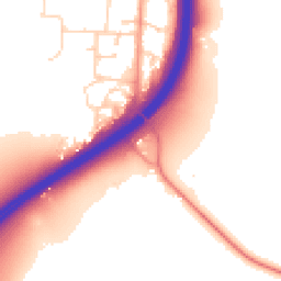
Daytime
07:00 – 23:00
54.8dB
Low
Night-time
23:00 – 07:00
47.1dB
Low55 dB
60 dB
65 dB
70 dB
75 dB
80 dB
Defra Road Noise Strategic Mapping, Round 4Crime Analysis
4 months of data for Pulborough
Total Crimes
8
Monthly Avg
2
Recent Trend
Stable
Most Common
Violence & Sexual
Crime by Category
Violence & Sexual6(75%)
Burglary1(13%)
Criminal Damage & Arson1(13%)
Recent Incidents
Violence & Sexual
Nov 2025On or near Parking Area
Violence & Sexual
Oct 2025On or near Wildbrooks Close
Violence & Sexual
Oct 2025On or near Park/open Space
Burglary
Oct 2025On or near Heather Lane
Violence & Sexual
Sept 2025On or near Park/open Space
Criminal Damage & Arson
Sept 2025On or near Harwood Close
Data from Police UK • Updated monthly
Local Amenities
Schools and transport links nearby
Nearby Schools
2 within 3kmP
Ashington CofE Primary School
745m
9 mins
P
St Mary's CofE Primary School
2.8km
33 mins
Transport Links
19 within 3kmMill House Hotel
Bus Stop263m
3 mins
The Red Lion
Bus Stop293m
4 mins
Fairfield Road
Bus Stop466m
6 mins
Hillcrest Drive
Bus Stop680m
8 mins
Rectory Lane
Bus Stop944m
11 mins
Kate's Cakes
Bus Stop967m
12 mins
School data from Dept. for Education • Transport data from NaPTAN
Nearby Property Businesses
Local professionals serving this area
Surveyor
Acorn Technical Associates Ltd
Pulborough
RICS
Surveyor
Downsview Associates Ltd
Pulborough
RICS
Surveyor
Quick Step Online Estate Agents
Pulborough
RICSResidential
Surveyor
Lewis - Chartered Surveyors
Codmore Hill
RICSResidential

Mills & Company
Pulborough
RICSResidential
Surveyor
Batcheller Monkhouse
Pulborough
RICS
Surveyor
Quasur
Pulborough
RICSResidential
Surveyor
Philips
Pulborough
RICS
Map
21 points of interest nearby
Map data from OpenStreetMap • Transport data from NaPTAN • School data from Dept. for Education • Scenic data from Beautifulplaces.ai
Frequently Asked Questions
Common questions about this property