Are you a property professional?Get qualified leads from motivated homeowners.
Get startedLeghorn Cottage, The Street, Bury, Pulborough, RH20 1PA
This property in Bury, Pulborough, Pulborough. Explore detailed information about this Bury, Pulborough property including energy performance, price history, local schools, transport links and crime statistics.
Property Type
Property
Bedrooms
—
Floor Area
— m²
Council Tax
Band F
Get started
Ready to take the next step? Find the right professionals for your property journey.
Energy Performance
EPC rating and efficiency details
A
B
C
D
E
F
G
No EPC on record
This property doesn't have an Energy Performance Certificate yet. An EPC helps us give a more accurate valuation and is required to sell or let.
Price & History
Transactions and market trends
Transaction history
No sales history found
Nearby in RH20 1PA
Street Cottage The Street Bury Pulborough RH20 1PA
Mar 2025
£937,000
6 Norfolk Cottages The Street Bury Pulborough RH20 1PA
Jun 2024
£480,000
8 Norfolk Cottages The Street Bury Pulborough RH20 1PA
Nov 2023
£610,000
Kesters House The Street Bury Pulborough RH20 1PA
Nov 2023
£710,000
Farriers The Street Bury Pulborough RH20 1PA
Jan 2023
£950,000
Campion House The Street Bury Pulborough RH20 1PA
Mar 2022
£1,300,000
1 / 5
House Price Index
England+1.5%
101.6
Jan 26
UK HPI from HM Land Registry. Baseline: Jan 2015 = 100.
How This Property Compares on The Street
See how this property stacks up against others nearby
Not enough similar properties in this postcode to make meaningful comparisons.
Get alerts for RH20 1PA
New sales, price changes, and market updates in this area
About Bury, Pulborough
This property is located in Bury, a village and parish within the Chichester district of West Sussex, positioned on the A29 road near Pulborough.
Bury, West Sussex is a village and civil parish in the Chichester district of West Sussex, England. It lies on the A29 road, roughly five miles (eight kilometres) south‑west of Pulborough. The locality is characterised by its rural setting and village atmosphere, typical of small communities in the region.
Places to visit
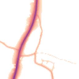
Road Noise
Average road noise levels for this postcode
Daytime
07:00 – 23:00
47.9dB
Low
Night-time
23:00 – 07:00
40.8dB
Low55 dB
60 dB
65 dB
70 dB
75 dB
80 dB
Defra Road Noise Strategic Mapping, Round 4Crime Analysis
4 months of data for Pulborough
Total Crimes
8
Monthly Avg
2
Recent Trend
Stable
Most Common
Violence & Sexual
Crime by Category
Violence & Sexual6(75%)
Burglary1(13%)
Criminal Damage & Arson1(13%)
Recent Incidents
Violence & Sexual
Nov 2025On or near Parking Area
Violence & Sexual
Oct 2025On or near Wildbrooks Close
Violence & Sexual
Oct 2025On or near Park/open Space
Burglary
Oct 2025On or near Heather Lane
Violence & Sexual
Sept 2025On or near Park/open Space
Criminal Damage & Arson
Sept 2025On or near Harwood Close
Data from Police UK • Updated monthly
Local Amenities
Schools and transport links nearby
Nearby Schools
2 within 3kmP
Bury CofE Primary School
487m
6 mins
P
Amberley CofE Primary School
2.1km
25 mins
Transport Links
23 within 3kmVillage Hall
Bus Stop215m
3 mins
The Squire and Horse
Bus Stop322m
4 mins
Coombe Crescent
Bus Stop448m
5 mins
The Hollow
Bus Stop521m
6 mins
Recreation Ground
Bus Stop731m
9 mins
Amberley Rail Station
Rail2.1km
26 mins
School data from Dept. for Education • Transport data from NaPTAN
Nearby Property Businesses
Local professionals serving this area
Surveyor
Lewis - Chartered Surveyors
Codmore Hill
RICSResidential
Surveyor
Batcheller Monkhouse
Pulborough
RICS
Surveyor
CPA Property
Pulborough
RICS
Surveyor
Quick Step Online Estate Agents
Pulborough
RICSResidential

Mills & Company
Pulborough
RICSResidential
Surveyor
Acorn Technical Associates Ltd
Pulborough
RICS
Surveyor
Downsview Associates Ltd
Pulborough
RICS
Surveyor
Quasur
Pulborough
RICSResidential
Map
25 points of interest nearby
Map data from OpenStreetMap • Transport data from NaPTAN • School data from Dept. for Education • Scenic data from Beautifulplaces.ai
Frequently Asked Questions
Common questions about this property