Are you a property professional?Get qualified leads from motivated homeowners.
Get started22 Fergus Close, Nottingham, NG11 9BD
This 83 square metre property in Nottingham carries an energy performance rating of D, in line with typical UK homes. It is heated by a gas central heating system and is currently listed as owner-occupied. The property last sold for £139,000 in 2020.
Property Type
Semi-Detached House
Bedrooms
3
Bathrooms
2
Floor Area
83 m²
Council Tax
Band A
Property Features
Built 1950–1966
Private Garden
Rear
Driveway
Off-street parking
Get started
Ready to take the next step? Find the right professionals for your property journey.
Energy Performance
EPC rating and efficiency details
EPC Rating
A
B
C
D
D60
E
F
G
Main Heating
Gas
Main Fuel
Gas
Hot Water
Good
Windows
Average
CO2 Emissions
4.3 t/year
Tenure
Owner Occupied
Price & History
Transactions and market trends
Estimated value
£206,000
How our AI predicts property prices · Accurate to within 10%
Automated estimate only. For an accurate valuation, consult a surveyor or estate agent.
Transaction history
£139,000Latest
Dec 2020Source: HM Land Registry
Nearby in NG11 9BD
30 Fergus Close Nottingham NG11 9BD
Jul 2020
£113,000
26 Fergus Close Nottingham NG11 9BD
Apr 2019
£140,000
2 Fergus Close Nottingham NG11 9BD
Mar 2017
£95,000
5 Fergus Close Nottingham NG11 9BD
Feb 2017
£113,000
7 Fergus Close Nottingham NG11 9BD
Sept 2016
£108,500
13 Fergus Close Nottingham NG11 9BD
Apr 2016
£113,000
1 / 3
House Price Index
England+1.5%
101.6
Jan 26
UK HPI from HM Land Registry. Baseline: Jan 2015 = 100.
How This Property Compares on Fergus Close
See how this property stacks up against others nearby
Comparing to 27 other houses on this street
Price per m²
Property value per square metre of floor space
£1,675/£1,038 avg
LowerHigher
Higher than all similar properties
Years Held
Time since last sale — indicates ownership stability
5 years/16 years avg
ShorterLonger
Lowest among similar properties
EPC Rating
Government energy efficiency score (1–100)
60 (D)/63 (D) avg
Less efficientMore efficient
More efficient than only 30% of similar properties
Floor Area
Total internal floor space
83 m²/82 m² avg
SmallerLarger
Around average
CO₂ Emissions
Annual carbon output from heating, hot water & lighting
4.3 t/year/3.8 t/year avg
Higher emissionsLower emissions
Lower emissions than only 30% of similar properties
Habitable Rooms
Living spaces like bedrooms & living rooms
4 rooms/4 rooms avg
FewerMore
More rooms than only 30% of similar properties
Comparisons are based on the most recent EPC data for each property in this postcode. Only similar property types (houses) are compared.
Get alerts for NG11 9BD
New sales, price changes, and market updates in this area
Places to visit
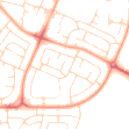
Road Noise
Average road noise levels for this postcode
Daytime
07:00 – 23:00
50.0dB
Low
Night-time
23:00 – 07:00
38.9dB
Low55 dB
60 dB
65 dB
70 dB
75 dB
80 dB
Defra Road Noise Strategic Mapping, Round 4Crime Analysis
8 months of data for Nottingham
Total Crimes
49
Monthly Avg
6
Recent Trend
Stable
Most Common
Violence & Sexual
Crime by Category
Violence & Sexual24(49%)
Criminal Damage & Arson6(12%)
Other Theft5(10%)
Vehicle Crime3(6%)
Drugs3(6%)
Other Crime2(4%)
Weapons2(4%)
Public Order1(2%)
Burglary1(2%)
Bicycle Theft1(2%)
Robbery1(2%)
Recent Incidents
Vehicle Crime
Nov 2025On or near Wrenthorpe Vale
Criminal Damage & Arson
Nov 2025On or near Wilkins Gardens
Other Theft
Nov 2025On or near Supermarket
Public Order
Nov 2025On or near Supermarket
Violence & Sexual
Nov 2025On or near Sprydon Walk
Criminal Damage & Arson
Nov 2025On or near Wilkins Gardens
Data from Police UK • Updated monthly
Local Amenities
Schools and transport links nearby
Nearby Schools
12 within 3kmP
The Milford Academy
201m
2 mins
P
Blessed Robert Widmerpool Catholic Primary and Nursery School
233m
3 mins
P
Whitegate Primary and Nursery School
754m
9 mins
S
Farnborough Spencer Academy
1.2km
14 mins
Transport Links
30 within 3kmStirling Grove On Demand
Bus Stop133m
2 mins
Wheatacre Road On Demand
Bus Stop177m
2 mins
Wheatacre Road
Bus Stop183m
2 mins
Dungannon Road
Bus Stop203m
2 mins
Peacock
Bus Stop241m
3 mins
Clifton Centre Tram Stop
Underground434m
5 mins
School data from Dept. for Education • Transport data from NaPTAN
Nearby Property Businesses
Local professionals serving this area
Surveyor
Savills (UK) Ltd
Nottingham
RICSResidential

GNA Surveyors Limited
Nottingham
RICSResidential
Surveyor
NG Block Management
Nottingham
RICS
Surveyor
SDL Surveying
Nottingham
RICS
Surveyor
Mellors & Kirk Ltd
Nottingham
RICS
Surveyor
RES Property Surveyors
Nottingham
RICSResidential
Surveyor
Fulcrum Consultants Limited
Nottingham
RICSResidential
Surveyor
APDCQS Ltd
Nottingham
RICSResidential
Map
42 points of interest nearby
Map data from OpenStreetMap • Transport data from NaPTAN • School data from Dept. for Education • Scenic data from Beautifulplaces.ai
Frequently Asked Questions
Common questions about this property