Are you a property professional?Get qualified leads from motivated homeowners.
Get started1 Chartwell Avenue, Ruddington, Nottingham, NG11 6DJ
This 49 square metre property in Ruddington, Nottingham, Nottingham carries an energy performance rating of C, which is above the national average. It is heated by a gas central heating system and is currently listed as owner-occupied. Records show the property last changed hands for £235,346 back in 2015.
Property Type
Semi-Detached House
Bedrooms
3
Bathrooms
1
Floor Area
49 m²
Council Tax
Band C
Property Features
Built 1976–1982
Private Garden
Enclosed private garden
Garage
Off-street covered parking
Driveway
Off-street parking
Dining Room
Separate dining space
Cloakroom
Downstairs WC
Solar Panels
Renewable energy generation
Recently Refurbished
Renovated and updated
Extended
Additional space added to the original build
Get started
Ready to take the next step? Find the right professionals for your property journey.
Energy Performance
EPC rating and efficiency details
EPC Expired
This certificate is over 10 years old and is no longer valid.Expired 18 Sept 2019
EPC Rating
A
B
C
C73
D
E
F
G
Main Heating
Gas
Main Fuel
Gas
Hot Water
Very Good
Windows
Average
CO2 Emissions
2.9 t/year
Tenure
Owner Occupied
Price & History
Transactions and market trends
Estimated value
£331,000
How our AI predicts property prices · Accurate to within 10%
Automated estimate only. For an accurate valuation, consult a surveyor or estate agent.
Transaction history
+34.5%(3y)
£235,346Latest
Jul 2015£175,000
Jul 2012£74,000
Apr 1999Source: HM Land Registry
Nearby in NG11 6DJ
10 Chartwell Avenue Ruddington Nottingham NG11 6DJ
Sept 2024
£500,000
16 Chartwell Avenue Ruddington Nottingham NG11 6DJ
Dec 2005
£199,000
14 Chartwell Avenue Ruddington Nottingham NG11 6DJ
Apr 2000
£97,500
11 Chartwell Avenue Ruddington Nottingham NG11 6DJ
Nov 1999
£88,000
3 Chartwell Avenue Ruddington Nottingham NG11 6DJ
Jul 1999
£115,000
7 Chartwell Avenue Ruddington Nottingham NG11 6DJ
Oct 1996
£80,000
1 / 2
House Price Index
England+1.5%
101.6
Jan 26
UK HPI from HM Land Registry. Baseline: Jan 2015 = 100.
How This Property Compares on Chartwell Avenue
See how this property stacks up against others nearby
Not enough similar properties in this postcode to make meaningful comparisons.
Get alerts for NG11 6DJ
New sales, price changes, and market updates in this area
About Ruddington, Nottingham
This property is located in Ruddington, a sizeable village in the Borough of Rushcliffe, Nottinghamshire, situated just 5 miles south of Nottingham and 11 miles northwest of Loughborough.
Ruddington is a large village in the Borough of Rushcliffe in Nottinghamshire, England. The village is 5 miles (8 km) south of Nottingham and 11 miles (18 km) northwest of Loughborough. It had a population of 6,441 at the 2001 Census, increasing to 7,216 at the 2011 Census and 7,674 in 2021. Ruddington is twinned with Grenay, France.
Places to visit
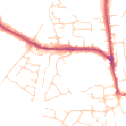
Road Noise
Average road noise levels for this postcode
Daytime
07:00 – 23:00
48.7dB
Low
Night-time
23:00 – 07:00
39.6dB
Low55 dB
60 dB
65 dB
70 dB
75 dB
80 dB
Defra Road Noise Strategic Mapping, Round 4Crime Analysis
8 months of data for Nottingham
Total Crimes
49
Monthly Avg
6
Recent Trend
Stable
Most Common
Violence & Sexual
Crime by Category
Violence & Sexual24(49%)
Criminal Damage & Arson6(12%)
Other Theft5(10%)
Vehicle Crime3(6%)
Drugs3(6%)
Other Crime2(4%)
Weapons2(4%)
Public Order1(2%)
Burglary1(2%)
Bicycle Theft1(2%)
Robbery1(2%)
Recent Incidents
Vehicle Crime
Nov 2025On or near Wrenthorpe Vale
Criminal Damage & Arson
Nov 2025On or near Wilkins Gardens
Other Theft
Nov 2025On or near Supermarket
Public Order
Nov 2025On or near Supermarket
Violence & Sexual
Nov 2025On or near Sprydon Walk
Criminal Damage & Arson
Nov 2025On or near Wilkins Gardens
Data from Police UK • Updated monthly
Local Amenities
Schools and transport links nearby
Nearby Schools
12 within 3kmP
James Peacock Infant and Nursery School
161m
2 mins
P
St Peter's CofE Junior School
1.1km
13 mins
P
The Milford Academy
1.5km
18 mins
S
Farnborough Spencer Academy
1.8km
22 mins
S
The West Bridgford School
3.0km
36 mins
Transport Links
30 within 3kmCamelot Street
Bus Stop177m
2 mins
Wilford Road
Bus Stop382m
5 mins
North Road
Bus Stop409m
5 mins
Clifton Road
Bus Stop426m
5 mins
Barton Close
Bus Stop455m
5 mins
Church
Bus Stop456m
5 mins
School data from Dept. for Education • Transport data from NaPTAN
Nearby Property Businesses
Local professionals serving this area

E-Value8 (UK) Ltd
Nottingham
RICSResidential
Surveyor
Savills (UK) Ltd
Nottingham
RICSResidential

GNA Surveyors Limited
Nottingham
RICSResidential
Surveyor
NG Block Management
Nottingham
RICS
Surveyor
SDL Surveying
Nottingham
RICS
Surveyor
Mellors & Kirk Ltd
Nottingham
RICS
Surveyor
RES Property Surveyors
Nottingham
RICSResidential
Surveyor
Fulcrum Consultants Limited
Nottingham
RICSResidential
Map
42 points of interest nearby
Map data from OpenStreetMap • Transport data from NaPTAN • School data from Dept. for Education • Scenic data from Beautifulplaces.ai
Frequently Asked Questions
Common questions about this property