Are you a property professional?Get qualified leads from motivated homeowners.
Get started6 Deepdale Crescent, Cowgate, Newcastle Upon Tyne, NE5 3HQ
This property in Cowgate, Newcastle Upon Tyne, Newcastle Upon Tyne. Explore detailed information about this Cowgate, Newcastle Upon Tyne property including energy performance, price history, local schools, transport links and crime statistics.
Property Type
Property
Bedrooms
—
Floor Area
— m²
Council Tax
Band A
Get started
Ready to take the next step? Find the right professionals for your property journey.
Energy Performance
EPC rating and efficiency details
A
B
C
D
E
F
G
No EPC on record
This property doesn't have an Energy Performance Certificate yet. An EPC helps us give a more accurate valuation and is required to sell or let.
Price & History
Transactions and market trends
Transaction history
No sales history found
Nearby in NE5 3HQ
No nearby sales found
House Price Index
Newcastle Upon Tyne+4.0%
112.0
Jan 26
UK HPI from HM Land Registry. Baseline: Jan 2015 = 100.
How This Property Compares on Deepdale Crescent
See how this property stacks up against others nearby
Not enough similar properties in this postcode to make meaningful comparisons.
Get alerts for NE5 3HQ
New sales, price changes, and market updates in this area
About Cowgate, Newcastle Upon Tyne
This property is located in Cowgate, Newcastle upon Tyne, a locality in the north‑west of the city within the NE 5 postcode. It lies just under three miles from the city centre and was historically part of the Kenton ward before moving to Blakelaw ward in 2018.
Cowgate, Newcastle upon Tyne is a locality situated in the north‑west of the city, approximately 2.8 miles from the city centre. Historically it fell within the Kenton ward until 2018, after which it became part of the Blakelaw ward. The name Cowgate is thought to derive from a gate used by local farmers to move livestock from the Nuns Moor area to the Newcastle cattle market. As part of the NE 5 postal district, Cowgate lies within the broader Newcastle upon Tyne area in England. The locality’s description is concise, identifying it as a residential area with a rural origin and a clear connection to the city’s market history.
Places to visit
Road Noise
Average road noise levels for this postcode
Daytime
07:00 – 23:00
51.8dB
Low
Night-time
23:00 – 07:00
42.3dB
Low55 dB
60 dB
65 dB
70 dB
75 dB
80 dB
Defra Road Noise Strategic Mapping, Round 4Crime Analysis
11 months of data for Newcastle Upon Tyne
Total Crimes
89
Monthly Avg
8
Recent Trend
Stable
Most Common
Violence & Sexual
Crime by Category
Violence & Sexual40(45%)
Criminal Damage & Arson13(15%)
Vehicle Crime10(11%)
Other Crime10(11%)
Burglary6(7%)
Other Theft4(4%)
Public Order3(3%)
Drugs1(1%)
Weapons1(1%)
Robbery1(1%)
Recent Incidents
Violence & Sexual
Dec 2025On or near Burnview Court
Vehicle Crime
Dec 2025On or near Burnview Court
Other Theft
Dec 2025On or near Burnview Court
Violence & Sexual
Nov 2025On or near Byrness
Violence & Sexual
Nov 2025On or near Byrness
Violence & Sexual
Nov 2025On or near Kidlandlee Green
Data from Police UK • Updated monthly
Local Amenities
Schools and transport links nearby
Nearby Schools
39 within 3kmP
Thomas Walling Primary Academy
915m
11 mins
P
English Martyrs' Catholic Primary School, Fenham
1.1km
13 mins
P
Wyndham Primary School
1.1km
13 mins
S
Kenton School
991m
12 mins
S
Sacred Heart Catholic High School
1.5km
18 mins
S
St Cuthbert's High School
2.2km
26 mins
Transport Links
30 within 3kmPonteland Road-St Peters Church
Bus Stop212m
3 mins
Ponteland Road-Springfield Road
Bus Stop219m
3 mins
Ponteland Road-Eastern Way
Bus Stop264m
3 mins
Ponteland Road - Greenhill View
Bus Stop327m
4 mins
Harehills Avenue-Terminus
Bus Stop342m
4 mins
Springfield Road-Firfield Road
Bus Stop372m
4 mins
School data from Dept. for Education • Transport data from NaPTAN
Nearby Property Businesses
Local professionals serving this area
Surveyor
Mableson Hall Limited
Newcastle Upon Tyne
RICS
Surveyor
Ian Watson Surveying Services
Newcastle Upon Tyne
RICS
Surveyor
Boydengroup LLP
Newcastle Upon Tyne
RICSResidential
Surveyor
Copro Consulting Limited
Newcastle Upon Tyne
RICSResidential
Surveyor
Christie & Co
Newcastle Upon Tyne
RICS
Surveyor
Adept Building Consultancy Ltd
Newcastle Upon Tyne
RICSResidential
Surveyor
surveylink france
Newcastle Upon Tyne
RICS

Robertson Hill Associates
Newcastle Upon Tyne
RICSResidential
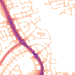
Map
69 points of interest nearby
Map data from OpenStreetMap • Transport data from NaPTAN • School data from Dept. for Education • Scenic data from Beautifulplaces.ai
Frequently Asked Questions
Common questions about this property