Are you a property professional?Get qualified leads from motivated homeowners.
Get startedExtendedDetached
39 Bracken Way, Ryton, NE40 4XP
This 95 square metre property in Ryton carries an energy performance rating of C, which is above the national average. It is heated by a gas central heating system and is currently listed as owner-occupied. The property last sold for £260,000 in 2020.
Property Type
Detached House
Bedrooms
3
Bathrooms
2
Floor Area
95 m²
Council Tax
Band D
Property Features
Built 1996–2002
Private Garden
Enclosed private garden
Garage
Off-street covered parking
Fireplace
Working or decorative fireplace
En-suite Bathroom
Private bathroom attached to bedroom
Dining Room
Separate dining space
Utility Room
Separate laundry and storage
Cloakroom
Downstairs WC
Recently Refurbished
Renovated and updated
Get started
Ready to take the next step? Find the right professionals for your property journey.
Energy Performance
EPC rating and efficiency details
EPC Rating
A
B
C
C70
D
E
F
G
Main Heating
Gas
Main Fuel
Gas
Hot Water
Good
Windows
Average
CO2 Emissions
3.6 t/year
Tenure
Owner Occupied
Price & History
Transactions and market trends
Estimated value
£331,000
How our AI predicts property prices · Accurate to within 10%
Automated estimate only. For an accurate valuation, consult a surveyor or estate agent.
Transaction history
£260,000Latest
Feb 2020Source: HM Land Registry
House Price Index
England+1.5%
101.6
Jan 26
UK HPI from HM Land Registry. Baseline: Jan 2015 = 100.
How This Property Compares on Bracken Way
See how this property stacks up against others nearby
Comparing to 21 other houses on this street
Price per m²
Property value per square metre of floor space
£2,737/£2,457 avg
LowerHigher
Higher than 65% of similar properties
Years Held
Time since last sale — indicates ownership stability
6 years/11 years avg
ShorterLonger
Held longer than only 29% of similar properties
EPC Rating
Government energy efficiency score (1–100)
70 (C)/67 (D) avg
Less efficientMore efficient
More efficient than 76% of similar properties
Floor Area
Total internal floor space
95 m²/109 m² avg
SmallerLarger
Larger than only 33% of similar properties
CO₂ Emissions
Annual carbon output from heating, hot water & lighting
3.6 t/year/4.4 t/year avg
Higher emissionsLower emissions
Lower emissions than 62% of similar properties
Habitable Rooms
Living spaces like bedrooms & living rooms
5 rooms/6 rooms avg
FewerMore
More rooms than only 36% of similar properties
Comparisons are based on the most recent EPC data for each property in this postcode. Only similar property types (houses) are compared.
Get alerts for NE40 4XP
New sales, price changes, and market updates in this area
Places to visit
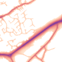
Road Noise
Average road noise levels for this postcode
Daytime
07:00 – 23:00
52.5dB
Low
Night-time
23:00 – 07:00
43.4dB
Low55 dB
60 dB
65 dB
70 dB
75 dB
80 dB
Defra Road Noise Strategic Mapping, Round 4Crime Analysis
6 months of data for Ryton
Total Crimes
16
Monthly Avg
3
Recent Trend
Stable
Most Common
Violence & Sexual
Crime by Category
Violence & Sexual4(25%)
Criminal Damage & Arson3(19%)
Public Order2(13%)
Other Theft2(13%)
Other Crime2(13%)
Drugs1(6%)
Vehicle Crime1(6%)
Weapons1(6%)
Recent Incidents
Public Order
Nov 2025On or near Greenside Road
Other Theft
Nov 2025On or near Crawcrook Lane
Violence & Sexual
Nov 2025On or near Crawcrook Lane
Other Theft
Nov 2025On or near Hexham Old Road
Other Crime
Nov 2025On or near Hexham Old Road
Criminal Damage & Arson
Nov 2025On or near Greenside Road
Data from Police UK • Updated monthly
Local Amenities
Schools and transport links nearby
Nearby Schools
9 within 3kmP
St Agnes' Catholic Primary School, Crawcrook
463m
6 mins
P
Emmaville Primary School
656m
8 mins
P
Ryton Community Infant School
817m
10 mins
S
Thorp Academy
868m
10 mins
Transport Links
30 within 3kmKepier Chare
Bus Stop231m
3 mins
Fairfield Manor Estate
Bus Stop266m
3 mins
Woodside
Bus Stop355m
4 mins
Woodside Lane-Woodside Lodge
Bus Stop388m
5 mins
Woodside Lane-Green Grove
Bus Stop406m
5 mins
Woodside Lane-Maiden Lane
Bus Stop414m
5 mins
School data from Dept. for Education • Transport data from NaPTAN
Map
39 points of interest nearby
Map data from OpenStreetMap • Transport data from NaPTAN • School data from Dept. for Education • Scenic data from Beautifulplaces.ai
Frequently Asked Questions
Common questions about this property