Are you a property professional?Get qualified leads from motivated homeowners.
Get startedLong-term Owner
23 Ponthaugh, Rowlands Gill, NE39 1AF
This 94 square metre property in Rowlands Gill carries an energy performance rating of D, in line with typical UK homes. It is heated by a gas central heating system and is currently listed as owner-occupied. Records show the property last changed hands for £157,495 back in 2010.
Property Type
Semi-Detached House
Bedrooms
3
Floor Area
94 m²
Council Tax
Band C
Property Features
Built 1950–1966
Get started
Ready to take the next step? Find the right professionals for your property journey.
Energy Performance
EPC rating and efficiency details
EPC Expired
This certificate is over 10 years old and is no longer valid.Expired 30 Apr 2019
EPC Rating
A
B
C
D
D56
E
F
G
Main Heating
Gas
Main Fuel
Gas
Hot Water
Poor
Windows
Average
CO2 Emissions
5.3 t/year
Tenure
Owner Occupied
Price & History
Transactions and market trends
Estimated value
£210,000
How our AI predicts property prices · Accurate to within 10%
Automated estimate only. For an accurate valuation, consult a surveyor or estate agent.
Transaction history
£157,495Latest
Oct 2010Source: HM Land Registry
Nearby in NE39 1AF
37 Ponthaugh Rowlands Gill NE39 1AF
Feb 2025
£205,000
27 Ponthaugh Rowlands Gill NE39 1AF
Jul 2024
£215,000
48 Ponthaugh Rowlands Gill NE39 1AF
Jan 2022
£240,000
33 Ponthaugh Rowlands Gill NE39 1AF
Jan 2021
£200,000
25 Ponthaugh Rowlands Gill NE39 1AF
Mar 2020
£140,000
43 Ponthaugh Rowlands Gill NE39 1AF
Jan 2018
£164,950
1 / 2
House Price Index
England+1.5%
101.6
Jan 26
UK HPI from HM Land Registry. Baseline: Jan 2015 = 100.
How This Property Compares on Ponthaugh
See how this property stacks up against others nearby
Comparing to 12 other houses on this street
Price per m²
Property value per square metre of floor space
£1,671/£1,880 avg
LowerHigher
Around average
Years Held
Time since last sale — indicates ownership stability
16 years/9 years avg
ShorterLonger
Held longer than 80% of similar properties
EPC Rating
Government energy efficiency score (1–100)
56 (D)/58 (D) avg
Less efficientMore efficient
More efficient than only 33% of similar properties
Floor Area
Total internal floor space
94 m²/103 m² avg
SmallerLarger
Around average
CO₂ Emissions
Annual carbon output from heating, hot water & lighting
5.3 t/year/5.7 t/year avg
Higher emissionsLower emissions
Around average
Habitable Rooms
Living spaces like bedrooms & living rooms
4 rooms/5 rooms avg
FewerMore
More rooms than only 13% of similar properties
Comparisons are based on the most recent EPC data for each property in this postcode. Only similar property types (houses) are compared.
Get alerts for NE39 1AF
New sales, price changes, and market updates in this area
Places to visit
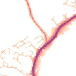
Road Noise
Average road noise levels for this postcode
Daytime
07:00 – 23:00
48.1dB
Low
Night-time
23:00 – 07:00
40.6dB
Low55 dB
60 dB
65 dB
70 dB
75 dB
80 dB
Defra Road Noise Strategic Mapping, Round 4Crime Analysis
7 months of data for Rowlands Gill
Total Crimes
23
Monthly Avg
3
Recent Trend
Stable
Most Common
Violence & Sexual
Crime by Category
Violence & Sexual9(39%)
Criminal Damage & Arson5(22%)
Public Order2(9%)
Other Theft2(9%)
Drugs2(9%)
Burglary1(4%)
Theft from Person1(4%)
Vehicle Crime1(4%)
Recent Incidents
Violence & Sexual
Nov 2025On or near Lintzford Lane
Public Order
Nov 2025On or near West Avenue
Criminal Damage & Arson
Nov 2025On or near West Avenue
Violence & Sexual
Nov 2025On or near Pontop View
Criminal Damage & Arson
Oct 2025On or near West Avenue
Burglary
Oct 2025On or near West Avenue
Data from Police UK • Updated monthly
Local Amenities
Schools and transport links nearby
Nearby Schools
8 within 3kmP
Rowlands Gill Community Primary School
375m
5 mins
P
Highfield Community Primary School
1.6km
19 mins
P
St Joseph's Roman Catholic Voluntary Aided Primary School, Highfield
1.6km
19 mins
Transport Links
30 within 3kmLockhaugh Road-Hollin Hill Lane
Bus Stop170m
2 mins
Rowlands Gill Primary School
Bus Stop273m
3 mins
Lockhaugh Road-Dominies Close
Bus Stop326m
4 mins
Sherburn Park
Bus Stop340m
4 mins
Lockhaugh Road-Cowen Terrace
Bus Stop366m
4 mins
Sherburn Towersestate-Snipes Dene
Bus Stop548m
7 mins
School data from Dept. for Education • Transport data from NaPTAN
Map
38 points of interest nearby
Map data from OpenStreetMap • Transport data from NaPTAN • School data from Dept. for Education • Scenic data from Beautifulplaces.ai
Frequently Asked Questions
Common questions about this property