Are you a property professional?Get qualified leads from motivated homeowners.
Get started12 John Street, Cullercoats, North Shields, NE30 4PL
This property in Cullercoats, North Shields, North Shields. Explore detailed information about this Cullercoats, North Shields property including energy performance, price history, local schools, transport links and crime statistics.
Property Type
Property
Bedrooms
—
Floor Area
— m²
Council Tax
Band A
Get started
Ready to take the next step? Find the right professionals for your property journey.
Energy Performance
EPC rating and efficiency details
A
B
C
D
E
F
G
No EPC on record
This property doesn't have an Energy Performance Certificate yet. An EPC helps us give a more accurate valuation and is required to sell or let.
Price & History
Transactions and market trends
Transaction history
No sales history found
Nearby in NE30 4PL
Flat 3 8 John Street Cullercoats North Shields NE30 4PL
Mar 2024
£200,000
7 John Street Cullercoats North Shields NE30 4PL
Apr 2019
£61,000
10 John Street Cullercoats North Shields NE30 4PL
Jan 2017
£345,000
22 John Street Cullercoats North Shields NE30 4PL
Jun 2014
£55,000
4 John Street Cullercoats North Shields NE30 4PL
Jul 2004
£258,000
Flat 2 8 John Street Cullercoats North Shields NE30 4PL
Mar 2003
£59,700
1 / 2
House Price Index
England+1.5%
101.6
Jan 26
UK HPI from HM Land Registry. Baseline: Jan 2015 = 100.
How This Property Compares on John Street
See how this property stacks up against others nearby
Not enough similar properties in this postcode to make meaningful comparisons.
Get alerts for NE30 4PL
New sales, price changes, and market updates in this area
About Cullercoats, North Shields
This property is located in Cullercoats, a coastal settlement in North Tyneside, Tyne and Wear, England. It sits within the NE 30 postal district and is part of the broader Tyneside conurbation, positioned between Tynemouth and Whitley Bay.
Cullercoats is a coastal settlement in the metropolitan borough of North Tyneside, Tyne and Wear, England. Historically part of Northumberland, it has become absorbed into the wider Tyneside conurbation. The locality lies between Tynemouth to the south and Whitley Bay to the north, giving it a position along the North Sea coast. According to the 2021 census, the population of Cullercoats was 6,232, indicating a small but established community. As a settlement within North Tyneside, it shares administrative ties with the larger borough while maintaining its distinct seaside character. Residents and visitors benefit from its proximity to neighbouring coastal towns and the broader amenities of the Tyneside area. The postal district NE 30 situates it within the local postal geography, aiding in identification and service provision.
Places to visit
Road Noise
Average road noise levels for this postcode
Daytime
07:00 – 23:00
51.1dB
Low
Night-time
23:00 – 07:00
40.4dB
Low55 dB
60 dB
65 dB
70 dB
75 dB
80 dB
Defra Road Noise Strategic Mapping, Round 4Crime Analysis
13 months of data for North Shields
Total Crimes
87
Monthly Avg
7
Recent Trend
Rising
Most Common
Shoplifting
Crime by Category
Shoplifting31(36%)
Violence & Sexual25(29%)
Public Order11(13%)
Robbery6(7%)
Criminal Damage & Arson3(3%)
Burglary3(3%)
Drugs2(2%)
Other Theft2(2%)
Other Crime2(2%)
Vehicle Crime1(1%)
Theft from Person1(1%)
Recent Incidents
Violence & Sexual
Dec 2025On or near Camden Street
Violence & Sexual
Dec 2025On or near Camden Street
Violence & Sexual
Dec 2025On or near Camden Street
Drugs
Nov 2025On or near Brewhouse Bank
Public Order
Nov 2025On or near Brewhouse Bank
Other Theft
Nov 2025On or near Camden Street
Data from Police UK • Updated monthly
Local Amenities
Schools and transport links nearby
Nearby Schools
25 within 3kmP
Cullercoats Primary School
227m
3 mins
P
Rockcliffe First School
584m
7 mins
P
St Mary's Catholic Primary School, North Shields
1.0km
12 mins
S
Marden High School
996m
12 mins
S
Marden Bridge Middle School
1.1km
13 mins
S
John Spence Community High School
1.8km
22 mins
Transport Links
30 within 3kmMarden Avenue-Beverley Villas
Bus Stop119m
1 min
Cullercoats (Tyne and Wear Metro Station)
Underground149m
2 mins
John Street
Bus Stop174m
2 mins
Beverley Terrace-Marden Avenue
Bus Stop180m
2 mins
Front Street-Cliff House
Bus Stop182m
2 mins
Marden Avenue-Georges Road
Bus Stop190m
2 mins
School data from Dept. for Education • Transport data from NaPTAN
Nearby Property Businesses
Local professionals serving this area
Surveyor
Butler-Curnow Building Surveyors
North Shields
RICS

R A Jackson & Son LLP
North Shields
RICSResidential
Surveyor
AJ Walton Surveying Ltd
North Shields
RICSResidential

Paul Airey Chartered Surveyors
North Shields
RICSResidential
Surveyor
Focus Architecture and Surveying Limited
North Shields
RICSResidential
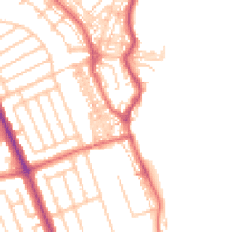
Map
55 points of interest nearby
Map data from OpenStreetMap • Transport data from NaPTAN • School data from Dept. for Education • Scenic data from Beautifulplaces.ai
Frequently Asked Questions
Common questions about this property