Are you a property professional?Get qualified leads from motivated homeowners.
Get startedVictorianTop Floor
23 Bamborough Terrace, North Shields, NE30 2BT
This 69 square metre property in North Shields carries an energy performance rating of D, in line with typical UK homes. It is heated by a gas central heating system and is currently listed as owner-occupied. The property last sold for £130,000 in 2022.
Property Type
1st Floor Flat
Bedrooms
2
Bathrooms
1
Floor Area
69 m²
Council Tax
Band A
Property Features
Built Before 1900
Private Garden
Rear
En-suite Bathroom
Private bathroom attached to bedroom
Cloakroom
Downstairs WC
Open-plan Living
Combined kitchen and living area
Balcony
Private outdoor balcony space
Get started
Ready to take the next step? Find the right professionals for your property journey.
Energy Performance
EPC rating and efficiency details
EPC Expired
This certificate is over 10 years old and is no longer valid.Expired 28 Nov 2023
EPC Rating
A
B
C
D
D65
E
F
G
Main Heating
Gas
Main Fuel
Gas
Hot Water
Good
Windows
Average
CO2 Emissions
3.2 t/year
Tenure
Owner Occupied
Price & History
Transactions and market trends
Estimated value
£170,000
How our AI predicts property prices · Accurate to within 10%
Automated estimate only. For an accurate valuation, consult a surveyor or estate agent.
Transaction history
+18.2%(3y)
£130,000Latest
Feb 2022£110,000
Jul 2019£97,500
Oct 2018£108,000
Jul 2016£82,500
Mar 2010£25,000
Nov 1998£29,000
Jul 1995Source: HM Land Registry
Nearby in NE30 2BT
79 Bamborough Terrace North Shields NE30 2BT
Oct 2025
£160,000
83 Bamborough Terrace North Shields NE30 2BT
Sept 2025
£172,000
85 Bamborough Terrace North Shields NE30 2BT
Oct 2024
£159,000
13 Bamborough Terrace North Shields NE30 2BT
Sept 2024
£149,950
75 Bamborough Terrace North Shields NE30 2BT
Aug 2024
£153,000
65 Bamborough Terrace North Shields NE30 2BT
Mar 2024
£112,500
1 / 8
House Price Index
England+1.5%
101.6
Jan 26
UK HPI from HM Land Registry. Baseline: Jan 2015 = 100.
How This Property Compares on Bamborough Terrace
See how this property stacks up against others nearby
Comparing to 35 other flats on this street
Price per m²
Property value per square metre of floor space
£1,884/£1,686 avg
LowerHigher
Higher than 70% of similar properties
Years Held
Time since last sale — indicates ownership stability
4 years/8 years avg
ShorterLonger
Held longer than only 30% of similar properties
EPC Rating
Government energy efficiency score (1–100)
65 (D)/62 (D) avg
Less efficientMore efficient
Around average
Floor Area
Total internal floor space
69 m²/74 m² avg
SmallerLarger
Around average
CO₂ Emissions
Annual carbon output from heating, hot water & lighting
3.2 t/year/3.9 t/year avg
Higher emissionsLower emissions
Around average
Habitable Rooms
Living spaces like bedrooms & living rooms
3 rooms/3 rooms avg
FewerMore
More rooms than only 34% of similar properties
Comparisons are based on the most recent EPC data for each property in this postcode. Only similar property types (flats) are compared.
Get alerts for NE30 2BT
New sales, price changes, and market updates in this area
Places to visit
Road Noise
Average road noise levels for this postcode
Daytime
07:00 – 23:00
53.9dB
Low
Night-time
23:00 – 07:00
42.3dB
Low55 dB
60 dB
65 dB
70 dB
75 dB
80 dB
Defra Road Noise Strategic Mapping, Round 4Crime Analysis
13 months of data for North Shields
Total Crimes
87
Monthly Avg
7
Recent Trend
Rising
Most Common
Shoplifting
Crime by Category
Shoplifting31(36%)
Violence & Sexual25(29%)
Public Order11(13%)
Robbery6(7%)
Criminal Damage & Arson3(3%)
Burglary3(3%)
Drugs2(2%)
Other Theft2(2%)
Other Crime2(2%)
Vehicle Crime1(1%)
Theft from Person1(1%)
Recent Incidents
Violence & Sexual
Dec 2025On or near Camden Street
Violence & Sexual
Dec 2025On or near Camden Street
Violence & Sexual
Dec 2025On or near Camden Street
Drugs
Nov 2025On or near Brewhouse Bank
Public Order
Nov 2025On or near Brewhouse Bank
Other Theft
Nov 2025On or near Camden Street
Data from Police UK • Updated monthly
Local Amenities
Schools and transport links nearby
Nearby Schools
31 within 3kmP
King Edward Primary School
214m
3 mins
P
Christ Church CofE Primary School
420m
5 mins
P
Spring Gardens Primary School
643m
8 mins
S
John Spence Community High School
796m
10 mins
S
Marden High School
1.3km
16 mins
S
Kings Priory School
1.4km
17 mins
Transport Links
30 within 3kmPreston Road-Preston Avenue
Bus Stop217m
3 mins
Preston Road-Hospital
Bus Stop235m
3 mins
Linskill Terrace-Jackson Street
Bus Stop350m
4 mins
Queen Alexandra Road
Bus Stop409m
5 mins
Linskill Terrace-Grey Street
Bus Stop426m
5 mins
Albion Road-Brandling Terrace
Bus Stop461m
6 mins
School data from Dept. for Education • Transport data from NaPTAN
Nearby Property Businesses
Local professionals serving this area
Surveyor
Butler-Curnow Building Surveyors
North Shields
RICS
Surveyor
AJ Walton Surveying Ltd
North Shields
RICSResidential

R A Jackson & Son LLP
North Shields
RICSResidential

Paul Airey Chartered Surveyors
North Shields
RICSResidential
Surveyor
Focus Architecture and Surveying Limited
North Shields
RICSResidential
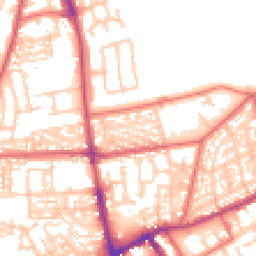
Map
61 points of interest nearby
Map data from OpenStreetMap • Transport data from NaPTAN • School data from Dept. for Education • Scenic data from Beautifulplaces.ai
Frequently Asked Questions
Common questions about this property