Are you a property professional?Get qualified leads from motivated homeowners.
Get started1 Belmont Avenue, Haringey, London, N17 6AX
This property in Haringey, London, London. Explore detailed information about this Haringey, London property including energy performance, price history, local schools, transport links and crime statistics.
Property Type
Property
Bedrooms
2
Bathrooms
1
Floor Area
— m²
Council Tax
Band D
Property Features
Freehold
You own the land
Private Garden
Enclosed private garden
Open-plan Living
Combined kitchen and living area
Recently Refurbished
Renovated and updated
Get started
Ready to take the next step? Find the right professionals for your property journey.
Energy Performance
EPC rating and efficiency details
A
B
C
D
E
F
G
No EPC on record
This property doesn't have an Energy Performance Certificate yet. An EPC helps us give a more accurate valuation and is required to sell or let.
Price & History
Transactions and market trends
Transaction history
No sales history found
Nearby in N17 6AX
33 Belmont Avenue Haringey London N17 6AX
Aug 2024
£2,000
First Floor Flat 65 Belmont Avenue London N17 6AX
Jun 2024
£495,000
11 Belmont Avenue Haringey London N17 6AX
Jun 2024
£460,000
Ground Floor Flat 29 Belmont Avenue London N17 6AX
Sept 2023
£420,000
43 Belmont Avenue Haringey London N17 6AX
Jan 2023
£417,000
17a Belmont Avenue London N17 6AX
Dec 2022
£340,000
1 / 8
House Price Index
London-1.9%
97.1
Jan 26
UK HPI from HM Land Registry. Baseline: Jan 2015 = 100.
How This Property Compares on Belmont Avenue
See how this property stacks up against others nearby
Not enough similar properties in this postcode to make meaningful comparisons.
Get alerts for N17 6AX
New sales, price changes, and market updates in this area
About Haringey, London
This property is located in Haringey, London, within the N8 postal district, placing it in a borough that borders Enfield, Waltham Forest, Hackney, Islington, Camden and Barnet.
Haringey London Borough Council, also known as Haringey Council, is the local authority for the London Borough of Haringey in Greater London, England. The London Borough of Haringey is a London borough in north London, classified by some definitions as part of Inner London, and by others as part of Outer London. It was created in 1965 by the amalgamation of three former boroughs. It shares borders with six other London boroughs. Clockwise from the north, they are: Enfield, Waltham Forest, Hackney, Islington, Camden, and Barnet.
Places to visit
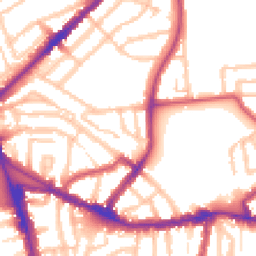
Road Noise
Average road noise levels for this postcode
Daytime
07:00 – 23:00
54.2dB
Low
Night-time
23:00 – 07:00
44.8dB
Low55 dB
60 dB
65 dB
70 dB
75 dB
80 dB
Defra Road Noise Strategic Mapping, Round 4Crime Analysis
12 months of data for London
Total Crimes
174
Monthly Avg
15
Recent Trend
Rising
Most Common
Violence & Sexual
Crime by Category
Violence & Sexual62(36%)
Vehicle Crime19(11%)
Theft from Person13(7%)
Drugs13(7%)
Public Order12(7%)
Shoplifting11(6%)
Robbery10(6%)
Burglary9(5%)
Other Theft8(5%)
Criminal Damage & Arson7(4%)
Other Crime6(3%)
Bicycle Theft3(2%)
Weapons1(1%)
Recent Incidents
Burglary
Dec 2025On or near Hampden Road
Violence & Sexual
Dec 2025On or near Hampden Road
Theft from Person
Nov 2025On or near Supermarket
Theft from Person
Nov 2025On or near Supermarket
Violence & Sexual
Nov 2025On or near Supermarket
Other Crime
Nov 2025On or near Forest Road
Data from Police UK • Updated monthly
Local Amenities
Schools and transport links nearby
Nearby Schools
82 within 3kmP
Belmont Junior School
251m
3 mins
P
Belmont Infant School
251m
3 mins
P
St John Vianney RC Primary School
507m
6 mins
S
Park View School
384m
5 mins
S
Mulberry Academy Woodside
1.6km
19 mins
S
Greig City Academy
1.7km
20 mins
Transport Links
30 within 3kmDownhills Way
Bus Stop100m
1 min
Belmont Road / Downhills Park
Bus Stop164m
2 mins
Linden Road
Bus Stop185m
2 mins
West Green Road / Belmont Road
Bus Stop342m
4 mins
Stanley Road West Green
Bus Stop385m
5 mins
Turnpike Lane Underground Station
Underground607m
7 mins
School data from Dept. for Education • Transport data from NaPTAN
Nearby Property Businesses
Local professionals serving this area
Surveyor
Novello Chartered Surveyors
London
RICSResidential
Surveyor
RES Property Surveyors
Stoke
RICSResidential
Surveyor
Scott Davidson
London
RICSResidential
Surveyor
Silver
London
RICSResidential
Surveyor
Ondare
London
RICS
Surveyor
SRVO Property Limited
London
RICSResidential
Surveyor
Hallas Commercial Ltd
London
RICS
Surveyor
Antony Patrick Associates Ltd
London
RICS
Map
112 points of interest nearby
Map data from OpenStreetMap • Transport data from NaPTAN • School data from Dept. for Education • Scenic data from Beautifulplaces.ai
Frequently Asked Questions
Common questions about this property