Are you a property professional?Get qualified leads from motivated homeowners.
Get startedBest EPC on StreetEPC B RatedDetached
1 Boyd Road, Melton Mowbray, LE13 0RH
This 164 square metre property in Melton Mowbray carries an energy performance rating of B, indicating very good energy efficiency standards. The property is heated by a gas central heating system. The property last sold for £549,995 in 2022.
Property Type
Detached House
Bedrooms
5
Floor Area
164 m²
Council Tax
Band N/A
Get started
Ready to take the next step? Find the right professionals for your property journey.
Energy Performance
EPC rating and efficiency details
EPC Rating
A
B
B86
C
D
E
F
G
Main Heating
Gas
Main Fuel
Gas
Hot Water
Good
Windows
Very Good
CO2 Emissions
2.3 t/year
Tenure
—
Price & History
Transactions and market trends
Estimated value
£586,000
How our AI predicts property prices · Accurate to within 10%
Automated estimate only. For an accurate valuation, consult a surveyor or estate agent.
Transaction history
£549,995Latest
Jun 2022Source: HM Land Registry
Nearby in LE13 0RH
25 Boyd Road Melton Mowbray LE13 0RH
May 2025
£205,000
22 Boyd Road Melton Mowbray LE13 0RH
Aug 2022
£274,995
30 Boyd Road Melton Mowbray LE13 0RH
Jun 2022
£204,995
24 Boyd Road Melton Mowbray LE13 0RH
Jun 2022
£299,995
20 Boyd Road Melton Mowbray LE13 0RH
Jun 2022
£309,995
29 Boyd Road Melton Mowbray LE13 0RH
Jun 2022
£219,995
1 / 6
House Price Index
England+3.3%
101.6
Jan 26
UK HPI from HM Land Registry. Baseline: Jan 2015 = 100.
How This Property Compares on Boyd Road
See how this property stacks up against others nearby
Comparing to 32 other houses on this street
Price per m²
Property value per square metre of floor space
£3,354/£2,921 avg
LowerHigher
Higher than 97% of similar properties
Years Held
Time since last sale — indicates ownership stability
4 years/4 years avg
ShorterLonger
Held longer than only 6% of similar properties
EPC Rating
Government energy efficiency score (1–100)
86 (B)/84 (B) avg
Less efficientMore efficient
More efficient than 95% of similar properties
Floor Area
Total internal floor space
164 m²/101 m² avg
SmallerLarger
Larger than 94% of similar properties
CO₂ Emissions
Annual carbon output from heating, hot water & lighting
2.3 t/year/1.5 t/year avg
Higher emissionsLower emissions
Lower emissions than only 5% of similar properties
Comparisons are based on the most recent EPC data for each property in this postcode. Only similar property types (houses) are compared.
Get alerts for LE13 0RH
New sales, price changes, and market updates in this area
Places to visit
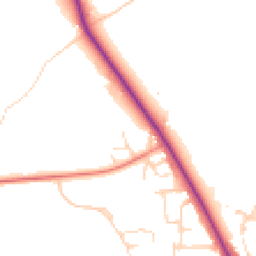
Road Noise
Average road noise levels for this postcode
Daytime
07:00 – 23:00
48.6dB
Low
Night-time
23:00 – 07:00
40.5dB
Low55 dB
60 dB
65 dB
70 dB
75 dB
80 dB
Defra Road Noise Strategic Mapping, Round 4Crime Analysis
9 months of data for Melton Mowbray
Total Crimes
48
Monthly Avg
5
Recent Trend
Stable
Most Common
Shoplifting
Crime by Category
Shoplifting16(33%)
Violence & Sexual14(29%)
Other Theft4(8%)
Public Order4(8%)
Criminal Damage & Arson4(8%)
Theft from Person2(4%)
Vehicle Crime2(4%)
Burglary1(2%)
Other Crime1(2%)
Recent Incidents
Other Theft
Nov 2025On or near Parking Area
Violence & Sexual
Nov 2025On or near Sherrard Street
Theft from Person
Nov 2025On or near Sherrard Street
Shoplifting
Nov 2025On or near Sherrard Street
Public Order
Nov 2025On or near Sherrard Street
Public Order
Nov 2025On or near Sherrard Street
Data from Police UK • Updated monthly
Local Amenities
Schools and transport links nearby
Nearby Schools
8 within 3kmP
St Mary's Church of England Primary School
310m
4 mins
P
The Grove Primary School
1.8km
22 mins
P
Brownlow Primary School
2.3km
28 mins
S
John Ferneley College
1.1km
13 mins
S
Long Field Spencer Academy
2.4km
29 mins
Transport Links
30 within 3kmBrampton Road
Bus Stop372m
4 mins
Beaconsfield Road
Bus Stop791m
10 mins
Gladstone Avenue
Bus Stop830m
10 mins
Kipling Drive
Bus Stop867m
10 mins
Tennyson Way
Bus Stop879m
11 mins
Garden Lane
Bus Stop945m
11 mins
School data from Dept. for Education • Transport data from NaPTAN
Nearby Property Businesses
Local professionals serving this area
Map
38 points of interest nearby
Map data from OpenStreetMap • Transport data from NaPTAN • School data from Dept. for Education • Scenic data from Beautifulplaces.ai
Frequently Asked Questions
Common questions about this property