Are you a property professional?Get qualified leads from motivated homeowners.
Get startedExtendedDetachedCharacter Fireplace
68 Sandy Lane, Melton Mowbray, LE13 0AW
This 107 square metre property in Melton Mowbray carries an energy performance rating of E. It is heated by a gas central heating system and is currently listed as owner-occupied.
Property Type
Detached House
Bedrooms
3
Floor Area
107 m²
Council Tax
Band D
Property Features
Built 1950–1966
Get started
Ready to take the next step? Find the right professionals for your property journey.
Energy Performance
EPC rating and efficiency details
EPC Expired
This certificate is over 10 years old and is no longer valid.Expired 05 Jun 2023
EPC Rating
A
B
C
D
E
E53
F
G
Main Heating
Gas
Main Fuel
Gas
Hot Water
Average
Windows
Average
CO2 Emissions
5.1 t/year
Tenure
Owner Occupied
Price & History
Transactions and market trends
Estimated value
£304,000
How our AI predicts property prices · Accurate to within 10%
Automated estimate only. For an accurate valuation, consult a surveyor or estate agent.
Transaction history
No sales history found
Nearby in LE13 0AW
117 Sandy Lane Melton Mowbray LE13 0AW
Oct 2025
£365,000
125 Sandy Lane Melton Mowbray LE13 0AW
Mar 2025
£475,000
106 Sandy Lane Melton Mowbray LE13 0AW
Jul 2024
£332,500
129 Sandy Lane Melton Mowbray LE13 0AW
Jan 2024
£425,000
107 Sandy Lane Melton Mowbray LE13 0AW
May 2022
£505,000
111a Sandy Lane Melton Mowbray LE13 0AW
Jan 2021
£405,000
1 / 4
House Price Index
England+3.3%
101.6
Jan 26
UK HPI from HM Land Registry. Baseline: Jan 2015 = 100.
How This Property Compares on Sandy Lane
See how this property stacks up against others nearby
Comparing to 24 other houses on this street
EPC Rating
Government energy efficiency score (1–100)
53 (E)/65 (D) avg
Less efficientMore efficient
More efficient than only 6% of similar properties
Floor Area
Total internal floor space
107 m²/101 m² avg
SmallerLarger
Larger than 71% of similar properties
CO₂ Emissions
Annual carbon output from heating, hot water & lighting
5.1 t/year/4.4 t/year avg
Higher emissionsLower emissions
Lower emissions than only 33% of similar properties
Habitable Rooms
Living spaces like bedrooms & living rooms
5 rooms/5 rooms avg
FewerMore
More rooms than 69% of similar properties
Comparisons are based on the most recent EPC data for each property in this postcode. Only similar property types (houses) are compared.
Get alerts for LE13 0AW
New sales, price changes, and market updates in this area
Places to visit
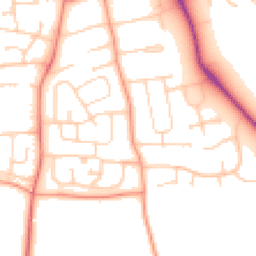
Road Noise
Average road noise levels for this postcode
Daytime
07:00 – 23:00
52.9dB
Low
Night-time
23:00 – 07:00
44.1dB
Low55 dB
60 dB
65 dB
70 dB
75 dB
80 dB
Defra Road Noise Strategic Mapping, Round 4Crime Analysis
9 months of data for Melton Mowbray
Total Crimes
48
Monthly Avg
5
Recent Trend
Stable
Most Common
Shoplifting
Crime by Category
Shoplifting16(33%)
Violence & Sexual14(29%)
Other Theft4(8%)
Public Order4(8%)
Criminal Damage & Arson4(8%)
Theft from Person2(4%)
Vehicle Crime2(4%)
Burglary1(2%)
Other Crime1(2%)
Recent Incidents
Other Theft
Nov 2025On or near Parking Area
Violence & Sexual
Nov 2025On or near Sherrard Street
Theft from Person
Nov 2025On or near Sherrard Street
Shoplifting
Nov 2025On or near Sherrard Street
Public Order
Nov 2025On or near Sherrard Street
Public Order
Nov 2025On or near Sherrard Street
Data from Police UK • Updated monthly
Local Amenities
Schools and transport links nearby
Nearby Schools
7 within 3kmP
Swallowdale Primary School and Community Centre
430m
5 mins
P
Sherard Primary School
810m
10 mins
P
Saint Francis Catholic Primary School
951m
11 mins
S
Melton Vale Sixth Form College
777m
9 mins
S
Long Field Spencer Academy
1.5km
18 mins
Transport Links
30 within 3kmPrincess Drive
Bus Stop144m
2 mins
Princess Drive
Bus Stop157m
2 mins
Tudor Hill
Bus Stop251m
3 mins
Methodist Church
Bus Stop272m
3 mins
Queensway
Bus Stop372m
4 mins
Swallowdale School
Bus Stop379m
5 mins
School data from Dept. for Education • Transport data from NaPTAN
Nearby Property Businesses
Local professionals serving this area
Map
37 points of interest nearby
Map data from OpenStreetMap • Transport data from NaPTAN • School data from Dept. for Education • Scenic data from Beautifulplaces.ai
Frequently Asked Questions
Common questions about this property