Are you a property professional?Get qualified leads from motivated homeowners.
Get started3 Barnfield Close, Bootle, L30 3UA
This property in Bootle. Explore detailed information about this Bootle property including energy performance, price history, local schools, transport links and crime statistics.
Property Type
Property
Bedrooms
—
Floor Area
— m²
Council Tax
Band C
Get started
Ready to take the next step? Find the right professionals for your property journey.
Energy Performance
EPC rating and efficiency details
A
B
C
D
E
F
G
No EPC on record
This property doesn't have an Energy Performance Certificate yet. An EPC helps us give a more accurate valuation and is required to sell or let.
Price & History
Transactions and market trends
Transaction history
No sales history found
Nearby in L30 3UA
35 Barnfield Close Bootle L30 3UA
Dec 2024
£221,625
37 Barnfield Close Bootle L30 3UA
Dec 2024
£221,625
33 Barnfield Close Bootle L30 3UA
Nov 2024
£221,625
8 Barnfield Close Bootle L30 3UA
Jun 2024
£163,000
20 Barnfield Close Bootle L30 3UA
Jun 2024
£160,000
15 Barnfield Close Bootle L30 3UA
Jun 2023
£125,000
1 / 3
House Price Index
England+1.5%
101.6
Jan 26
UK HPI from HM Land Registry. Baseline: Jan 2015 = 100.
How This Property Compares on Barnfield Close
See how this property stacks up against others nearby
Not enough similar properties in this postcode to make meaningful comparisons.
Get alerts for L30 3UA
New sales, price changes, and market updates in this area
Places to visit
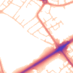
Road Noise
Average road noise levels for this postcode
Daytime
07:00 – 23:00
51.9dB
Low
Night-time
23:00 – 07:00
42.8dB
Low55 dB
60 dB
65 dB
70 dB
75 dB
80 dB
Defra Road Noise Strategic Mapping, Round 4Crime Analysis
7 months of data for Bootle
Total Crimes
33
Monthly Avg
5
Recent Trend
Stable
Most Common
Violence & Sexual
Crime by Category
Violence & Sexual15(45%)
Public Order5(15%)
Burglary3(9%)
Criminal Damage & Arson2(6%)
Other Crime2(6%)
Vehicle Crime2(6%)
Robbery1(3%)
Drugs1(3%)
Weapons1(3%)
Theft from Person1(3%)
Recent Incidents
Violence & Sexual
Dec 2025On or near Parkfield Avenue
Violence & Sexual
Nov 2025On or near St Thomas's Drive
Violence & Sexual
Nov 2025On or near Dale Acre Drive
Public Order
Nov 2025On or near St Ambrose Croft
Criminal Damage & Arson
Nov 2025On or near St Ambrose Croft
Violence & Sexual
Nov 2025On or near St Patrick's Drive
Data from Police UK • Updated monthly
Local Amenities
Schools and transport links nearby
Nearby Schools
36 within 3kmP
Our Lady of Walsingham Primary School
190m
2 mins
P
St Oswald's Church of England Primary School
472m
6 mins
P
Netherton Moss Primary School
584m
7 mins
S
Litherland High School
894m
11 mins
S
The Salesian Academy of St John Bosco
916m
11 mins
S
Chesterfield High School
2.3km
27 mins
Transport Links
30 within 3kmLinden Avenue
Bus Stop191m
2 mins
Leonard Cheshire Drive
Bus Stop198m
2 mins
Elton Avenue
Bus Stop211m
3 mins
Stand Park Avenue
Bus Stop329m
4 mins
Netherton Park
Bus Stop377m
5 mins
Park Lane
Bus Stop383m
5 mins
School data from Dept. for Education • Transport data from NaPTAN
Nearby Property Businesses
Local professionals serving this area
Map
66 points of interest nearby
Map data from OpenStreetMap • Transport data from NaPTAN • School data from Dept. for Education • Scenic data from Beautifulplaces.ai
Frequently Asked Questions
Common questions about this property