Are you a property professional?Get qualified leads from motivated homeowners.
Get startedLowest CarbonEPC B Rated
2 Treswell Road, Liverpool, L14 7AT
This 89 square metre property in Liverpool carries an energy performance rating of B, indicating very good energy efficiency standards. The property is heated by a gas central heating system. Records show the property last changed hands for £197,995 back in 2015.
Property Type
Semi-Detached House
Bedrooms
3
Floor Area
89 m²
Council Tax
Band C
Get started
Ready to take the next step? Find the right professionals for your property journey.
Energy Performance
EPC rating and efficiency details
EPC Expired
This certificate is over 10 years old and is no longer valid.Expired 22 Apr 2025
EPC Rating
A
B
B83
C
D
E
F
G
Main Heating
Gas
Main Fuel
Gas
Hot Water
Good
Windows
Very Good
CO2 Emissions
1.4 t/year
Tenure
—
Price & History
Transactions and market trends
Estimated value
£262,000
How our AI predicts property prices · Accurate to within 10%
Automated estimate only. For an accurate valuation, consult a surveyor or estate agent.
Transaction history
£197,995Latest
May 2015Source: HM Land Registry
Nearby in L14 7AT
12 Treswell Road Liverpool L14 7AT
Mar 2025
£372,000
7 Treswell Road Liverpool L14 7AT
Dec 2020
£349,950
15 Treswell Road Liverpool L14 7AT
Oct 2020
£347,500
21 Treswell Road Liverpool L14 7AT
Jul 2018
£256,995
17 Treswell Road Liverpool L14 7AT
May 2018
£262,995
9 Treswell Road Liverpool L14 7AT
Apr 2018
£309,995
1 / 3
House Price Index
Liverpool+3.7%
111.9
Jan 26
UK HPI from HM Land Registry. Baseline: Jan 2015 = 100.
How This Property Compares on Treswell Road
See how this property stacks up against others nearby
Comparing to 16 other houses on this street
Price per m²
Property value per square metre of floor space
£2,225/£2,551 avg
LowerHigher
Higher than only 25% of similar properties
Years Held
Time since last sale — indicates ownership stability
11 years/8 years avg
ShorterLonger
Held longer than all similar properties
EPC Rating
Government energy efficiency score (1–100)
83 (B)/84 (B) avg
Less efficientMore efficient
Around average
Floor Area
Total internal floor space
89 m²/114 m² avg
SmallerLarger
Larger than only 3% of similar properties
CO₂ Emissions
Annual carbon output from heating, hot water & lighting
1.4 t/year/1.7 t/year avg
Higher emissionsLower emissions
Lower emissions than 97% of similar properties
Comparisons are based on the most recent EPC data for each property in this postcode. Only similar property types (houses) are compared.
Get alerts for L14 7AT
New sales, price changes, and market updates in this area
Places to visit
Road Noise
Average road noise levels for this postcode
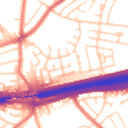
Daytime
07:00 – 23:00
55.6dB
Moderate
Night-time
23:00 – 07:00
46.5dB
Low55 dB
60 dB
65 dB
70 dB
75 dB
80 dB
Defra Road Noise Strategic Mapping, Round 4Crime Analysis
12 months of data for Liverpool
Total Crimes
67
Monthly Avg
6
Recent Trend
Rising
Most Common
Violence & Sexual
Crime by Category
Violence & Sexual29(43%)
Criminal Damage & Arson15(22%)
Public Order12(18%)
Drugs7(10%)
Burglary1(1%)
Bicycle Theft1(1%)
Vehicle Crime1(1%)
Other Theft1(1%)
Recent Incidents
Drugs
Nov 2025On or near Petunia Close
Criminal Damage & Arson
Nov 2025On or near Turriff Road
Drugs
Nov 2025On or near Petunia Close
Burglary
Nov 2025On or near Petunia Close
Public Order
Nov 2025On or near Fincham Square
Criminal Damage & Arson
Nov 2025On or near Woodford Road
Data from Police UK • Updated monthly
Local Amenities
Schools and transport links nearby
Nearby Schools
50 within 3kmP
Malvern Primary School
486m
6 mins
P
St Margaret Mary's Catholic Junior School
821m
10 mins
P
St Margaret Mary's Catholic Infant School
863m
10 mins
S
Dixons Broadgreen Academy
1.1km
13 mins
S
Childwall Sports & Science Academy
1.4km
17 mins
S
Cardinal Heenan Catholic High School
1.6km
20 mins
Transport Links
30 within 3kmEvington Drive
Bus Stop246m
3 mins
Chelwood Avenue
Bus Stop267m
3 mins
Ashfield Way
Bus Stop296m
4 mins
Inchape Road
Bus Stop324m
4 mins
Lingfield Grove
Bus Stop366m
4 mins
Broad Green Rail Station
Rail508m
6 mins
School data from Dept. for Education • Transport data from NaPTAN
Nearby Property Businesses
Local professionals serving this area
Surveyor
Mason Wright Associates
Liverpool
RICSResidential
Surveyor
Cosey Homes Chartered Surveyors
Liverpool
RICSResidential
Surveyor
Alan Wright - Chartered Surveyors
Liverpool
RICSResidential
Surveyor
TWC Consulting
Liverpool
RICSResidential
Surveyor
Kingsmead Consultants Ltd
Liverpool
RICS

Mesones Engineers & Surveyors
Liverpool
RICS
Surveyor
Sedulo Surveying Limited
Liverpool
RICS
Surveyor
Bladon & Kirkham
Liverpool
RICS
Map
80 points of interest nearby
Map data from OpenStreetMap • Transport data from NaPTAN • School data from Dept. for Education • Scenic data from Beautifulplaces.ai
Frequently Asked Questions
Common questions about this property