Are you a property professional?Get qualified leads from motivated homeowners.
Get startedDetached
9 Crythan Walk, Up Hatherley, Cheltenham, GL51 3XY
This 130 square metre property in Up Hatherley, Cheltenham, Cheltenham carries an energy performance rating of C, which is above the national average. It is heated by a gas central heating system and is currently listed as a private rental. Records show the property last changed hands for £350,000 back in 2015.
Property Type
Detached House
Bedrooms
4
Bathrooms
2
Floor Area
130 m²
Council Tax
Band F
Property Features
Built 1996–2002
Freehold
You own the land
Private Garden
Enclosed private garden
Double Detached Garage
Off-street covered parking
Gas Heating
Solar Panels
Renewable energy generation
Get started
Ready to take the next step? Find the right professionals for your property journey.
Energy Performance
EPC rating and efficiency details
Current Certificate(1 of 2)
Aug 2022
EPC Rating
A
B
C
C69
D
E
F
G
Main Heating
Gas
Main Fuel
Gas
Hot Water
Good
Windows
Average
CO2 Emissions
3.9 t/year
Tenure
Rented
Property Improvements
Changes detected from historical EPC data
Aug 2022from Aug 2015
EPC improved fromD68toC69
Roof Insulation
InsulatedWell Insulated
Loft insulation upgraded to recommended levels
Floor Insulation
UninsulatedPartial
Floor insulation added or improved
Low Energy Lighting
43%75%
More low energy lighting installed
Are we missing something? Tell us about home improvements to help adjust your valuation.
Price & History
Transactions and market trends
Estimated value
£594,000
How our AI predicts property prices · Accurate to within 10%
Automated estimate only. For an accurate valuation, consult a surveyor or estate agent.
Transaction history
£350,000Latest
Dec 2015Source: HM Land Registry
Nearby in GL51 3XY
7 Crythan Walk Up Hatherley Cheltenham GL51 3XY
Sept 2020
£385,000
6 Crythan Walk Up Hatherley Cheltenham GL51 3XY
Oct 2018
£445,000
4 Crythan Walk Up Hatherley Cheltenham GL51 3XY
Nov 2003
£315,000
3 Crythan Walk Up Hatherley Cheltenham GL51 3XY
Jun 2002
£245,000
8 Crythan Walk Up Hatherley Cheltenham GL51 3XY
Nov 1998
£142,000
House Price Index
Cheltenham+3.9%
101.8
Jan 26
UK HPI from HM Land Registry. Baseline: Jan 2015 = 100.
How This Property Compares on Crythan Walk
See how this property stacks up against others nearby
Not enough similar properties in this postcode to make meaningful comparisons.
Get alerts for GL51 3XY
New sales, price changes, and market updates in this area
About Up Hatherley, Cheltenham
This property is located in Up Hatherley, a suburb of Cheltenham within the GL 51 postal district, where the local landscape is shaped by the nearby Hatherley Brook.
Up Hatherley is a civil parish and a suburb of the spa town of Cheltenham, Gloucestershire, England. Formerly a hamlet in the parish of Shurdington, it now forms part of the wider Cheltenham area. Hatherley Brook is a tributary of the River Severn; it begins at Up Hatherley and flows in a westernly direction towards Longford, where it meets the Severn. The locality falls within the GL 51 postal district. The setting is rural with a brook running through it, linking the community to the wider river system of the Severn. The description highlights its status as a civil parish and its historical connection to the nearby spa town of Cheltenham, suggesting a blend of village character and proximity to a larger urban centre.
Places to visit
Road Noise
Average road noise levels for this postcode
Daytime
07:00 – 23:00
48.5dB
Low
Night-time
23:00 – 07:00
39.0dB
Low55 dB
60 dB
65 dB
70 dB
75 dB
80 dB
Defra Road Noise Strategic Mapping, Round 4Crime Analysis
12 months of data for Cheltenham
Total Crimes
52
Monthly Avg
4
Recent Trend
Rising
Most Common
Violence & Sexual
Crime by Category
Violence & Sexual17(33%)
Other Theft13(25%)
Shoplifting7(13%)
Vehicle Crime4(8%)
Criminal Damage & Arson3(6%)
Public Order3(6%)
Burglary2(4%)
Weapons1(2%)
Bicycle Theft1(2%)
Drugs1(2%)
Recent Incidents
Vehicle Crime
Nov 2025On or near Bournside Road
Burglary
Nov 2025On or near Monks Croft
Other Theft
Nov 2025On or near Monks Croft
Violence & Sexual
Nov 2025On or near Monks Croft
Violence & Sexual
Nov 2025On or near Monks Croft
Violence & Sexual
Nov 2025On or near Monks Croft
Data from Police UK • Updated monthly
Local Amenities
Schools and transport links nearby
Nearby Schools
17 within 3kmP
Greatfield Park Primary School
227m
3 mins
P
Warden Hill Primary School
354m
4 mins
P
St James' Church of England Primary School
923m
11 mins
S
Cheltenham Bournside School and Sixth Form Centre
672m
8 mins
S
Pate's Grammar School
2.9km
35 mins
Transport Links
30 within 3kmDavallia Drive
Bus Stop138m
2 mins
Azalea Drive
Bus Stop177m
2 mins
Morrisons Superstore
Bus Stop200m
2 mins
Winchester Way
Bus Stop255m
3 mins
Wells Close
Bus Stop268m
3 mins
St Christophers Church
Bus Stop282m
3 mins
School data from Dept. for Education • Transport data from NaPTAN
Nearby Property Businesses
Local professionals serving this area
Surveyor
Maple Leaf Property Consultants Ltd
Cheltenham
RICS
Surveyor
Dadson & Butler Ltd
Northleach
RICS

Barrett Corp and Harrington Limited
RICSResidential
Surveyor
The Surveying Practice
Cheltenham
RICS
Surveyor
Sheldon Bosley Knight Ltd
Winchcombe
RICSResidential
Surveyor
Jeremy Moore Associates Limited
Cheltenham
RICSResidential

Cotswold Surveyors
Cheltenham
RICSResidential
Surveyor
Nuven Surveyors Ltd
Cheltenham
RICSResidential
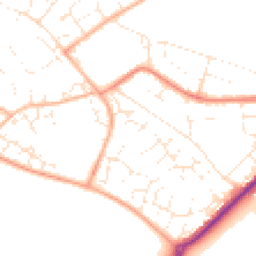
Map
47 points of interest nearby
Map data from OpenStreetMap • Transport data from NaPTAN • School data from Dept. for Education • Scenic data from Beautifulplaces.ai
Frequently Asked Questions
Common questions about this property