Are you a property professional?Get qualified leads from motivated homeowners.
Get startedEPC B RatedModern BuildLong-term Owner
Marmara Apartments, Flat 11, 13 Western Gateway, Newham, London, E16 1AJ
This 56 square metre property in Newham, London, London carries an energy performance rating of B, indicating very good energy efficiency standards. It is heated by electric heating and is currently listed as a private rental. Records show the property last changed hands for £239,995 back in 2005.
Property Type
3rd Floor Flat
Bedrooms
1
Floor Area
56 m²
Council Tax
Band C
Property Features
Built 2003–2006
Balcony
Private outdoor balcony space
Concierge Service
On-site concierge or porter
Period Features
Original architectural details
Get started
Ready to take the next step? Find the right professionals for your property journey.
Energy Performance
EPC rating and efficiency details
Current Certificate(1 of 2)
Jul 2023
EPC Rating
A
B
B82
C
D
E
F
G
Main Heating
Electric
Main Fuel
Electric
Hot Water
Poor
Windows
Good
CO2 Emissions
1.4 t/year
Tenure
Rented
Property Improvements
Changes detected from historical EPC data
Jul 2023from May 2011
EPC improved fromE44toB82
Heating System
CommunityRoom Heaters
Heating system changed
Hot Water
ImmersionImmersion (Off-Peak)
Hot water system upgraded
Low Energy Lighting
0%100%
More low energy lighting installed
Are we missing something? Tell us about home improvements to help adjust your valuation.
Price & History
Transactions and market trends
Estimated value
£321,000
How our AI predicts property prices · Accurate to within 10%
Automated estimate only. For an accurate valuation, consult a surveyor or estate agent.
Transaction history
£239,995Latest
Feb 2005Source: HM Land Registry
Nearby in E16 1AJ
Marmara Apartments Flat 23 13 Western Gateway Newham London E16 1AJ
Oct 2022
£367,500
Marmara Apartments Flat 13 13 Western Gateway Newham London E16 1AJ
Sept 2022
£565,000
Marmara Apartments Flat 15 13 Western Gateway Newham London E16 1AJ
Aug 2022
£345,000
Marmara Apartments Flat 2 13 Western Gateway Newham London E16 1AJ
Apr 2020
£355,000
Marmara Apartments Flat 31 13 Western Gateway Newham London E16 1AJ
Jul 2017
£350,000
Marmara Apartments Flat 19 13 Western Gateway Newham London E16 1AJ
Sept 2016
£405,000
1 / 6
House Price Index
London-2.1%
97.1
Jan 26
UK HPI from HM Land Registry. Baseline: Jan 2015 = 100.
How This Property Compares on Western Gateway
See how this property stacks up against others nearby
Comparing to 34 other flats on this street
Price per m²
Property value per square metre of floor space
£4,286/£4,928 avg
LowerHigher
Higher than only 36% of similar properties
Years Held
Time since last sale — indicates ownership stability
21 years/15 years avg
ShorterLonger
Held longer than 95% of similar properties
EPC Rating
Government energy efficiency score (1–100)
82 (B)/74 (C) avg
Less efficientMore efficient
More efficient than 82% of similar properties
Floor Area
Total internal floor space
56 m²/88 m² avg
SmallerLarger
Larger than only 34% of similar properties
CO₂ Emissions
Annual carbon output from heating, hot water & lighting
1.4 t/year/2.5 t/year avg
Higher emissionsLower emissions
Lower emissions than 90% of similar properties
Habitable Rooms
Living spaces like bedrooms & living rooms
2 rooms/3 rooms avg
FewerMore
More rooms than only 22% of similar properties
Comparisons are based on the most recent EPC data for each property in this postcode. Only similar property types (flats) are compared.
Get alerts for E16 1AJ
New sales, price changes, and market updates in this area
About Newham, London
This property is located in Newham, a borough that lies 5 miles east of the City of London and is bounded by the River Lea to the west and the North Circular Road to the east.
Newham London Borough Council /ˈnjuːəm/ also known as Newham Council, is the local authority for the London Borough of Newham in Greater London, England. The London Borough of Newham is a London borough created in 1965 by the London Government Act 1963. It covers an area previously administered by the Essex county boroughs of West Ham and East Ham, authorities that were both abolished by the same act. The name Newham reflects its creation and combines the compass points of the old borough names. It is 5 miles (8 km) east of the City of London and north of the River Thames. Newham is bounded by the River Lea to its west and the North Circular Road to its east.
Places to visit
Road Noise
Average road noise levels for this postcode
Daytime
07:00 – 23:00
54.6dB
Low
Night-time
23:00 – 07:00
45.7dB
Low55 dB
60 dB
65 dB
70 dB
75 dB
80 dB
Defra Road Noise Strategic Mapping, Round 4Crime Analysis
12 months of data for London
Total Crimes
283
Monthly Avg
24
Recent Trend
Rising
Most Common
Violence & Sexual
Crime by Category
Violence & Sexual68(24%)
Other Theft55(19%)
Vehicle Crime34(12%)
Public Order23(8%)
Shoplifting23(8%)
Theft from Person20(7%)
Burglary18(6%)
Drugs14(5%)
Criminal Damage & Arson11(4%)
Robbery10(4%)
Weapons3(1%)
Other Crime2(1%)
Bicycle Theft2(1%)
Recent Incidents
Other Theft
Dec 2025On or near Western Gateway
Other Theft
Dec 2025On or near Western Gateway
Violence & Sexual
Dec 2025On or near Western Gateway
Vehicle Crime
Dec 2025On or near Western Gateway
Theft from Person
Dec 2025On or near Western Gateway
Vehicle Crime
Dec 2025On or near Western Gateway
Data from Police UK • Updated monthly
Local Amenities
Schools and transport links nearby
Nearby Schools
69 within 3kmP
Britannia Village Primary School
557m
7 mins
P
Hallsville Primary School
609m
7 mins
P
St Joachim's Catholic Primary School
796m
10 mins
S
Oasis Academy Silvertown
514m
6 mins
S
Royal Docks Academy
1.0km
12 mins
S
Rokeby School
1.3km
15 mins
Transport Links
30 within 3kmRoyal Victoria Station
Tram218m
3 mins
Bridgeland Road
Bus Stop226m
3 mins
Royal Victoria DLR Station
Underground236m
3 mins
IFS Cloud Royal Docks
Tram240m
3 mins
IFS Cloud Royal Docks
Underground245m
3 mins
Seagull Lane
Bus Stop258m
3 mins
School data from Dept. for Education • Transport data from NaPTAN
Nearby Property Businesses
Local professionals serving this area
Surveyor
Exigen Property Limited
London
RICS
Surveyor
Geometra Surveyors LLP
London
RICSResidential
Surveyor
Novello Chartered Surveyors
London
RICSResidential
Surveyor
RES Property Surveyors
Stoke
RICSResidential
Surveyor
Scott Davidson
London
RICSResidential
Surveyor
Silver
London
RICSResidential
Surveyor
Ondare
London
RICS
Surveyor
SRVO Property Limited
London
RICSResidential
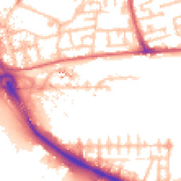
Map
99 points of interest nearby
Map data from OpenStreetMap • Transport data from NaPTAN • School data from Dept. for Education • Scenic data from Beautifulplaces.ai
Frequently Asked Questions
Common questions about this property