Are you a property professional?Get qualified leads from motivated homeowners.
Get startedExtendedDetached
7 Asquith Close, Haslington, Crewe, CW1 5TX
This 112 square metre property in Haslington, Crewe, Crewe carries an energy performance rating of D, in line with typical UK homes. It is heated by a gas central heating system and is currently listed as owner-occupied. The property last sold for £232,500 in 2021, representing a significant increase from its previous sale.
Property Type
Detached House
Bedrooms
4
Bathrooms
1
Floor Area
112 m²
Council Tax
Band C
Property Features
Built 1967–1975
Private Garden
Enclosed private garden
Garage
Off-street covered parking
En-suite Bathroom
Private bathroom attached to bedroom
Dining Room
Separate dining space
Cul-de-sac
Quiet, low-traffic location
Get started
Ready to take the next step? Find the right professionals for your property journey.
Energy Performance
EPC rating and efficiency details
Current Certificate(1 of 2)
Oct 2016
EPC Rating
A
B
C
D
D56
E
F
G
Main Heating
Gas
Main Fuel
Gas
Hot Water
Good
Windows
Average
CO2 Emissions
6.1 t/year
Tenure
Owner Occupied
Price & History
Transactions and market trends
Estimated value
£296,000
How our AI predicts property prices · Accurate to within 10%
Automated estimate only. For an accurate valuation, consult a surveyor or estate agent.
Transaction history
+114.8%(18y)
£232,500Latest
Jan 2021£108,250
Dec 2002Source: HM Land Registry
House Price Index
England+1.5%
101.6
Jan 26
UK HPI from HM Land Registry. Baseline: Jan 2015 = 100.
How This Property Compares on Asquith Close
See how this property stacks up against others nearby
Not enough similar properties in this postcode to make meaningful comparisons.
Get alerts for CW1 5TX
New sales, price changes, and market updates in this area
About Haslington, Crewe
This property is located in the village of Haslington, within the CW 1 postal district of Cheshire East, offering a quiet countryside lifestyle close to the railway town of Crewe.
Haslington is a village and civil parish in the unitary authority of Cheshire East and the ceremonial county of Cheshire, England. It lies about 2 miles (3.2 km) north‑east of the much larger railway town of Crewe and approximately 4 miles (6.4 km) south of Sandbach. The village was originally bisected by the A534 road that links Crewe with Sandbach, however, this road has now been re‑routed to bypass the village to the north‑west. The village is also a close neighbour to a number of small towns and villages, and is approximately 6 miles (9.7 km) from the Elizabethan market town of Nantwich. The village lies approximately 11 miles (18 km) north‑west of the Staffordshire Potteries.
Places to visit
Road Noise
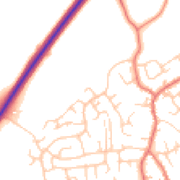
Average road noise levels for this postcode
Daytime
07:00 – 23:00
50.5dB
Low
Night-time
23:00 – 07:00
41.0dB
Low55 dB
60 dB
65 dB
70 dB
75 dB
80 dB
Defra Road Noise Strategic Mapping, Round 4Crime Analysis
6 months of data for Crewe
Total Crimes
26
Monthly Avg
4
Recent Trend
Stable
Most Common
Violence & Sexual
Crime by Category
Violence & Sexual21(81%)
Criminal Damage & Arson3(12%)
Vehicle Crime1(4%)
Public Order1(4%)
Recent Incidents
Violence & Sexual
Nov 2025On or near Coronation Street
Violence & Sexual
Nov 2025On or near Mill Bridge Close
Violence & Sexual
Nov 2025On or near Mill Bridge Close
Criminal Damage & Arson
Oct 2025On or near Mill Bridge Close
Violence & Sexual
Oct 2025On or near Coronation Street
Vehicle Crime
Oct 2025On or near Mayfair Drive
Data from Police UK • Updated monthly
Local Amenities
Schools and transport links nearby
Nearby Schools
8 within 3kmP
The Dingle Primary School
453m
5 mins
P
Haslington Primary Academy
765m
9 mins
P
Hungerford Primary Academy
1.9km
23 mins
S
Sir William Stanier School
2.1km
26 mins
S
Cheshire Studio School
2.9km
35 mins
S
Crewe Engineering and Design UTC
2.9km
35 mins
Transport Links
30 within 3kmShelburne Drive
Bus Stop118m
1 min
The Dingle
Bus Stop266m
3 mins
Russell Drive
Bus Stop306m
4 mins
Bradeley Road
Bus Stop454m
5 mins
Broughton Arms PH
Bus Stop511m
6 mins
Cartwright Road
Bus Stop605m
7 mins
School data from Dept. for Education • Transport data from NaPTAN
Nearby Property Businesses
Local professionals serving this area
Map
38 points of interest nearby
Map data from OpenStreetMap • Transport data from NaPTAN • School data from Dept. for Education • Scenic data from Beautifulplaces.ai
Frequently Asked Questions
Common questions about this property