Are you a property professional?Get qualified leads from motivated homeowners.
Get startedLowest Carbon
6 Bennett Close, Crewe, CW1 5HB
This 58 square metre property in Crewe carries an energy performance rating of C, which is above the national average. It is heated by a gas central heating system and is currently listed as a private rental. The property last sold for £157,000 in 2021.
Property Type
Semi-Detached House
Bedrooms
3
Floor Area
58 m²
Council Tax
Band B
Property Features
Built 1996–2002
Get started
Ready to take the next step? Find the right professionals for your property journey.
Energy Performance
EPC rating and efficiency details
Current Certificate(1 of 2)
Feb 2026
EPC Rating
A
B
C
C70
D
E
F
G
Main Heating
Gas
Main Fuel
Gas
Hot Water
Good
Windows
Poor
CO2 Emissions
1.8 t/year
Tenure
Rented
Property Improvements
Changes detected from historical EPC data
Feb 2026from Mar 2021
EPC improved fromD68toC70
Low Energy Lighting
67%100%
More low energy lighting installed
Are we missing something? Tell us about home improvements to help adjust your valuation.
Price & History
Transactions and market trends
Estimated value
£198,000
How our AI predicts property prices · Accurate to within 10%
Automated estimate only. For an accurate valuation, consult a surveyor or estate agent.
Transaction history
+17.2%(14y)
£157,000Latest
Jul 2021£134,000
Jan 2007£74,950
Oct 2002£49,500
Oct 1999£45,995
Oct 1997Source: HM Land Registry
House Price Index
England+1.5%
101.6
Jan 26
UK HPI from HM Land Registry. Baseline: Jan 2015 = 100.
How This Property Compares on Bennett Close
See how this property stacks up against others nearby
Comparing to 17 other houses on this street
Price per m²
Property value per square metre of floor space
£2,707/£2,196 avg
LowerHigher
Higher than 82% of similar properties
Years Held
Time since last sale — indicates ownership stability
5 years/8 years avg
ShorterLonger
Held longer than only 24% of similar properties
EPC Rating
Government energy efficiency score (1–100)
70 (C)/68 (D) avg
Less efficientMore efficient
More efficient than 74% of similar properties
Floor Area
Total internal floor space
58 m²/68 m² avg
SmallerLarger
Larger than only 35% of similar properties
CO₂ Emissions
Annual carbon output from heating, hot water & lighting
1.8 t/year/2.6 t/year avg
Higher emissionsLower emissions
Lower emissions than all similar properties
Habitable Rooms
Living spaces like bedrooms & living rooms
5 rooms/5 rooms avg
FewerMore
Around average
Comparisons are based on the most recent EPC data for each property in this postcode. Only similar property types (houses) are compared.
Get alerts for CW1 5HB
New sales, price changes, and market updates in this area
Places to visit
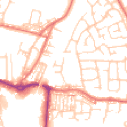
Road Noise
Average road noise levels for this postcode
Daytime
07:00 – 23:00
52.2dB
Low
Night-time
23:00 – 07:00
40.8dB
Low55 dB
60 dB
65 dB
70 dB
75 dB
80 dB
Defra Road Noise Strategic Mapping, Round 4Crime Analysis
6 months of data for Crewe
Total Crimes
26
Monthly Avg
4
Recent Trend
Stable
Most Common
Violence & Sexual
Crime by Category
Violence & Sexual21(81%)
Criminal Damage & Arson3(12%)
Vehicle Crime1(4%)
Public Order1(4%)
Recent Incidents
Violence & Sexual
Nov 2025On or near Coronation Street
Violence & Sexual
Nov 2025On or near Mill Bridge Close
Violence & Sexual
Nov 2025On or near Mill Bridge Close
Criminal Damage & Arson
Oct 2025On or near Mill Bridge Close
Violence & Sexual
Oct 2025On or near Coronation Street
Vehicle Crime
Oct 2025On or near Mayfair Drive
Data from Police UK • Updated monthly
Local Amenities
Schools and transport links nearby
Nearby Schools
22 within 3kmP
Hungerford Primary Academy
199m
2 mins
P
Brierley Primary School
541m
7 mins
P
Beechwood Primary School and Nursery
1.2km
15 mins
S
Sir William Stanier School
667m
8 mins
S
Cheshire Studio School
961m
12 mins
S
Crewe Engineering and Design UTC
988m
12 mins
Transport Links
30 within 3kmThe Flying Lady
Bus Stop157m
2 mins
Coleridge Way
Bus Stop159m
2 mins
Bargain Booze
Bus Stop238m
3 mins
Coleridge Way
Bus Stop269m
3 mins
Oak Tree Drive
Bus Stop307m
4 mins
Tennyson Avenue
Bus Stop309m
4 mins
School data from Dept. for Education • Transport data from NaPTAN
Nearby Property Businesses
Local professionals serving this area
Map
52 points of interest nearby
Map data from OpenStreetMap • Transport data from NaPTAN • School data from Dept. for Education • Scenic data from Beautifulplaces.ai
Frequently Asked Questions
Common questions about this property