Are you a property professional?Get qualified leads from motivated homeowners.
Get started1 Graysmead, Sible Hedingham, Halstead, CO9 3NX
This property in Sible Hedingham, Halstead, Halstead. Explore detailed information about this Sible Hedingham, Halstead property including energy performance, price history, local schools, transport links and crime statistics.
Property Type
Property
Bedrooms
—
Floor Area
— m²
Council Tax
Band D
Get started
Ready to take the next step? Find the right professionals for your property journey.
Energy Performance
EPC rating and efficiency details
A
B
C
D
E
F
G
No EPC on record
This property doesn't have an Energy Performance Certificate yet. An EPC helps us give a more accurate valuation and is required to sell or let.
Price & History
Transactions and market trends
Transaction history
No sales history found
House Price Index
England+1.5%
101.6
Jan 26
UK HPI from HM Land Registry. Baseline: Jan 2015 = 100.
How This Property Compares on Graysmead
See how this property stacks up against others nearby
Not enough similar properties in this postcode to make meaningful comparisons.
Get alerts for CO9 3NX
New sales, price changes, and market updates in this area
About Sible Hedingham, Halstead
This property is located in Sible Hedingham, a village and civil parish in Essex, positioned within the Colne Valley and near the borders of Suffolk and Cambridgeshire, and is reachable by the A1017 road.
Sible Hedingham is a village and civil parish in the county of Essex, England. The village is located within the Colne Valley, in the northern region of Essex, close to both the Suffolk and Cambridgeshire borders, situated on the A1017 road. Outside of the village, the parish contains numerous smaller hamlets. The village is 21.3 miles (34 km) north of Chelmsford. The locality falls within the postal district CO 9.
Places to visit
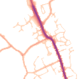
Road Noise
Average road noise levels for this postcode
Daytime
07:00 – 23:00
47.7dB
Low
Night-time
23:00 – 07:00
38.9dB
Low55 dB
60 dB
65 dB
70 dB
75 dB
80 dB
Defra Road Noise Strategic Mapping, Round 4Crime Analysis
6 months of data for Halstead
Total Crimes
8
Monthly Avg
1
Recent Trend
Stable
Most Common
Violence & Sexual
Crime by Category
Violence & Sexual4(50%)
Drugs2(25%)
Burglary1(13%)
Other Theft1(13%)
Recent Incidents
Violence & Sexual
Nov 2025On or near Windmill Road
Violence & Sexual
Oct 2025On or near Windmill Road
Violence & Sexual
Oct 2025On or near High Street
Drugs
Sept 2025On or near Monklands Court
Burglary
Sept 2025On or near Church Street
Drugs
Aug 2025On or near High Street
Data from Police UK • Updated monthly
Local Amenities
Schools and transport links nearby
Nearby Schools
4 within 3kmP
St Peter's Church of England Voluntary Controlled Primary School, Sible Hedingham
705m
8 mins
P
de Vere Primary School
1.5km
18 mins
P
St Giles' Church of England Primary School
2.9km
34 mins
S
Hedingham School and Sixth Form
548m
7 mins
Transport Links
21 within 3kmRectory Rd
Bus Stop103m
1 min
Station Road
Bus Stop367m
4 mins
Post Office
Bus Stop489m
6 mins
Hedingham School
Bus Stop518m
6 mins
The Swan
Bus Stop850m
10 mins
Sheepcot Rd
Bus Stop977m
12 mins
School data from Dept. for Education • Transport data from NaPTAN
Nearby Property Businesses
Local professionals serving this area
Map
25 points of interest nearby
Map data from OpenStreetMap • Transport data from NaPTAN • School data from Dept. for Education • Scenic data from Beautifulplaces.ai
Frequently Asked Questions
Common questions about this property