Are you a property professional?Get qualified leads from motivated homeowners.
Get started10 St Aidans Court, Prenton, CH43 8TP
This 55 square metre property in Prenton carries an energy performance rating of C, which is above the national average. It is heated by a gas central heating system and is currently listed as a private rental. It was sold for £84,000 in March 2024.
Property Type
Ground Floor Flat
Bedrooms
2
Bathrooms
1
Floor Area
55 m²
Council Tax
Band A
Property Features
Built 1991–1995
Communal Garden
Shared with other residents
Off Road Parking
Recently Refurbished
Renovated and updated
Get started
Ready to take the next step? Find the right professionals for your property journey.
Energy Performance
EPC rating and efficiency details
Current Certificate(1 of 2)
May 2023
EPC Rating
A
B
C
C75
D
E
F
G
Main Heating
Gas
Main Fuel
Gas
Hot Water
Good
Windows
Good
CO2 Emissions
1.6 t/year
Tenure
Rented
Property Improvements
Changes detected from historical EPC data
May 2023from Apr 2017
Windows
AverageGood
Window efficiency improved
Wall Insulation
UninsulatedInsulated Cavity
Cavity wall insulation installed
Are we missing something? Tell us about home improvements to help adjust your valuation.
Price & History
Transactions and market trends
Estimated value
£124,000
How our AI predicts property prices · Accurate to within 10%
Automated estimate only. For an accurate valuation, consult a surveyor or estate agent.
Transaction history
-18.0%(20y)
£84,000Latest
Mar 2024£102,500
Sept 2004£73,000
Sept 2003Source: HM Land Registry
Nearby in CH43 8TP
12 St Aidans Court Prenton CH43 8TP
Jun 2025
£125,000
3 St Aidans Court Prenton CH43 8TP
Sept 2023
£89,000
8 St Aidans Court Prenton CH43 8TP
Mar 2023
£52,000
17 St Aidans Court Prenton CH43 8TP
May 2022
£84,000
6 St Aidans Court Prenton CH43 8TP
Jun 2021
£56,000
5 St Aidans Court Prenton CH43 8TP
Apr 2018
£56,000
1 / 3
House Price Index
England+1.5%
101.6
Jan 26
UK HPI from HM Land Registry. Baseline: Jan 2015 = 100.
How This Property Compares on St Aidans Court
See how this property stacks up against others nearby
Comparing to 13 other flats on this street
Price per m²
Property value per square metre of floor space
£1,527/£1,457 avg
LowerHigher
Around average
Years Held
Time since last sale — indicates ownership stability
2 years/9 years avg
ShorterLonger
Held longer than only 8% of similar properties
EPC Rating
Government energy efficiency score (1–100)
75 (C)/72 (C) avg
Less efficientMore efficient
Around average
Floor Area
Total internal floor space
55 m²/56 m² avg
SmallerLarger
Larger than only 35% of similar properties
CO₂ Emissions
Annual carbon output from heating, hot water & lighting
1.6 t/year/1.9 t/year avg
Higher emissionsLower emissions
Around average
Habitable Rooms
Living spaces like bedrooms & living rooms
3 rooms/3 rooms avg
FewerMore
Around average
Comparisons are based on the most recent EPC data for each property in this postcode. Only similar property types (flats) are compared.
Get alerts for CH43 8TP
New sales, price changes, and market updates in this area
Places to visit
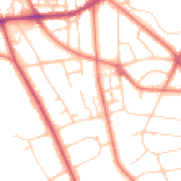
Road Noise
Average road noise levels for this postcode
Daytime
07:00 – 23:00
51.5dB
Low
Night-time
23:00 – 07:00
41.5dB
Low55 dB
60 dB
65 dB
70 dB
75 dB
80 dB
Defra Road Noise Strategic Mapping, Round 4Crime Analysis
7 months of data for Prenton
Total Crimes
17
Monthly Avg
2
Recent Trend
Stable
Most Common
Violence & Sexual
Crime by Category
Violence & Sexual11(65%)
Burglary2(12%)
Public Order2(12%)
Criminal Damage & Arson2(12%)
Recent Incidents
Burglary
Dec 2025On or near Fender Lane
Violence & Sexual
Nov 2025On or near Stoneridge Court
Violence & Sexual
Nov 2025On or near Stoneridge Court
Violence & Sexual
Nov 2025On or near Wexford Road
Violence & Sexual
Nov 2025On or near Observatory Road
Violence & Sexual
Nov 2025On or near Ledbury Close
Data from Police UK • Updated monthly
Local Amenities
Schools and transport links nearby
Nearby Schools
39 within 3kmS
Birkenhead High School Academy
478m
6 mins
P
Bidston Avenue Primary School
790m
10 mins
P
Co-op Academy Portland
1.0km
13 mins
S
Birkenhead High School Academy
478m
6 mins
S
St Anselm's College
480m
6 mins
S
Birkenhead Sixth Form College
510m
6 mins
Transport Links
30 within 3kmShrewsbury Close
Bus Stop67m
1 min
Shrewsbury Close
Bus Stop91m
1 min
Tollemache Road
Bus Stop132m
2 mins
Forest Road
Bus Stop189m
2 mins
Shrewsbury Road
Bus Stop191m
2 mins
Hill Road
Bus Stop340m
4 mins
School data from Dept. for Education • Transport data from NaPTAN
Nearby Property Businesses
Local professionals serving this area
Map
69 points of interest nearby
Map data from OpenStreetMap • Transport data from NaPTAN • School data from Dept. for Education • Scenic data from Beautifulplaces.ai
Frequently Asked Questions
Common questions about this property