Are you a property professional?Get qualified leads from motivated homeowners.
Get startedEdwardian
13 Alvanley Place, Prenton, CH43 4XA
This 145 square metre property in Prenton carries an energy performance rating of E. It is heated by a gas central heating system and is currently listed as a private rental. The property last sold for £130,000 in 2020.
Property Type
Mid-Terrace House
Bedrooms
5
Floor Area
145 m²
Council Tax
Band A
Property Features
Built 1900–1929
Get started
Ready to take the next step? Find the right professionals for your property journey.
Energy Performance
EPC rating and efficiency details
Current Certificate(1 of 2)
Feb 2017
EPC Rating
A
B
C
D
E
E40
F
G
Main Heating
Gas
Main Fuel
Gas
Hot Water
Good
Windows
Average
CO2 Emissions
9.5 t/year
Tenure
Rented
Price & History
Transactions and market trends
Estimated value
£160,000
How our AI predicts property prices · Accurate to within 10%
Automated estimate only. For an accurate valuation, consult a surveyor or estate agent.
Transaction history
-7.1%(12y)
£130,000Latest
Dec 2020£140,000
Sept 2008£119,000
Jun 2006£40,000
Dec 2003Source: HM Land Registry
Nearby in CH43 4XA
6 Alvanley Place Prenton CH43 4XA
Mar 2024
£175,000
21 Alvanley Place Prenton CH43 4XA
Jul 2023
£167,500
10 Alvanley Place Prenton CH43 4XA
Dec 2022
£180,000
19 Alvanley Place Prenton CH43 4XA
Nov 2021
£215,000
11 Alvanley Place Prenton CH43 4XA
Sept 2021
£135,000
8 Alvanley Place Prenton CH43 4XA
Mar 2016
£75,000
1 / 3
House Price Index
England+1.5%
101.6
Jan 26
UK HPI from HM Land Registry. Baseline: Jan 2015 = 100.
How This Property Compares on Alvanley Place
See how this property stacks up against others nearby
Comparing to 14 other houses on this street
Price per m²
Property value per square metre of floor space
£897/£996 avg
LowerHigher
Higher than 62% of similar properties
Years Held
Time since last sale — indicates ownership stability
5 years/10 years avg
ShorterLonger
Held longer than only 38% of similar properties
EPC Rating
Government energy efficiency score (1–100)
40 (E)/58 (D) avg
Less efficientMore efficient
Lowest among similar properties
Floor Area
Total internal floor space
145 m²/125 m² avg
SmallerLarger
Larger than 93% of similar properties
CO₂ Emissions
Annual carbon output from heating, hot water & lighting
9.5 t/year/5.9 t/year avg
Higher emissionsLower emissions
Lowest among similar properties
Habitable Rooms
Living spaces like bedrooms & living rooms
7 rooms/7 rooms avg
FewerMore
Around average
Comparisons are based on the most recent EPC data for each property in this postcode. Only similar property types (houses) are compared.
Get alerts for CH43 4XA
New sales, price changes, and market updates in this area
Places to visit
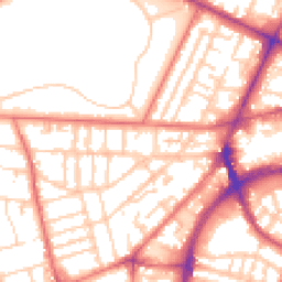
Road Noise
Average road noise levels for this postcode
Daytime
07:00 – 23:00
54.2dB
Low
Night-time
23:00 – 07:00
43.0dB
Low55 dB
60 dB
65 dB
70 dB
75 dB
80 dB
Defra Road Noise Strategic Mapping, Round 4Crime Analysis
7 months of data for Prenton
Total Crimes
17
Monthly Avg
2
Recent Trend
Stable
Most Common
Violence & Sexual
Crime by Category
Violence & Sexual11(65%)
Burglary2(12%)
Public Order2(12%)
Criminal Damage & Arson2(12%)
Recent Incidents
Burglary
Dec 2025On or near Fender Lane
Violence & Sexual
Nov 2025On or near Stoneridge Court
Violence & Sexual
Nov 2025On or near Stoneridge Court
Violence & Sexual
Nov 2025On or near Wexford Road
Violence & Sexual
Nov 2025On or near Observatory Road
Violence & Sexual
Nov 2025On or near Ledbury Close
Data from Police UK • Updated monthly
Local Amenities
Schools and transport links nearby
Nearby Schools
34 within 3kmP
St Werburgh's Catholic Primary School
516m
6 mins
P
Birkenhead Christ Church CofE Primary School
568m
7 mins
P
The Priory Parish CofE Primary School
679m
8 mins
S
Birkenhead Park School
478m
6 mins
S
St Anselm's College
873m
11 mins
S
Birkenhead High School Academy
980m
12 mins
Transport Links
30 within 3kmCole Street
Bus Stop96m
1 min
Paterson Street
Bus Stop98m
1 min
Eastbourne Street
Bus Stop185m
2 mins
Francis Avenue
Bus Stop264m
3 mins
Bentinck Street
Bus Stop274m
3 mins
Barton Street
Bus Stop292m
4 mins
School data from Dept. for Education • Transport data from NaPTAN
Nearby Property Businesses
Local professionals serving this area
Map
64 points of interest nearby
Map data from OpenStreetMap • Transport data from NaPTAN • School data from Dept. for Education • Scenic data from Beautifulplaces.ai
Frequently Asked Questions
Common questions about this property